Landscape Evolution
A short term landscape evolution using a path sampling method to solve water and sediment flow continuity equations and model mass flows over complex topographies.
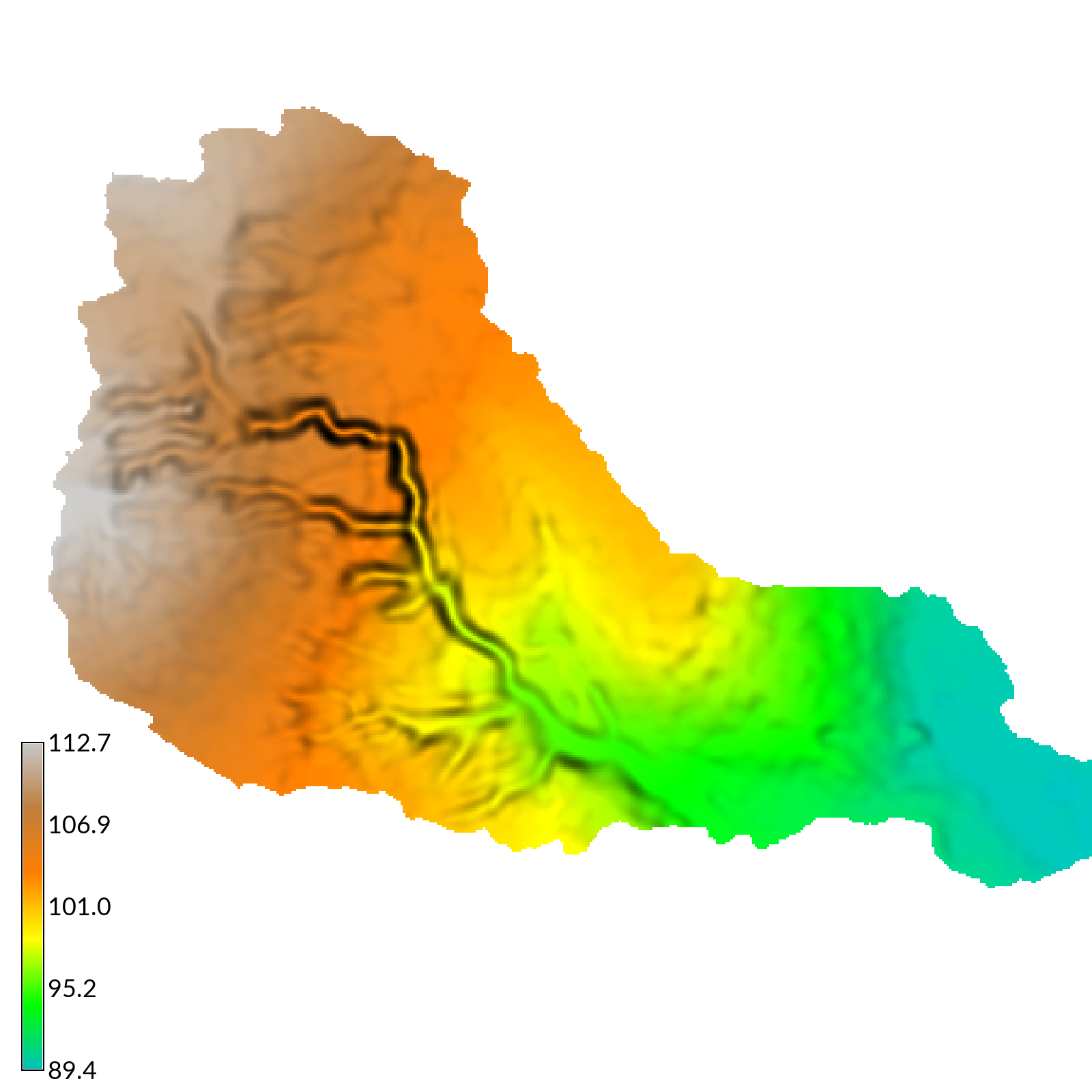
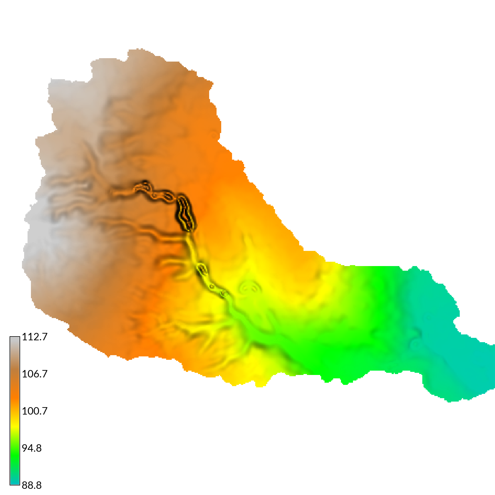
Digital elevation models a) before and b) after a simulated 2 hour storm with 50 mm/hr of rainfall.
r.sim.terrain
Team: Brendan Harmon, Helena Mitasova, Vacalv Petras, & Anna Petrasova
Open Science Framework Repository
A short-term landscape evolution model that simulates topographic change for both steady state and dynamic flow regimes across a range of spatial scales. This free and open source, GIS-based landscape evolution model uses empirical models (RUSLE3D & USPED) for soil erosion at watershed to regional scales and a physics-based model (SIMWE) for shallow overland water flow and soil erosion at subwatershed scales to compute short-term topographic change. This either steady state or dynamic model simulates how overland sediment mass flows reshape topography for a range of hydrologic soil erosion regimes based on topographic, land cover, soil, and rainfall parameters. As demonstrated by a case study for Patterson Branch subwatershed on the Fort Bragg military installation in North Carolina, r.sim.terrain can realistically simulate the development of fine-scale morphological features including ephemeral gullies, rills, and hillslopes. Applications include land management, erosion control, landscape planning, and landscape restoration. It has been implemented as the add-on module r.sim.terrain for GRASS GIS.
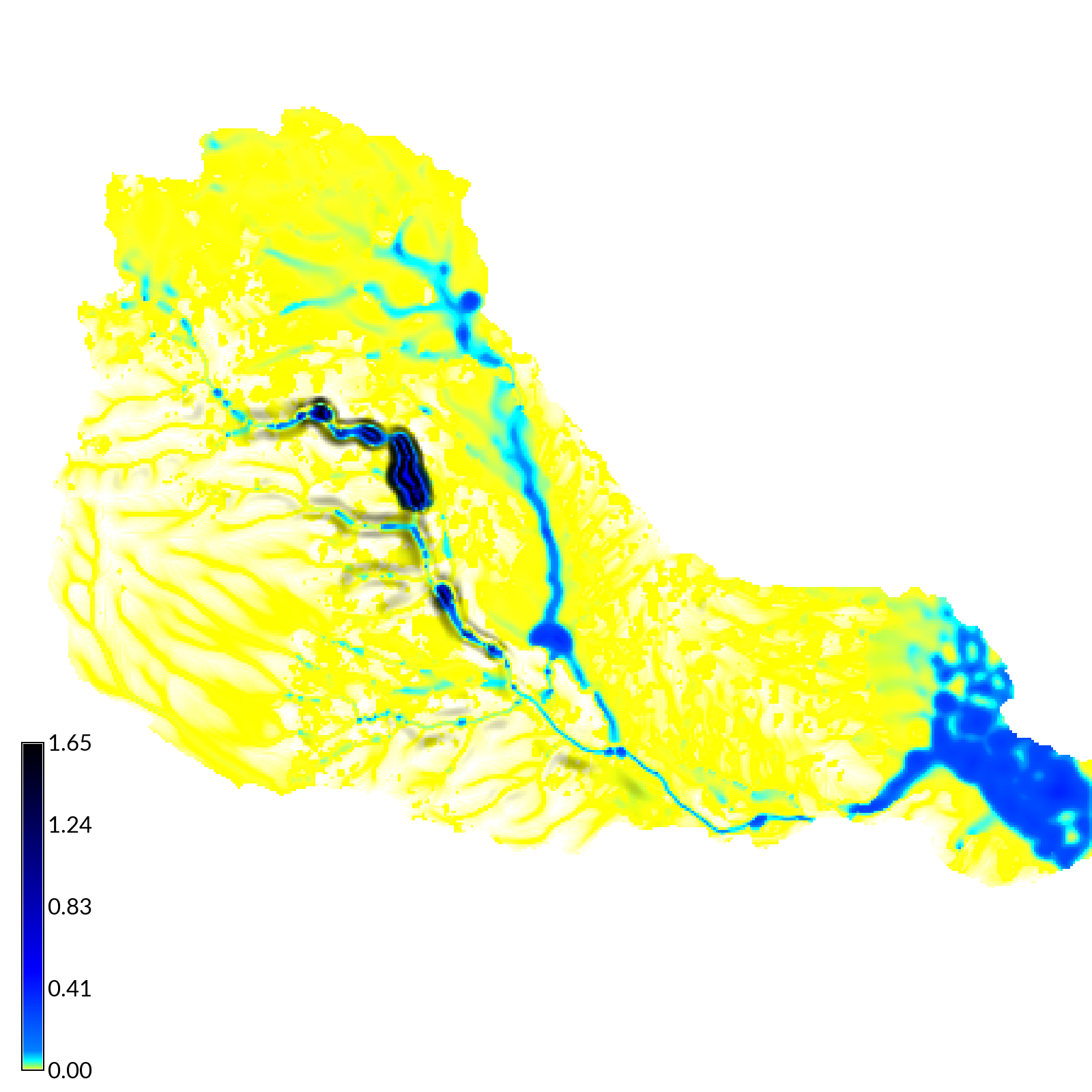
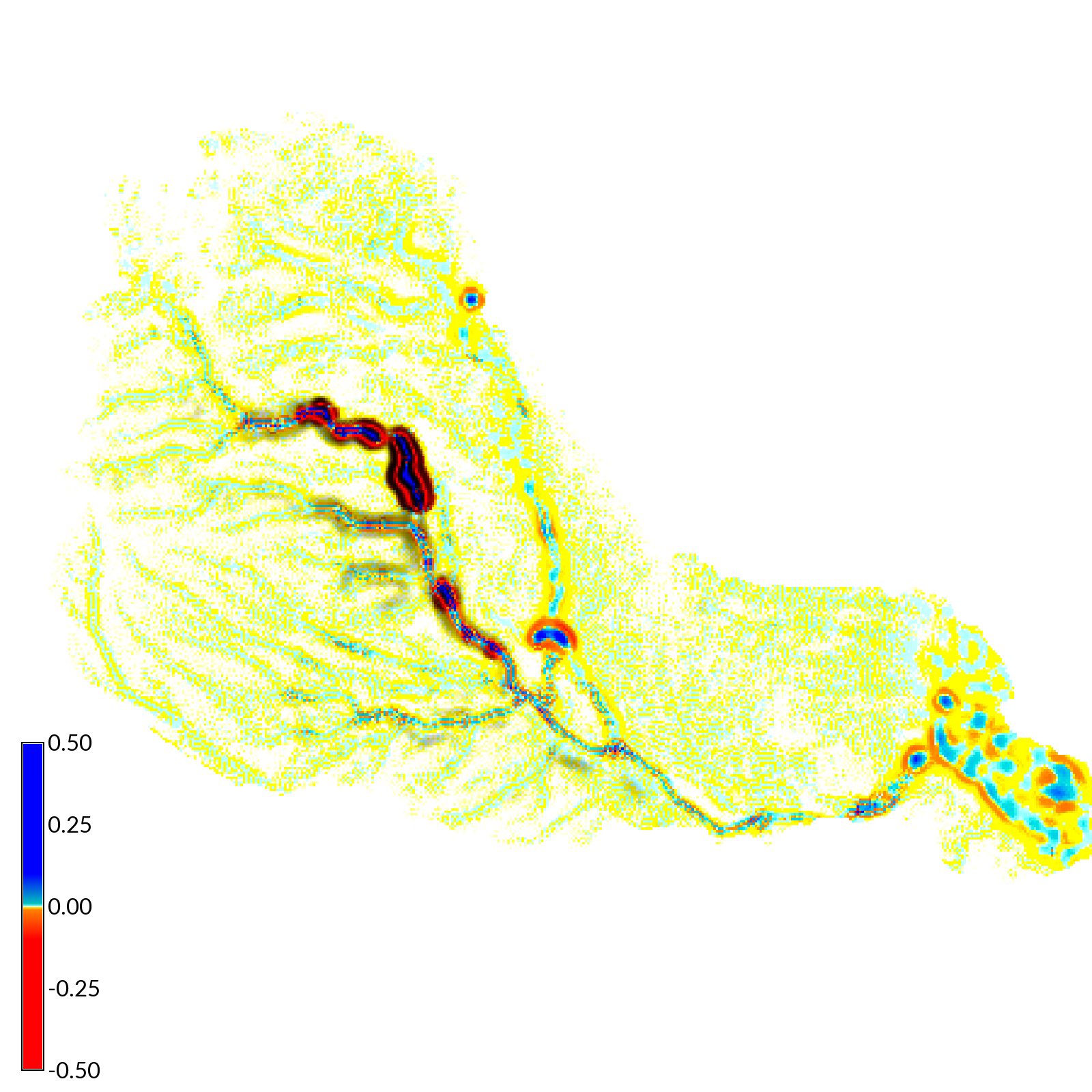
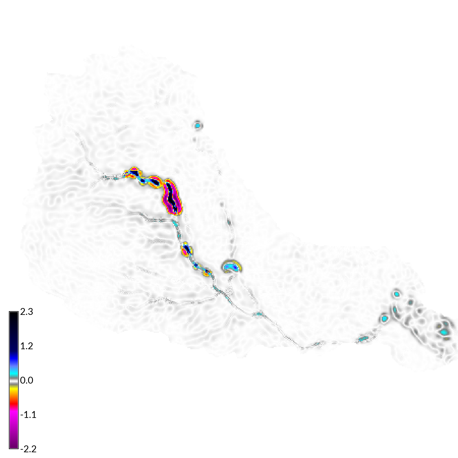
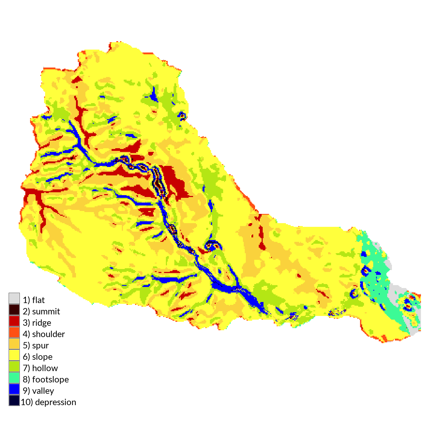
a) water depth, b) erosion and deposition, c) net difference in elevation, and d) landforms for a simulated 2 hour storm with 50 mm/hr of rainfall.
Publications
Harmon, Brendan A, Helena Mitasova, Anna Petrasova, and Vaclav Petras. 2019. “r.sim.terrain: a dynamic landscape evolution model.” Geoscientific Model Development Discussions 2019: 1–23. https://doi.org/10.5194/gmd-2019-18.