Heritage Preservation
We are using lidar, photogrammetry, and radiance fields to 3D scan historic landscapes, buildings, and artifacts. Our aim is to create immersive, minutely detailed digital archives of these heritage sites. Our server xyz.cct.lsu.edu hosts a growing collection of point clouds using Potree for interative point cloud rendering.
Contents
Atlas of Heritage Trees
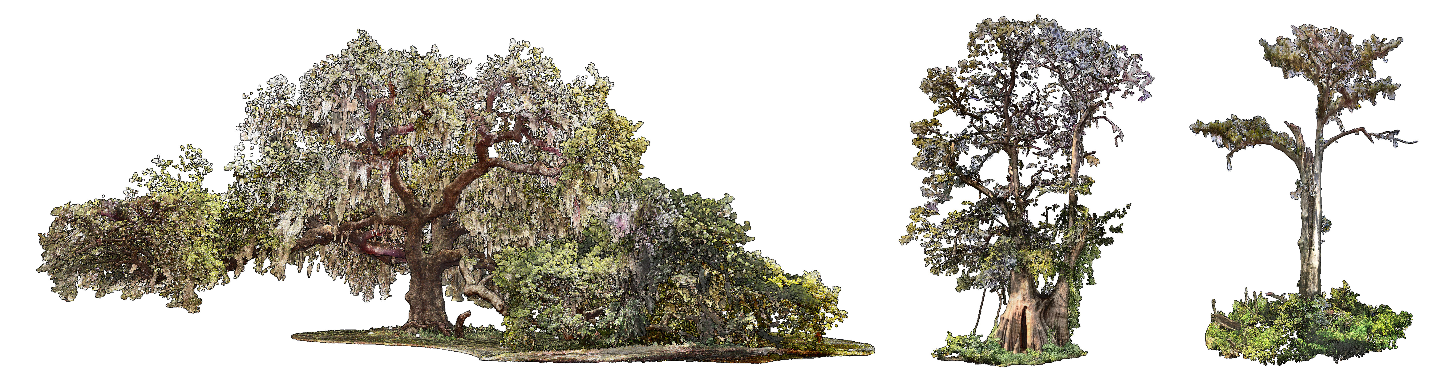
The Atlas of Heritage Trees
is an archive of ancient trees
of exceptional historical, cultural, and ecological significance.
The trees, captured using terrestrial laser scanning and drone lidar,
have been archived in
laz, e57, pcd, xyz, and 3dm format point clouds.
This project was funded by the LSU Arts & Humanities Support Fund.
The project leads are Brendan Harmon
and Hye Yeon Nam.
Contributors include
Javier Zamora,
Huan Guo,
William Reinhardt,
Julie Whitbeck,
Kaiti Fink,
and Jeff Boucher.
The point clouds are released under the
Creative Commons Zero
public domain dedication.
Datasets
Atlas of Heritage Trees Point Clouds
Atlas of Heritage Trees Dataset
Papers
Harmon, Brendan and Hye Yeon Nam. 2024. 3D Printing Heritage Trees. In: Journal of Digital Landscape Architecture 9, pp. 605–613.
African American Burial Grounds

African American Burial Grounds This project aims to document African American burial grounds in the Louisiana River Parishes. The Louisiana River Parishes are scattered with hundreds of African American cemeteries dating back to the antebellum period when plantations lined both sides of the Mississippi River. This history of environmental racism continued into the 20th century as the region was favored for hazardous petrochemical production facilities. Today these cultural landscapes are threatened by industrial expansion, climate change, missing land-tenure records, and dwindling populations of descendant communities. Our team is 3D scanning burial grounds and compiling a database of interactive, publicly accessible digital models to preserve the record of these cultural landscapes. The project leads are Annicia Streete, Brendan Harmon, and Nicholas Serrano. This research is funded by a National Park Service Preservation Technology and Training Grant. The point clouds are released under the Creative Commons Zero public domain dedication.
Datasets
African American Burial Grounds Point Clouds
Papers
Brooks, Joseph, Carlos Roman, Harmon, Brendan, Annicia Streete, and Nicholas Serrano (2025b). Visualizing Spatial Audio in Digital Landscapes. In: Journal of Digital Landscape Architecture 10, pages 547–554.
Streete, Annicia, Nicholas Serrano, and Brendan Harmon (2025). Endangered African American Burial Grounds of the Lower Mississippi: Acts of Reparation and Preservation. In: 2025 ACSA 113th Annual Meeting Paper and Project Proceedings. New Orleans, Louisiana, USA: Association of Collegiate Schools of Architecture.
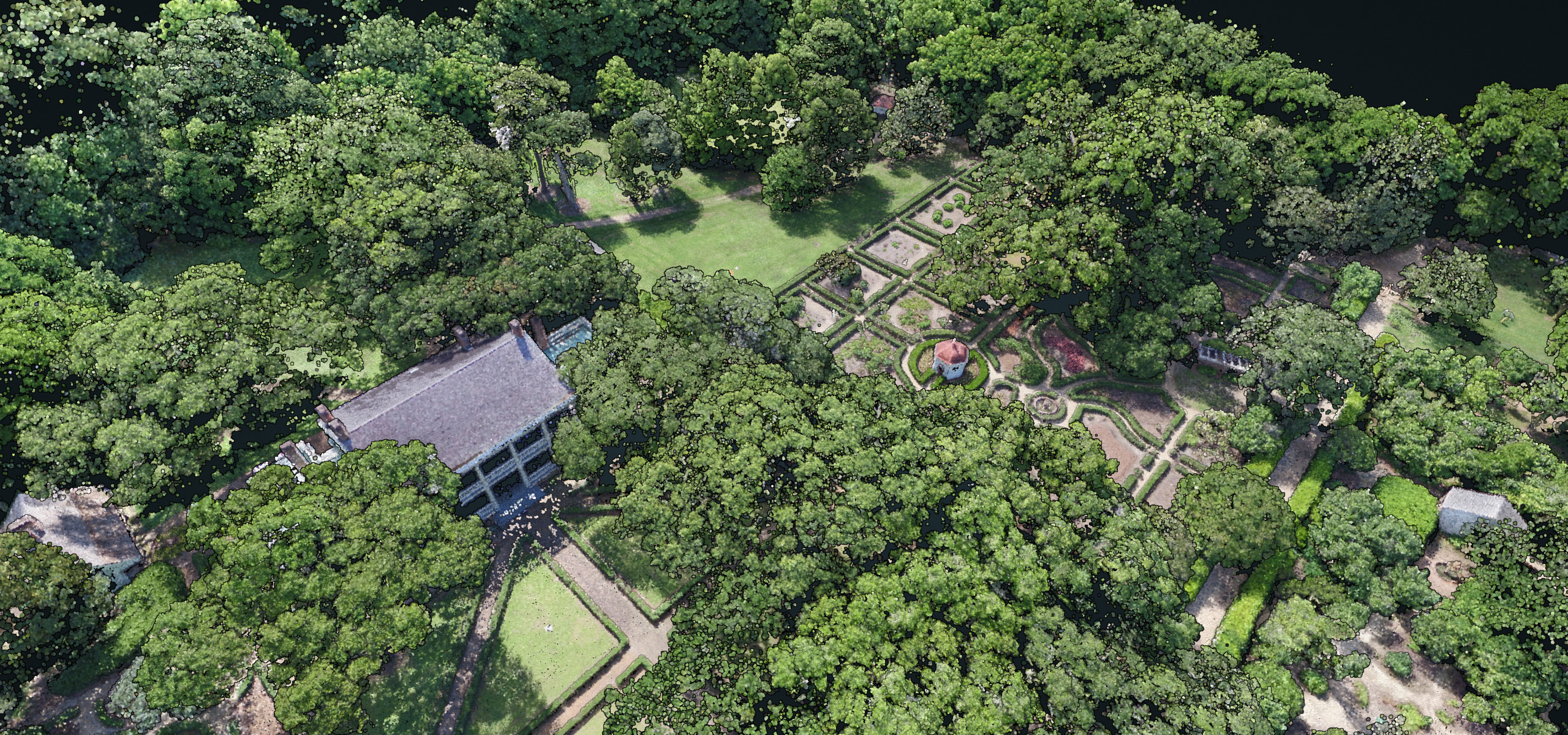
Rosedown
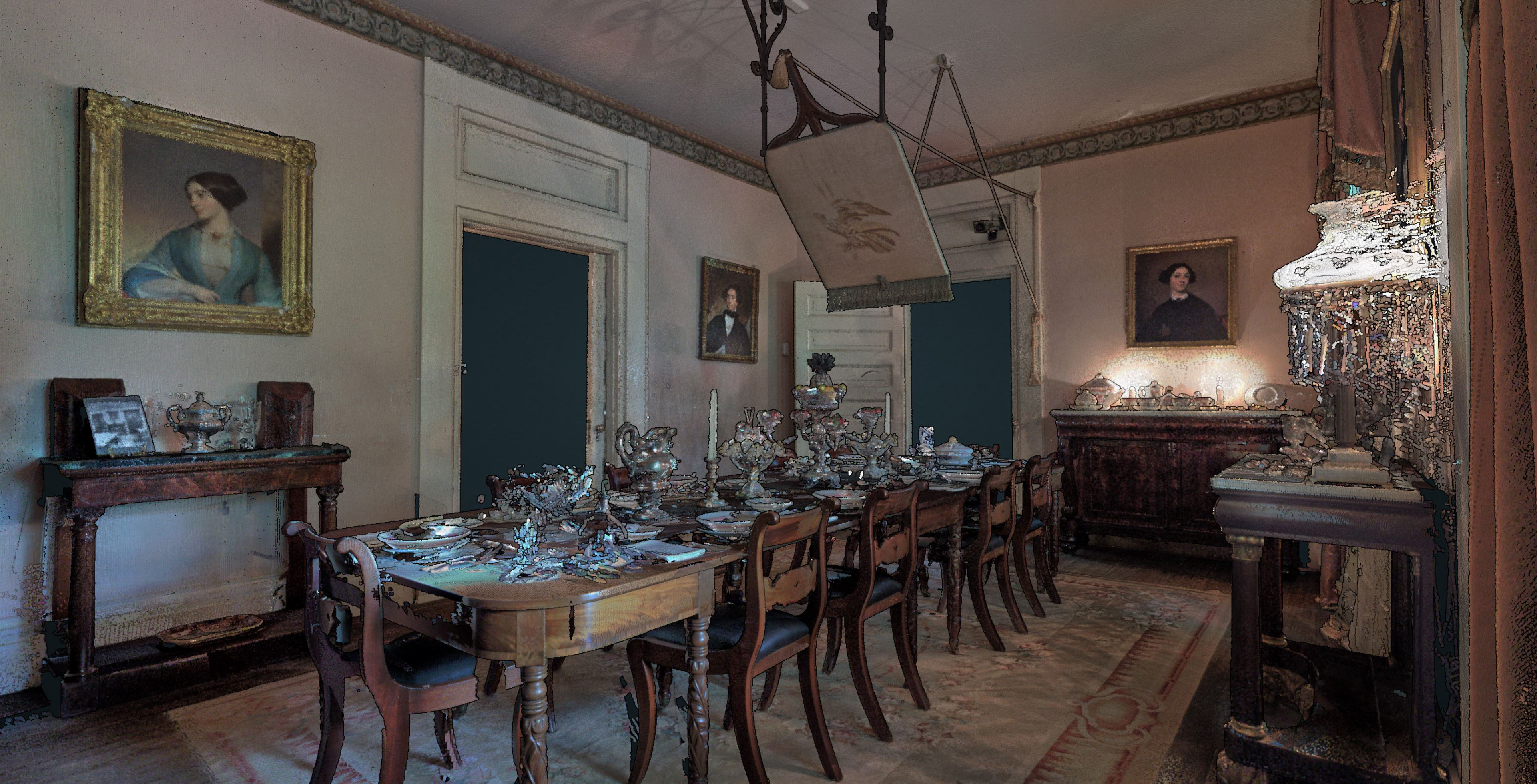
Rosedown is a two hundred acre site in St. Francisville, Louisiana with the well preserved remains of an antebellum plantation dating from 1834 including the main house, ancillary buildings, and formal gardens. The plantation was documented using terrestrial laser scanning with a Faro Focus and drone photogrammetry with a DJI Matrice 600 Pro with Zenmuse X5 camera. The project was lead by Brendan Harmon and Nicholas Serrano. The team included Josef Horacek, Sasha Matthieu, William Conrad, Javier Zamora, Matthew Cranney, and Ming Li. This project was supported by the LSU Center for GeoInformatics and LSU Coastal Sustainability Studio and funded by the National Park Service’s Historic Preservation Fund. The point clouds are licensed Creative Commons Zero public domain dedication.
Datasets
Papers
Harmon, Brendan A and Nicholas Serrano. 2022. Point Cloud Aesthetics. In: Journal of Digital Landscape Architecture 7, pp. 335–344.