Methodology
We have conducted a rigorous experiment using geospatial analytics to compare spatial performance in analog modeling by hand, in tangible computing using Tangible Landscape, and in visual computing using 3D modeling programs via a GUI. Tangible Landscape is a continuous shape display tightly integrated with GRASS GIS that was designed to intuitively 3D sketch landscapes. Conceptually, Tangible Landscape couples a physical model with a digital model in a real-time feedback cycle of 3D scanning, geospatial modeling and simulation, and projection. We tested our hypotheses using quantitative and qualitative methods. We studied applied spatial cognitive processes using the metrics and parameters of the given application. We studied how participants perform in a series of time constrained terrain modeling exercises using analog modeling, visual computing, and tangible computing. We assessed their performance with each technology using spatial statistics, topographic parameters, morphology, process-form interactions, and differencing. We used a fast, fluid, iterative process as a proxy for creative thinking that can be assessed using these methods.
Terrain modeling experiment
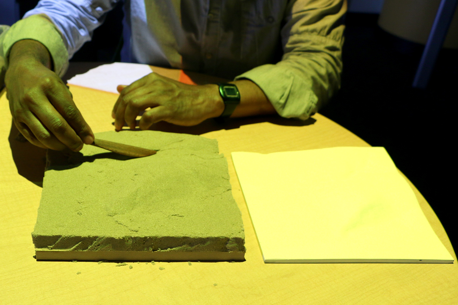
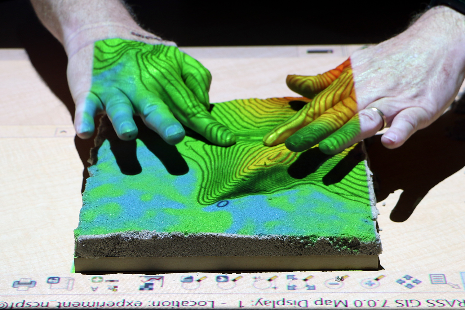
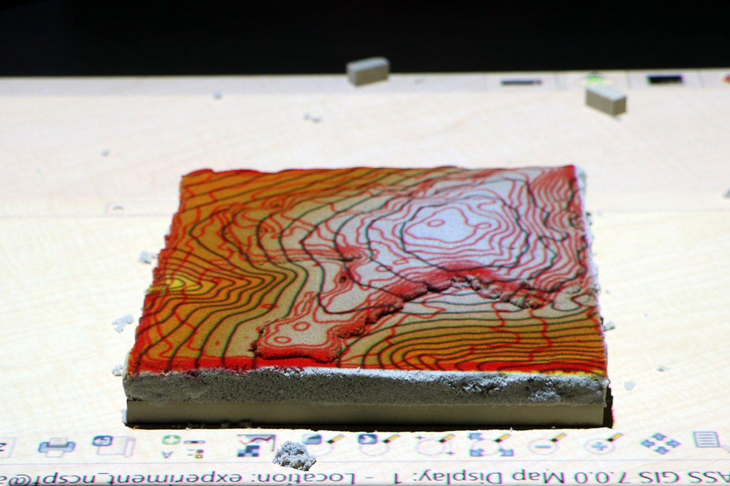
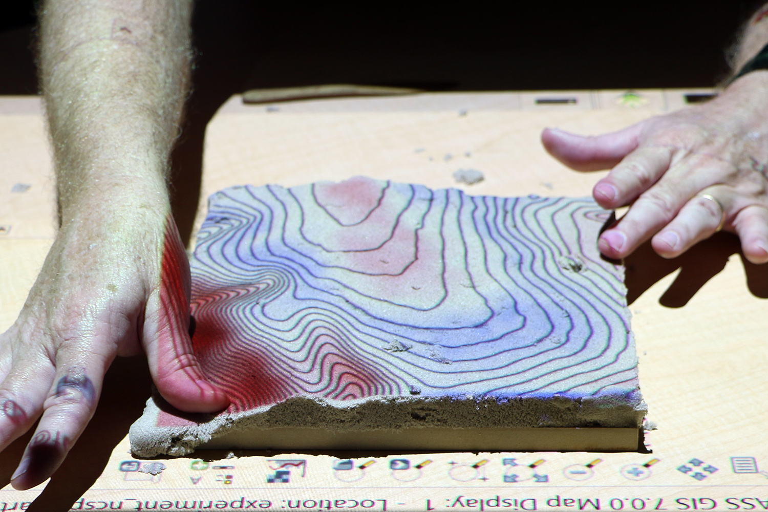
The 1st exercise tests spatial performance in analog modeling to establish the baseline spatial ability of each participant. In this exercise participants sculpt a given terrain in polymeric sand using their hands with a CNC routed model for reference. The 2nd exercise tests spatial performance in projection augmented analog modeling to establish a baseline for spatial performance in tangible computing. In this exercise participants sculpt a given terrain in polymeric sand using a projected map of the given elevation and contours as a guide. The 3rd-5th exercises test spatial performance in tangible computing augmented with different analytics. In the 3rd exercise participants use Tangible Landscape to sculpt a given terrain in polymeric sand using the given and scanned contours as a guide. In the 4th exercise participants use Tangible Landscape to sculpt a given terrain in polymeric sand using the difference between the given and the scanned landscape as a guide. In the 5th exercise participants use Tangible Landscape to sculpt a given terrain in polymeric sand using the simulated water flow over the scanned landscape as a guide in order to study 4D thinking. The 6th and 7th exercises test spatial performance in visual computing. In the 6th exercise participants digitally sculpt a given terrain in Rhinoceros, a 3D modeling program, using the given 3D contours as a guide. In the 7th exercise participants digitally sculpt a given terrain in VUE, a 3D modeling program designed for intuitive terrain sculpting, with a CNC routed model for reference.
Exercises
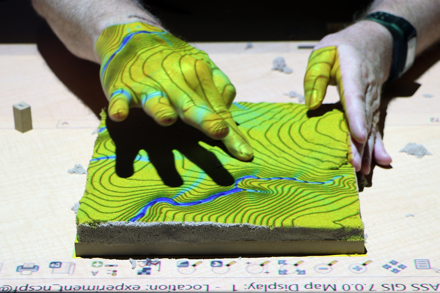
Exercise 2: projection augmented modeling by hand
Exercise 3: modeling with Tangible Landscape using the contour analytic
Exercise 4: modeling with Tangible Landscape using the differencing analytic
Exercise 6: digital modeling with Rhino
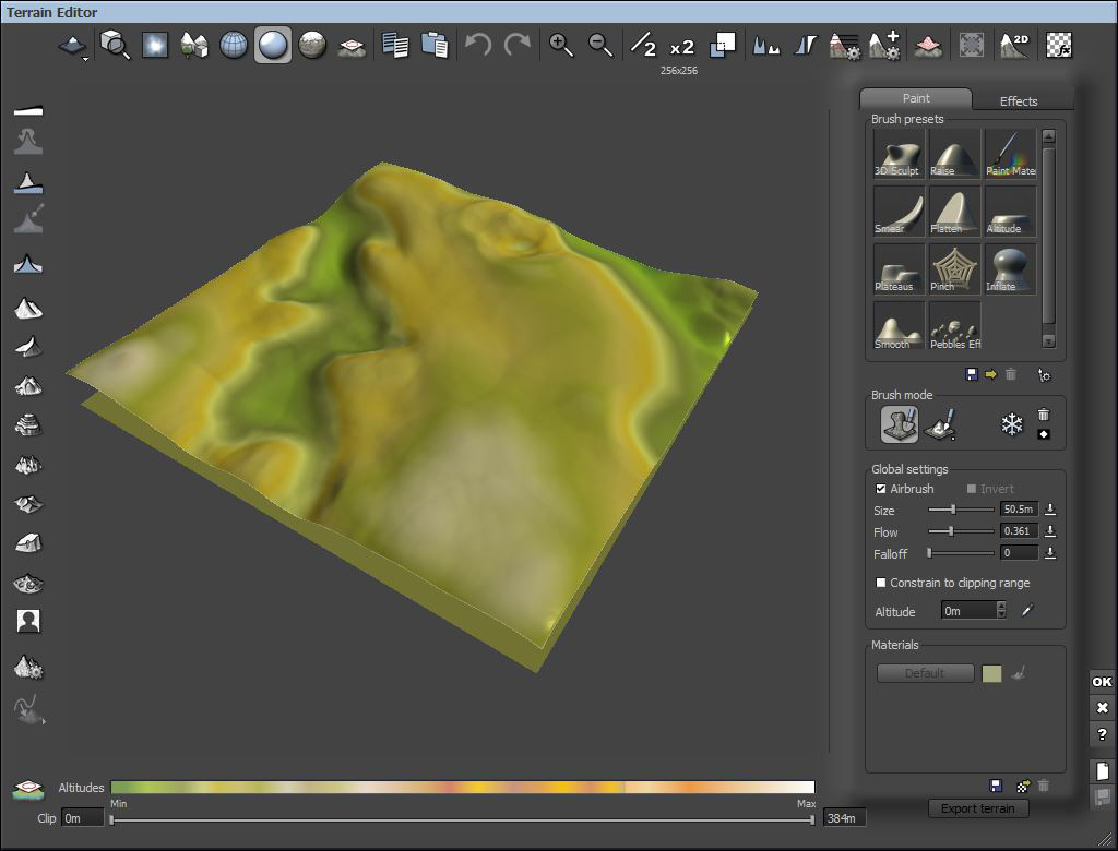
Exercise 7: digital modeling with Vue
Data collection and analysis
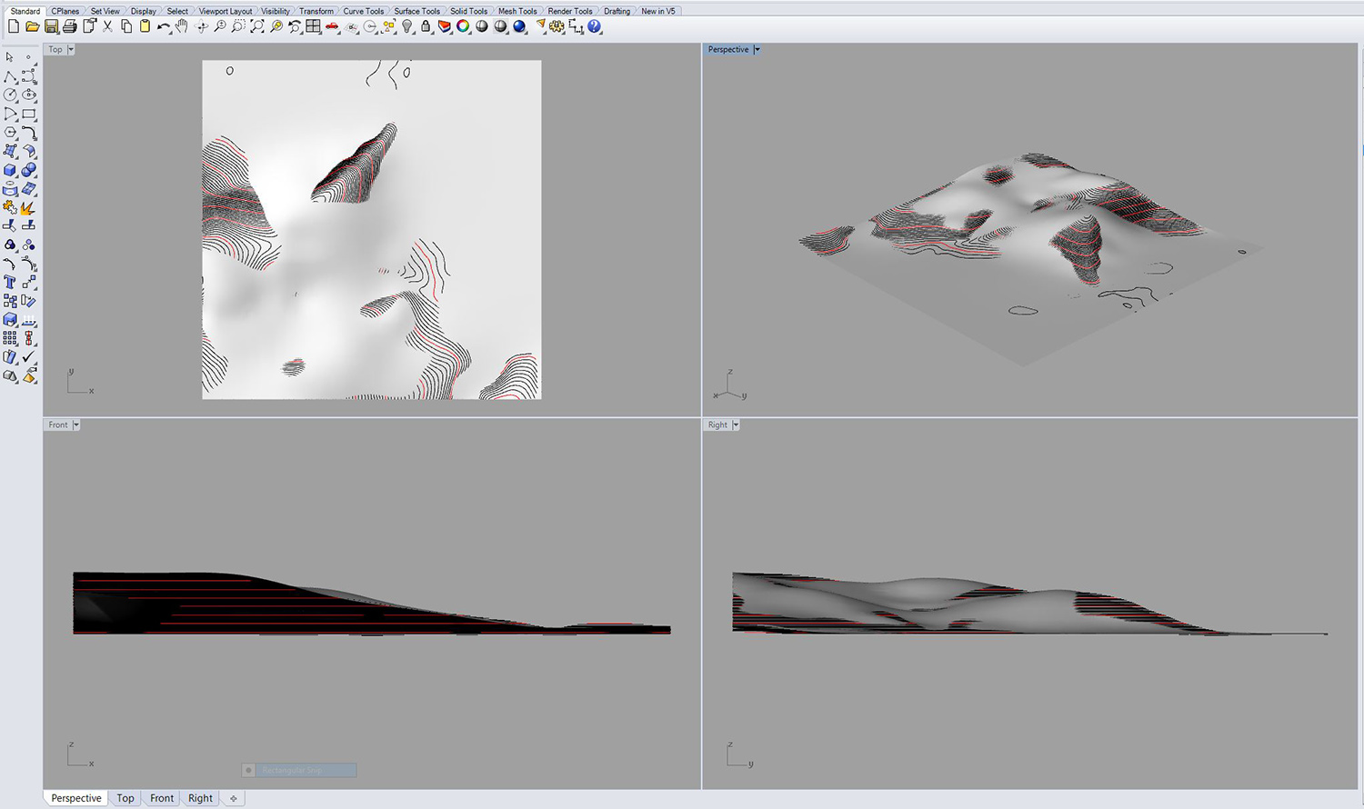
In the 1st-5th exercises the resulting physical models are 3D scanned, imported into GRASS GIS as point clouds, and interpolated as DEMs for analysis. In the 6th and 7th exercises the resulting digital models are exported as point clouds, imported into GRASS GIS, and interpolated as DEMs for analysis. For each model I compute the elevation and its histogram and bivariate scatterplot, the slope, the difference and its histogram, the simulated water flow, and morphology. For each exercise I compute a map of the coefficient of variance of all the of DEMs, bivariate scatterplots of the covariance and correlation matrix of all the of DEMs, and the mean and the absolute value of the mean of the differences between the the reference terrain and the modeled terrain.
During the experiment the participants creative processes were observed and documented with photographs and notes. Semistructured interviews were conducted with select participants after the experiment. The interviews were focused on the intuitiveness and affordances of each technology, strategies and modes of representation, participants’ understanding of space in a given medium, and their creative process.