Tangible Landscape
a tangible interface for geospatial modeling
Brendan Harmon

North Carolina State University
Brendan Harmon
PhD in Design | NCSU | 2013-2017
MPhil in Geography | University of Oxford | 2010-2012
MLA | Harvard Graduate School of Design | 2005-2008
Analog design
Analog design
| Pros | Cons |
|---|---|
| Intuitive | Laborious to reproduce |
| Expressive | Imprecise |
| Imaginative | No quantitative analysis |
Digital design
Computer Aided Design
Digital design
Geographic Information Systems
Tools for geospatial data management and analysis, image processing, graphics and maps production, spatial modeling, & visualization
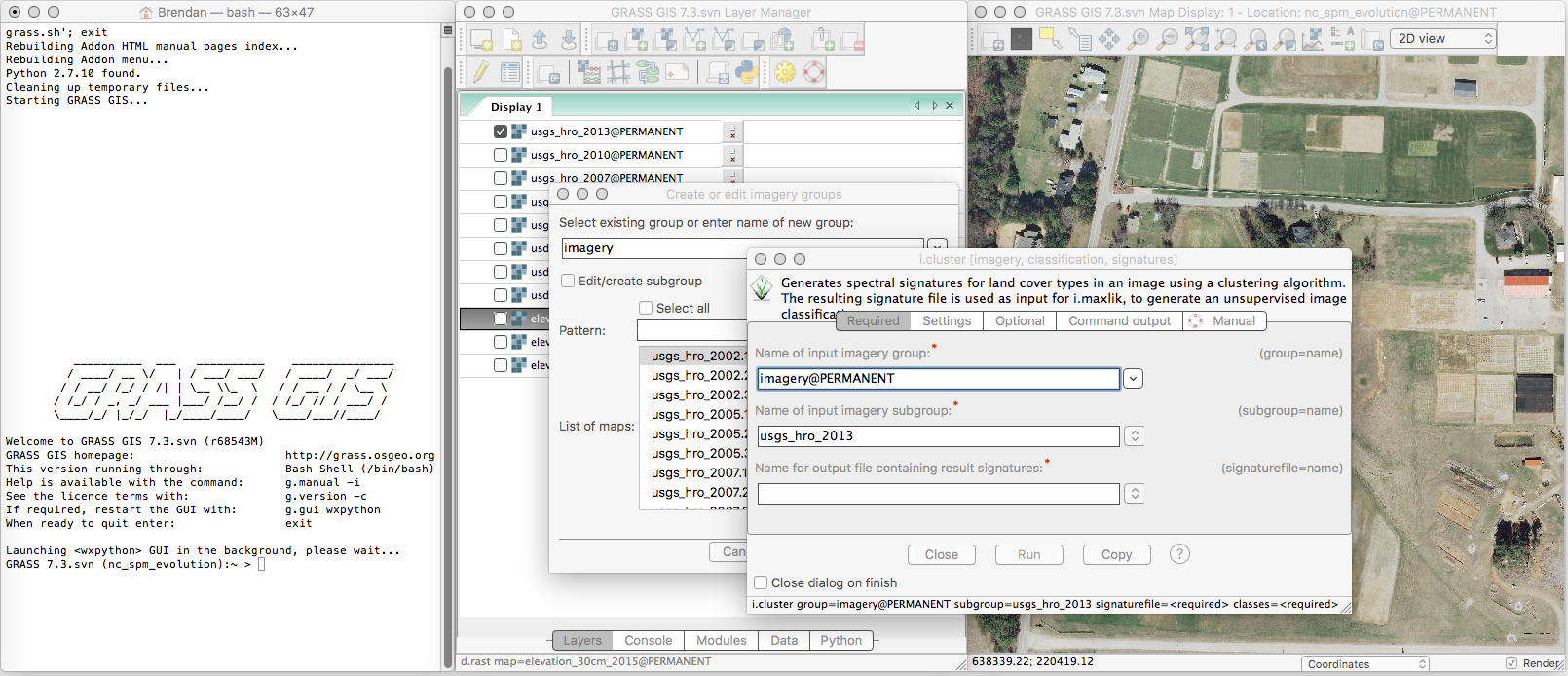
GRASS GIS Command Line Interface (CLI) & Graphical User Interface (GUI)
Digital design
| Pros | Cons |
|---|---|
| Repeatable | Unintuitive |
| Precise | Complex software |
| Large datasets | Complex workflows |
| Quantitative analysis | Learning curve |
Carlo Ratti et al. 2004. Tangible User Interfaces (TUIs): A Novel Paradigm for GIS. Trans. GIS 8, 4 (2004), 407–421. DOI:http://dx.doi.org/10.1111/j.1467-9671.2004.00193.x
Natural interaction
- Virtual Reality (VR)
- Augumented Reality (AR)
- Touch User Interfaces
- Tangible User Interfaces (TUI)
Tangible interaction
Couple physical and digital data
- Enables embodied cognition
- Draws on existing motor schemas
- Seamlessly connects intention, action, and feedback
- Offloads cognitive tasks onto the body
David Kirsh. 2013. Embodied cognition and the magical future of interaction design. ACM Trans. Comput. Interact. 20, 1 (2013), 3:1–3:30. DOI:http://dx.doi.org/10.1145/2442106.2442109
Tangible interfaces for geospatial modeling
Couple physical and digital geospatial models
Augmented architectural models
Urp, 1996-2001
John Underkoffler and Hiroshi Ishii. 1999. Urp: a luminous-tangible workbench for urban planning and design. In CHI ’99 Proceedings of the SIGCHI conference on Human Factors in Computing Systems. New York, New York, USA: ACM Press, 386–393. DOI:http://dx.doi.org/10.1145/302979.303114
Augmented sandboxes
Sandscape & Illuminating Clay, 2002-2004
H. Ishii, C. Ratti, B. Piper, Y. Wang, A. Biderman, and E. Ben-Joseph. 2004. Bringing Clay and Sand into Digital Design — Continuous Tangible user Interfaces. BT Technol. J. 22, 4 (2004), 287–299. DOI:http://dx.doi.org/10.1023/B:BTTJ.0000047607.16164.16
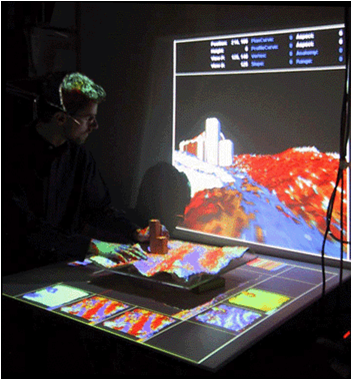
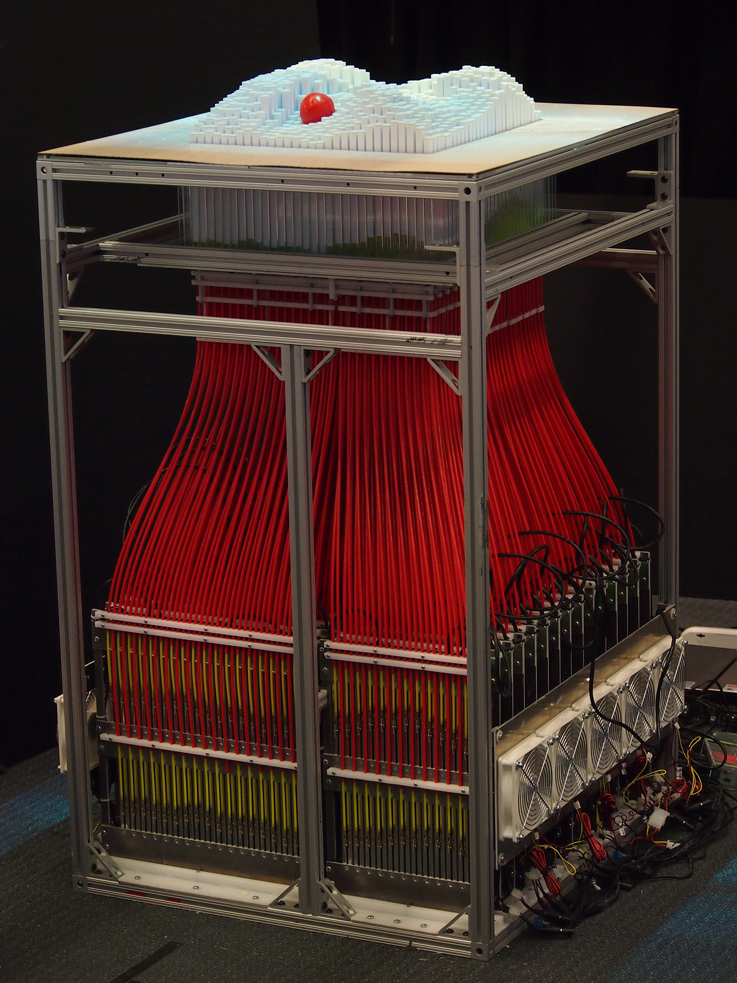
Actuated pin tables
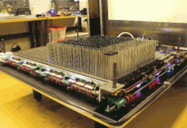
XenoVision Mark III Dynamic Sand Table, 2004
Source: Xenotran
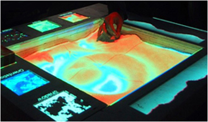
Augmented sandboxes
Tangible Geospatial Modeling System, 2006-2010
Laura Tateosian, Helena Mitasova, Brendan A. Harmon, Brent Fogleman, Katherine Weaver, and Russell S. Harmon. 2010. TanGeoMS: Tangible Geospatial Modeling System. IEEE Trans. Vis. Comput. Graph. 16, 6 (2010), 1605–12. DOI:http://dx.doi.org/10.1109/TVCG.2010.202
Source: NCSU GeoForAll Lab
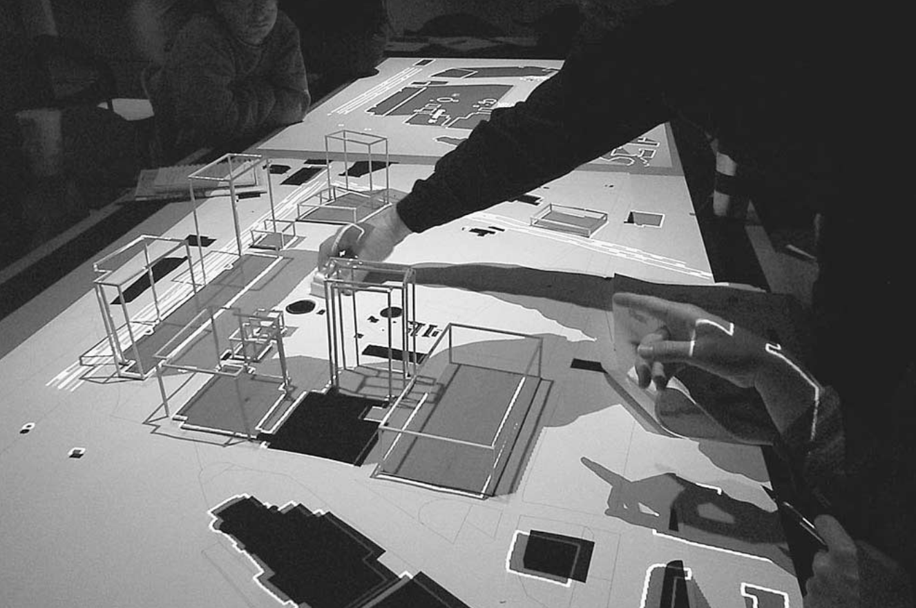
Augmented architectural models
Collaborative Design Platform, 2011-present
Gerhard Schubert, Sebastian Riedel, and Frank Petzold. 2013. Seamfully connected: Real working models as tangible interfaces for architectural design. In Global Design and Local Materialization. Springer-Verlag Berlin Heidelberg, 210–221. DOI:http://dx.doi.org/10.1007/978-3-642-38974-0_20
Source: Dr.-Ing. Gerhard Schubert, Technische Universität München
Augmented sandboxes
Augmented Reality Sandbox, 2012-present
Source: Oliver Kreylos, UC Davis
Actuated pin tables
inFORM, 2013-present
Sean Follmer, Daniel Leithinger, Alex Olwal, Akimitsu Hogge, and Hiroshi Ishii. 2013. inFORM: dynamic physical affordances and constraints through shape and object actuation. In Proceedings of the 26th annual ACM symposium on User interface software and technology - UIST ’13. New York, New York, USA: ACM Press, 417–426. DOI:http://dx.doi.org/10.1145/2501988.2502032
Augmented sandboxes
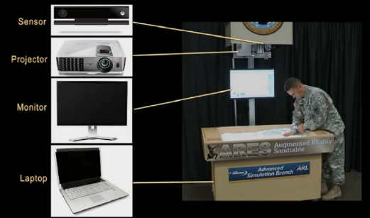
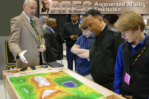
The Augmented REality Sandtable (ARES), 2015-present
Charles R. Amburn, Nathan L. Vey, Michael W. Boyce, and MAJ Jerry R. Mize. 2015. The Augmented REality Sandtable ( ARES ). US Army Research Laboratory. ARL-SR-0340. DOI:http://dx.doi.org/10.13140/RG.2.1.2685.0006
Source: US Army Research Laboratory
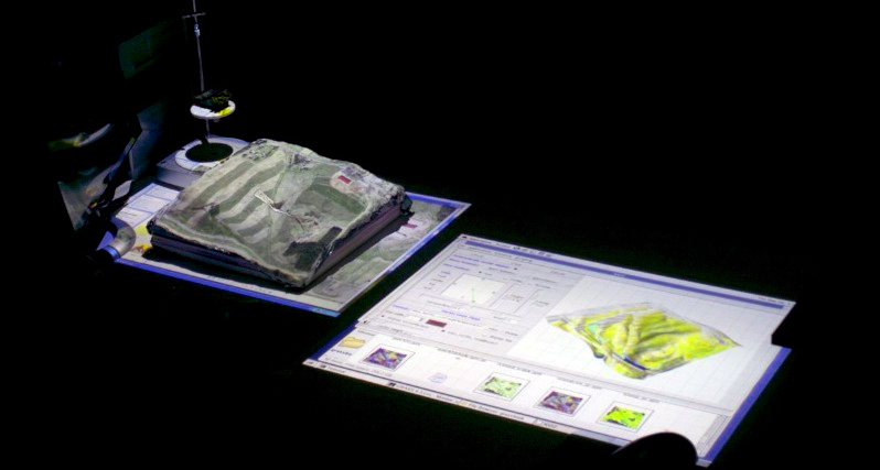
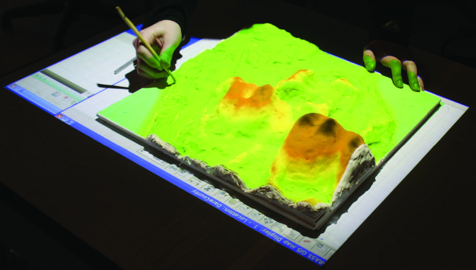
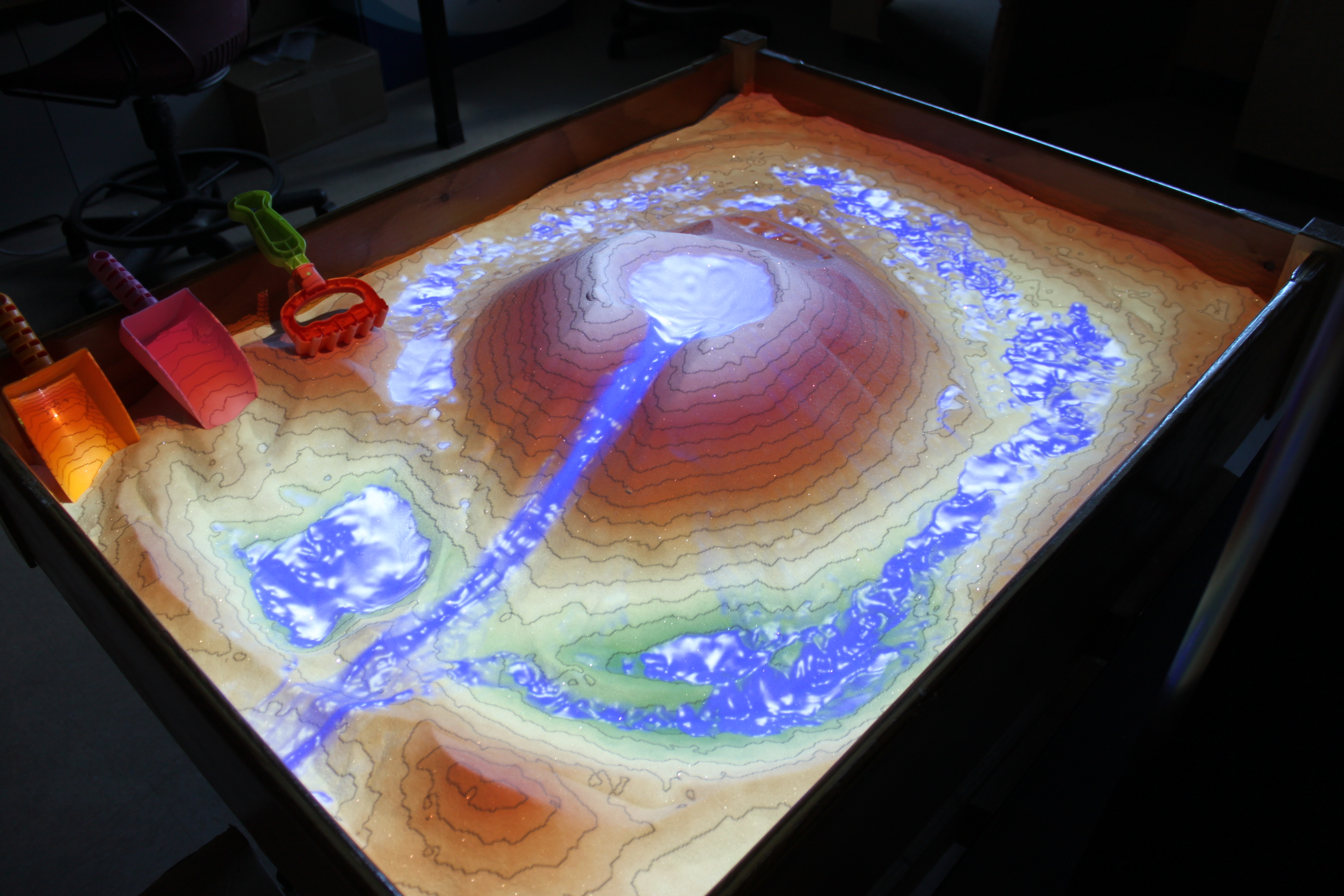
Tangible Landscape
A tangible user interface powered by open source GIS
2013-present
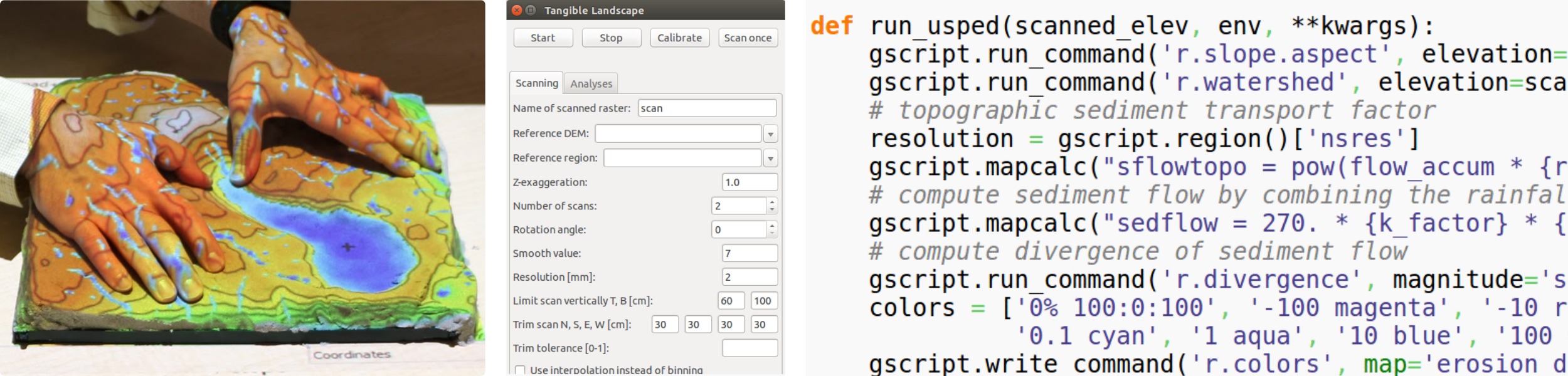
Tanigble interaction with GIS
With Tangible Landscape you can hold a GIS in your hands - feeling the shape of the earth, sculpting its topography, and directing the flow of water.
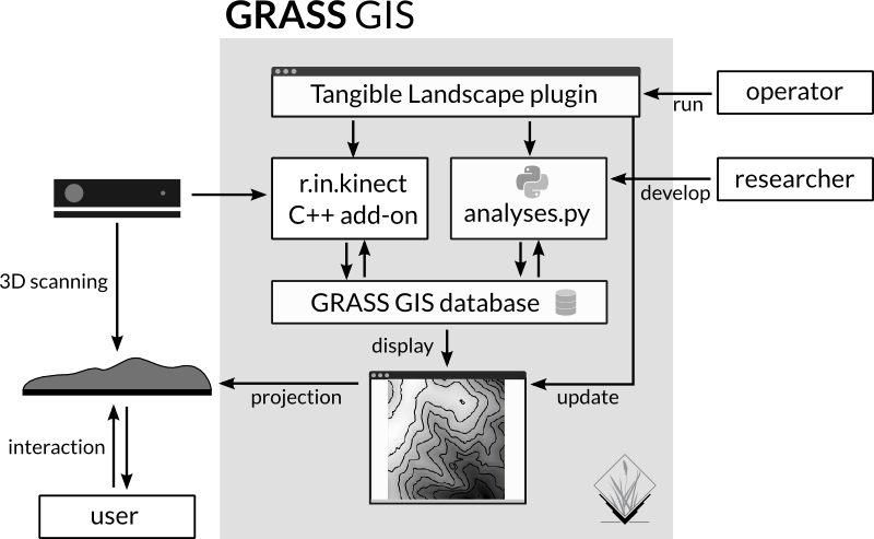
How it works
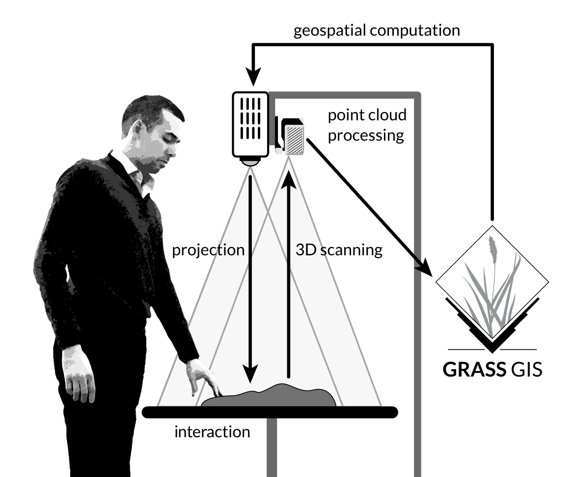
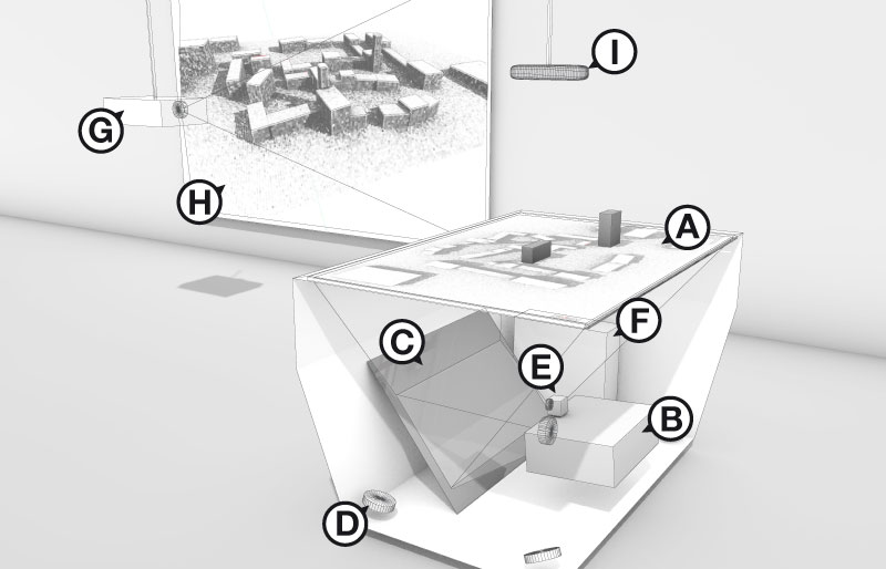
Tangible Landscape couples a digital and a physical model through a continuous cycle of 3D scanning, geospatial modeling, and projection
Realtime 3D scanning
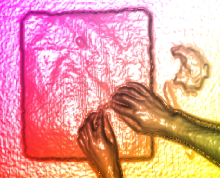
with Kinect sensor
Interactions
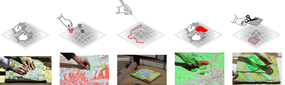
| surface | points | lines | areas | areas |
Features
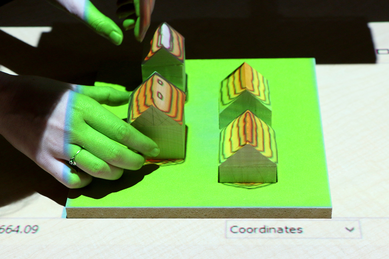
A collaborative environment for tangible freeform modeling, object detection, real-time geospatial analytics, 3D rendering, and virtual reality
Payam Tabrizian, Anna Petrasova, Brendan Harmon, Vaclav Petras, Helena Mitasova, and Ross Meentemeyer. 2016. Immersive Tangible Geospatial Modeling. In Proceedings of the 24th ACM SIGSPATIAL International Conference on Advances in Geographic Information Systems. GIS ’16. San Francisco, CA: ACM, 88:1-88:4. DOI:http://dx.doi.org/10.1145/2996913.2996950
Applications: visibility
Visibility and line of sight
Applications: solar analysis
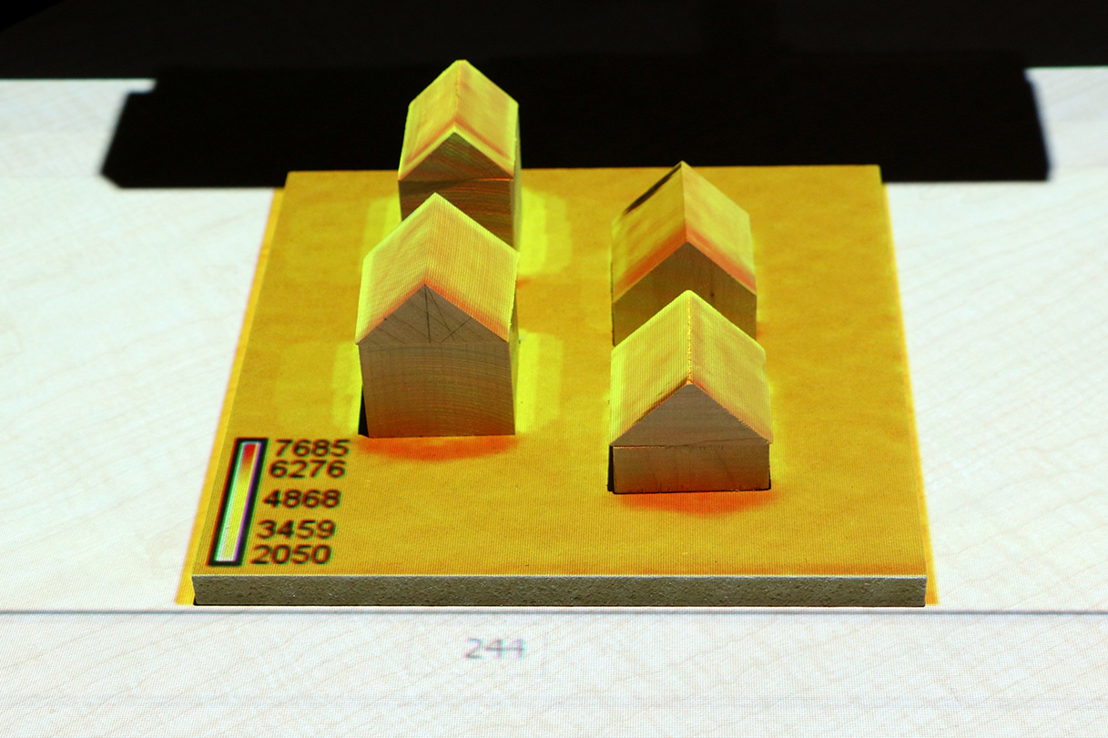
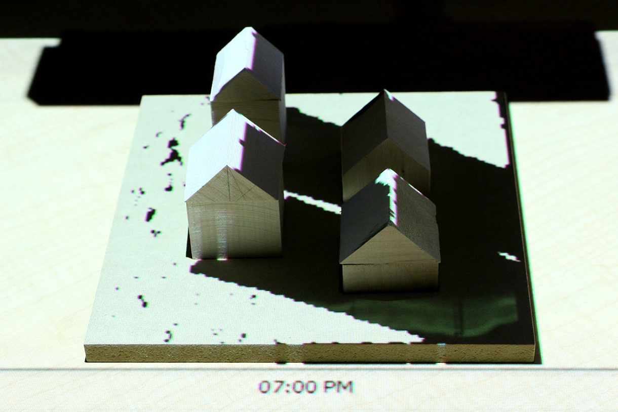
Solar irradiation and cast shadows
Applications: trail planning
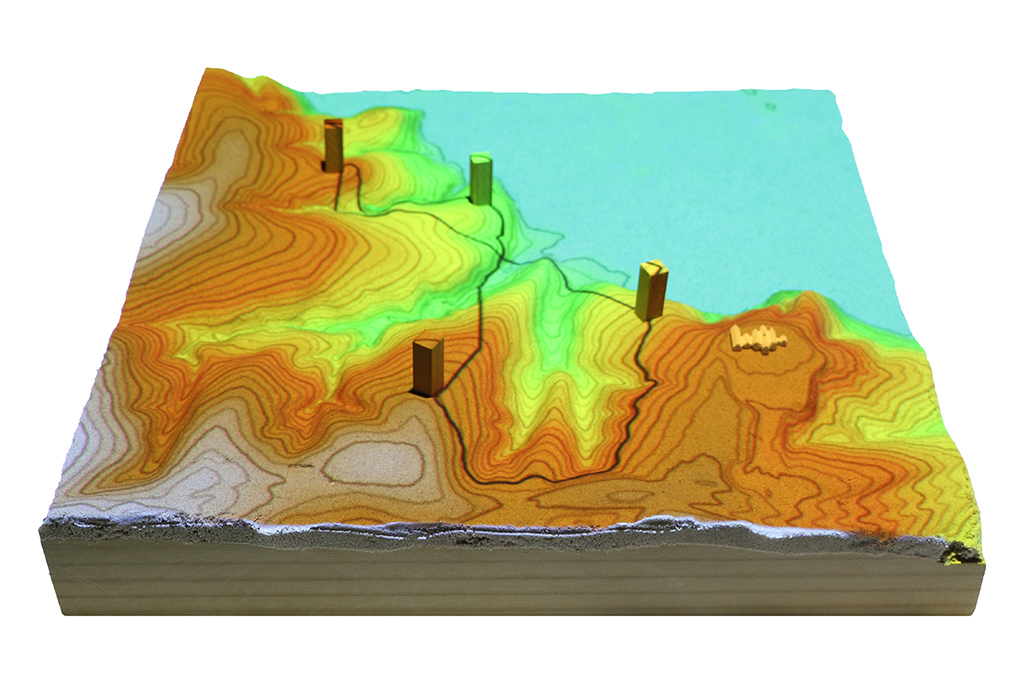
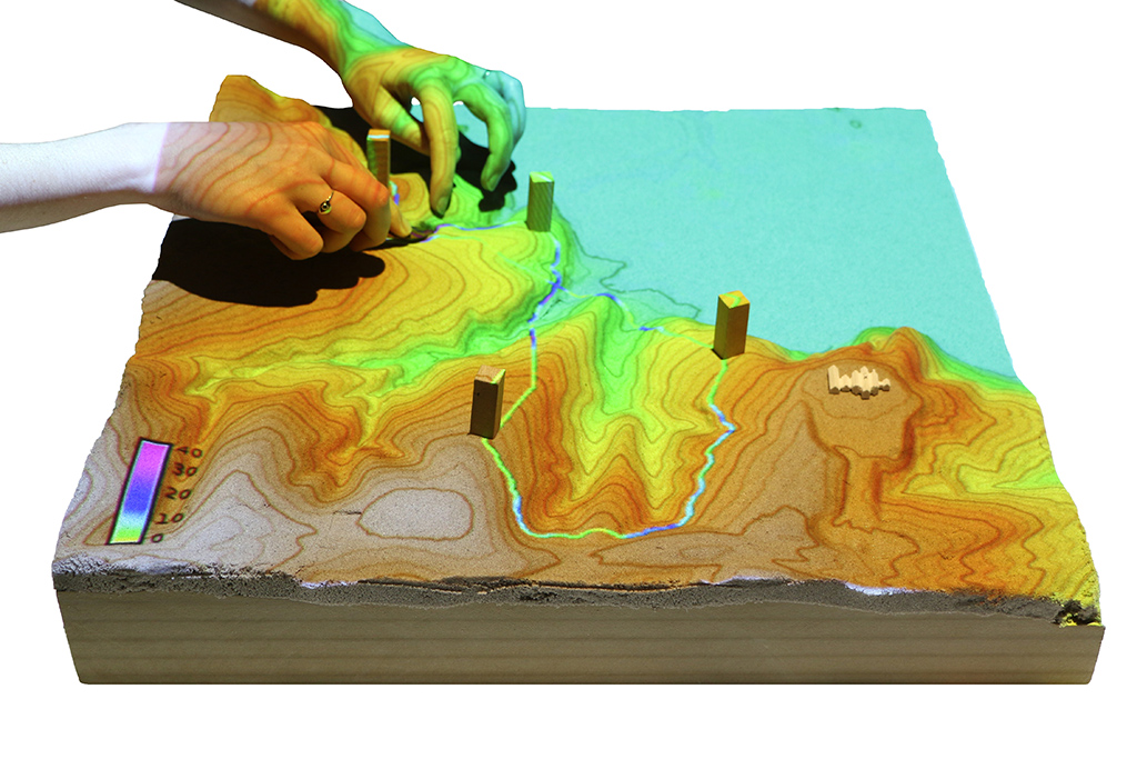
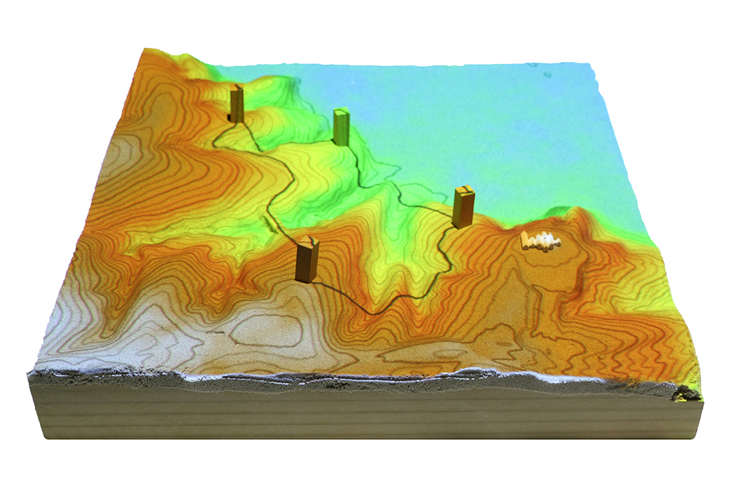
Optimized trail routing between waypoints based on energetics, topography, and cost maps with feedback including trail slopes and viewsheds
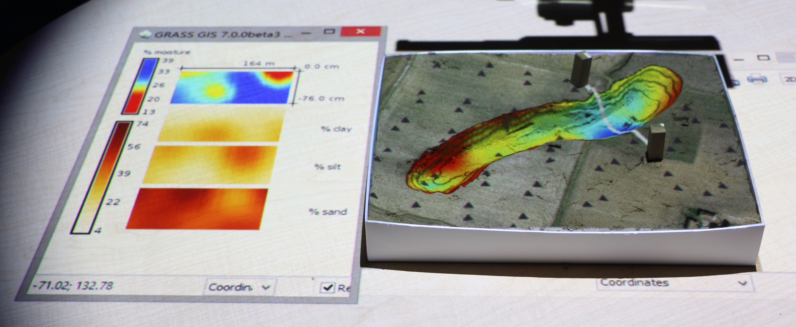
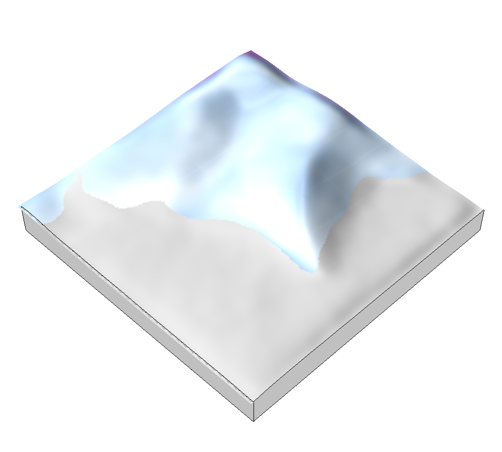
Applications: 3D soil moisture exploration
Applications: wildfire spread
Designing and testing fire breaks
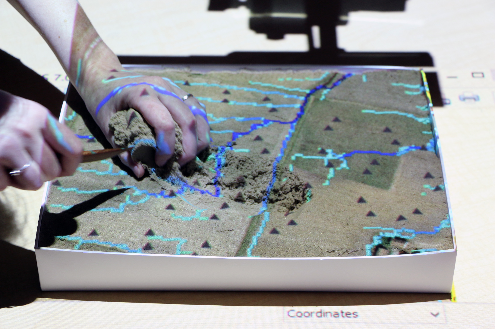
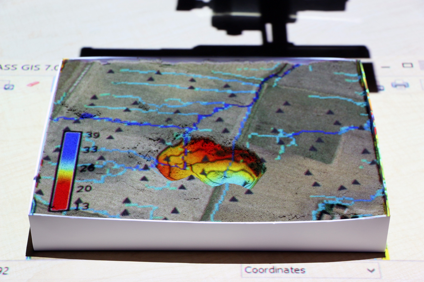
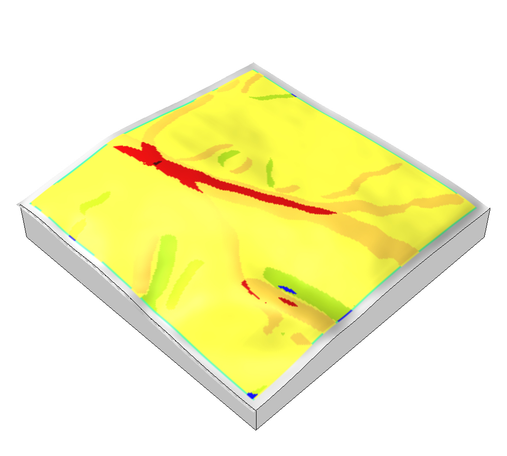
Applications: erosion control
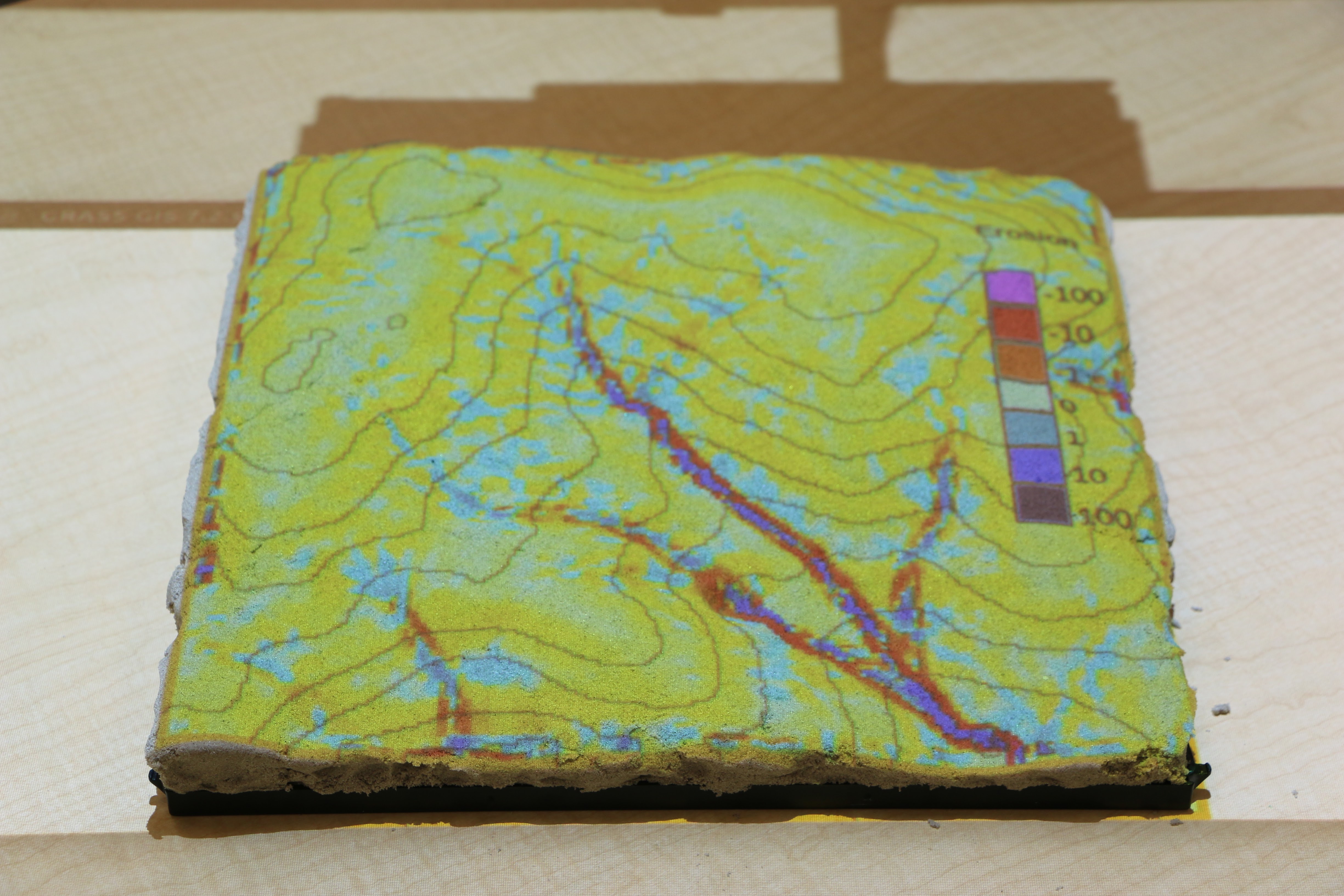
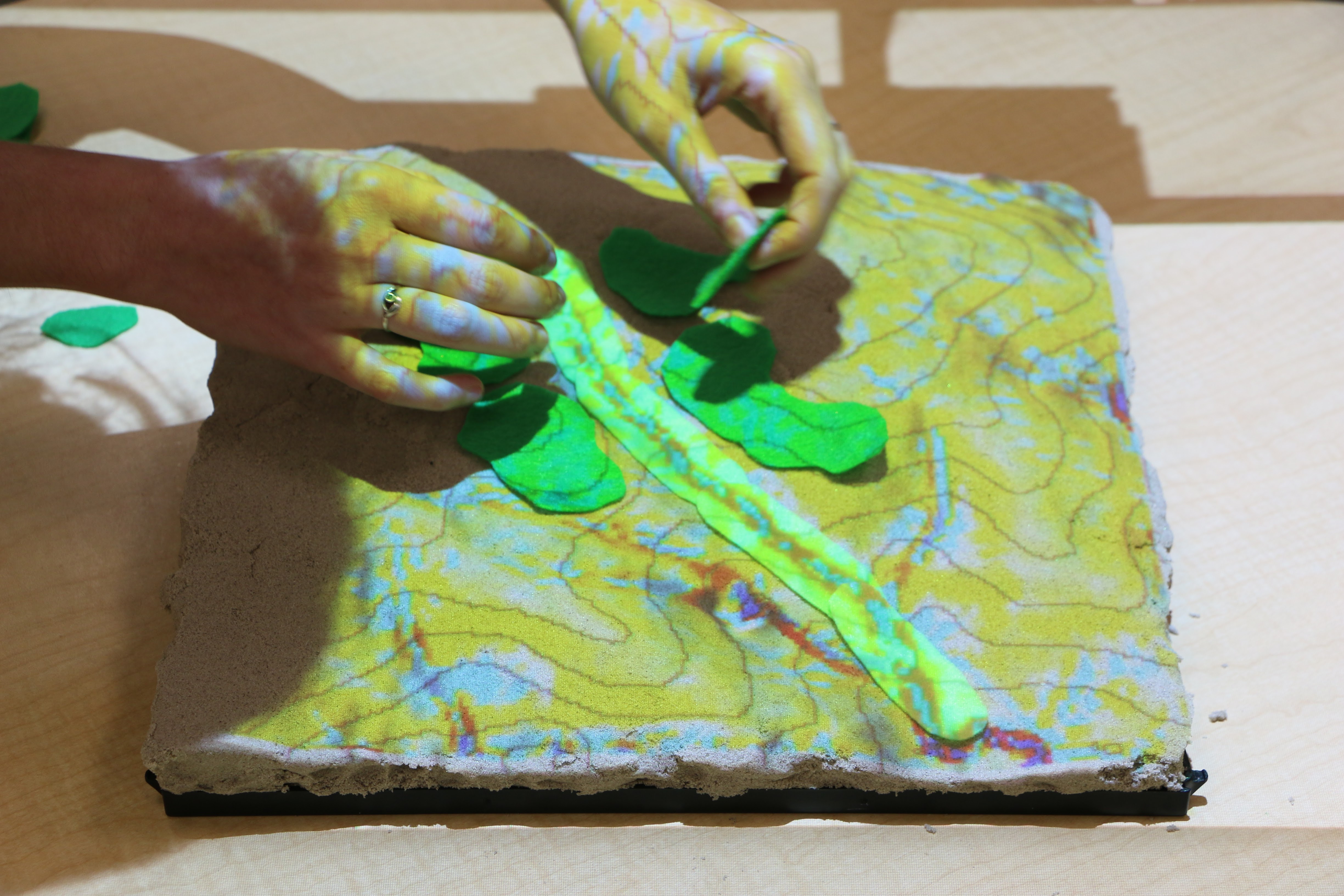
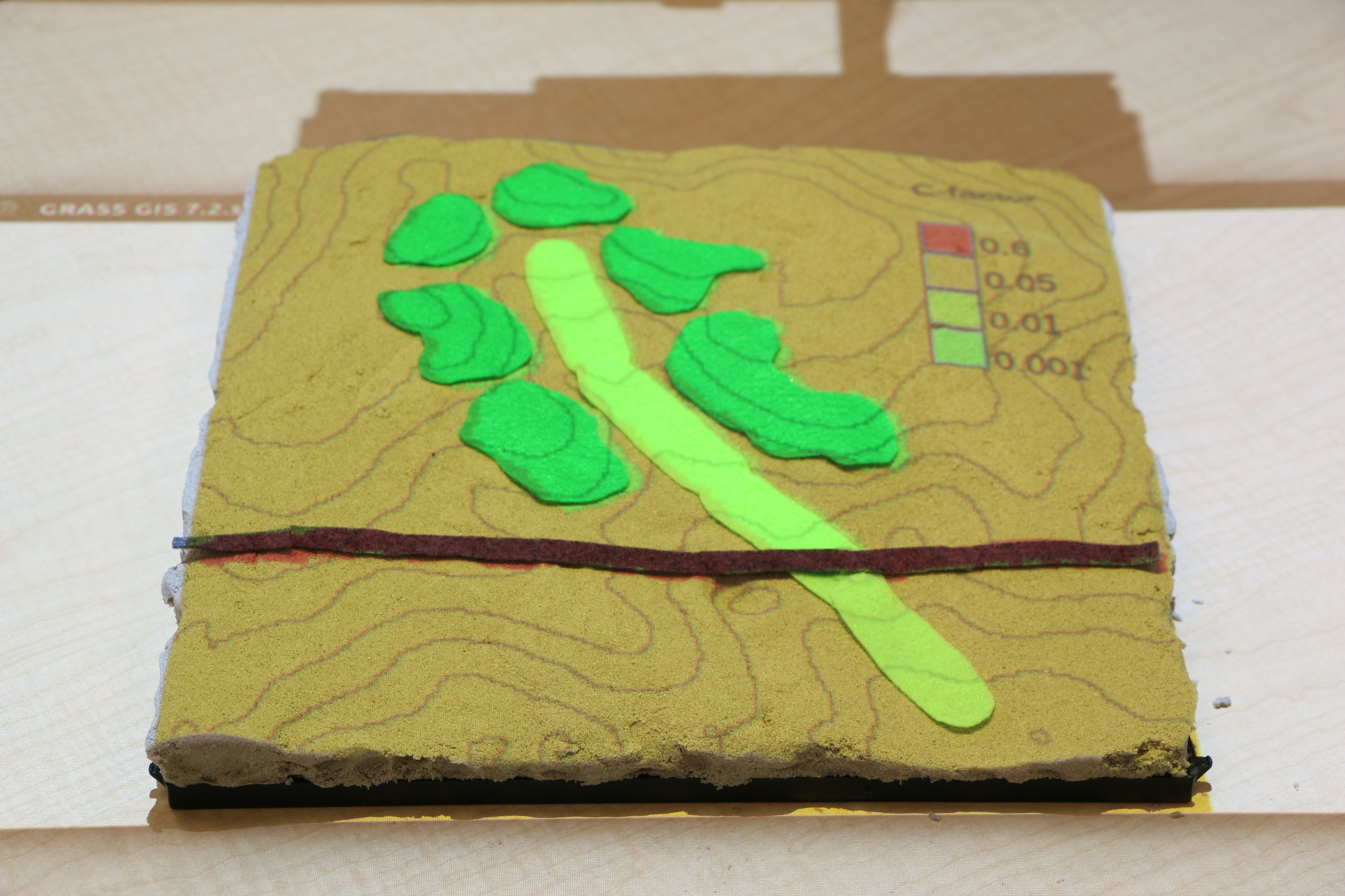
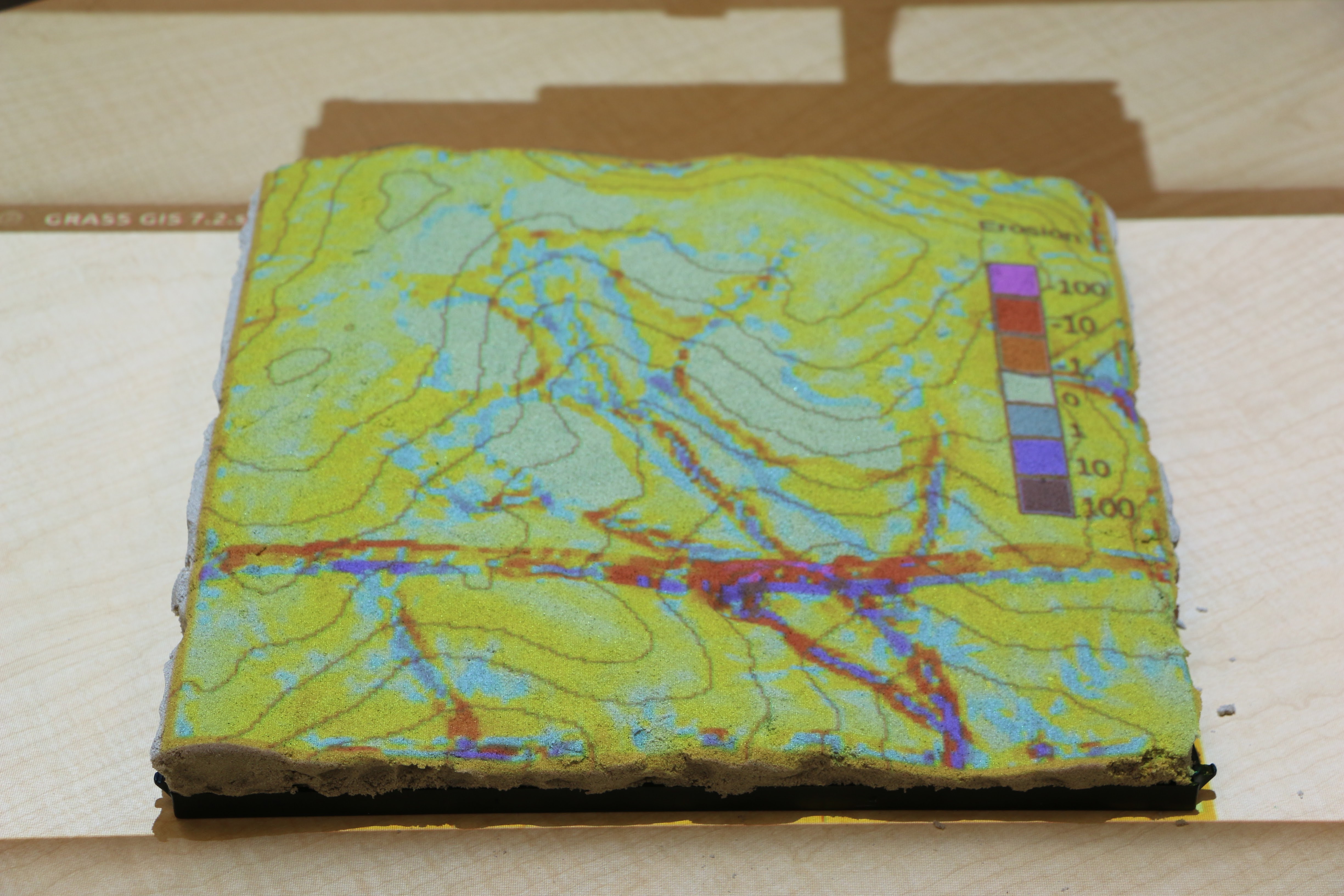
Modifying land cover with colored felt
Applications: urban growth
Simulation of urban growth scenarios with FUTURES model
Applications: coastal flooding
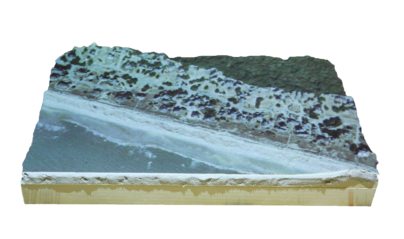
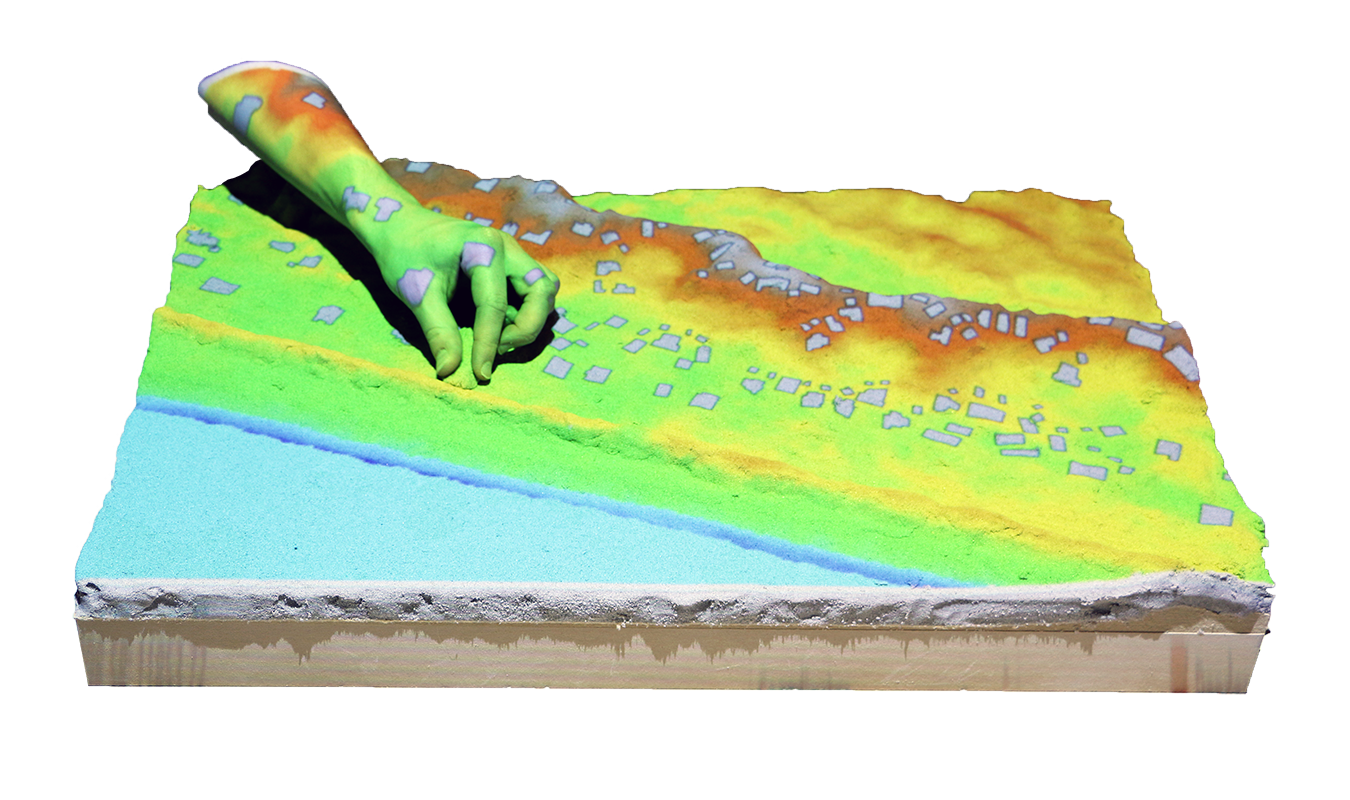
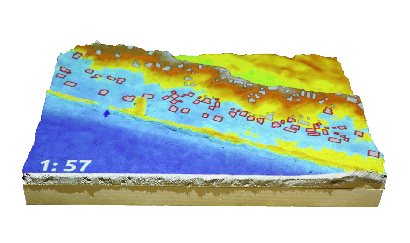
Save houses from coastal flooding by building coastal defenses
Structured problem-solving with rules, challenging objectives, and scoring
Applications: termite infestation
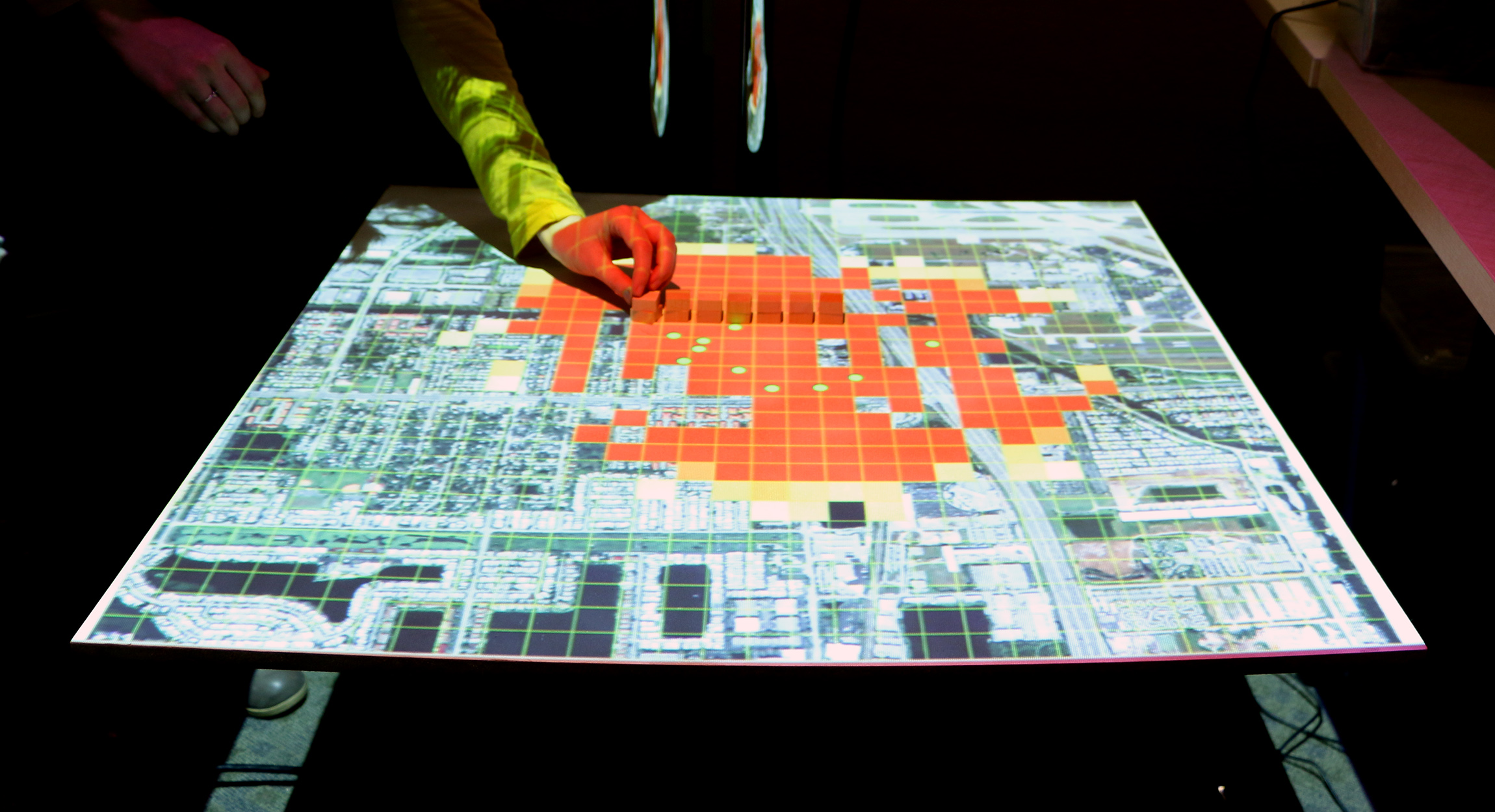
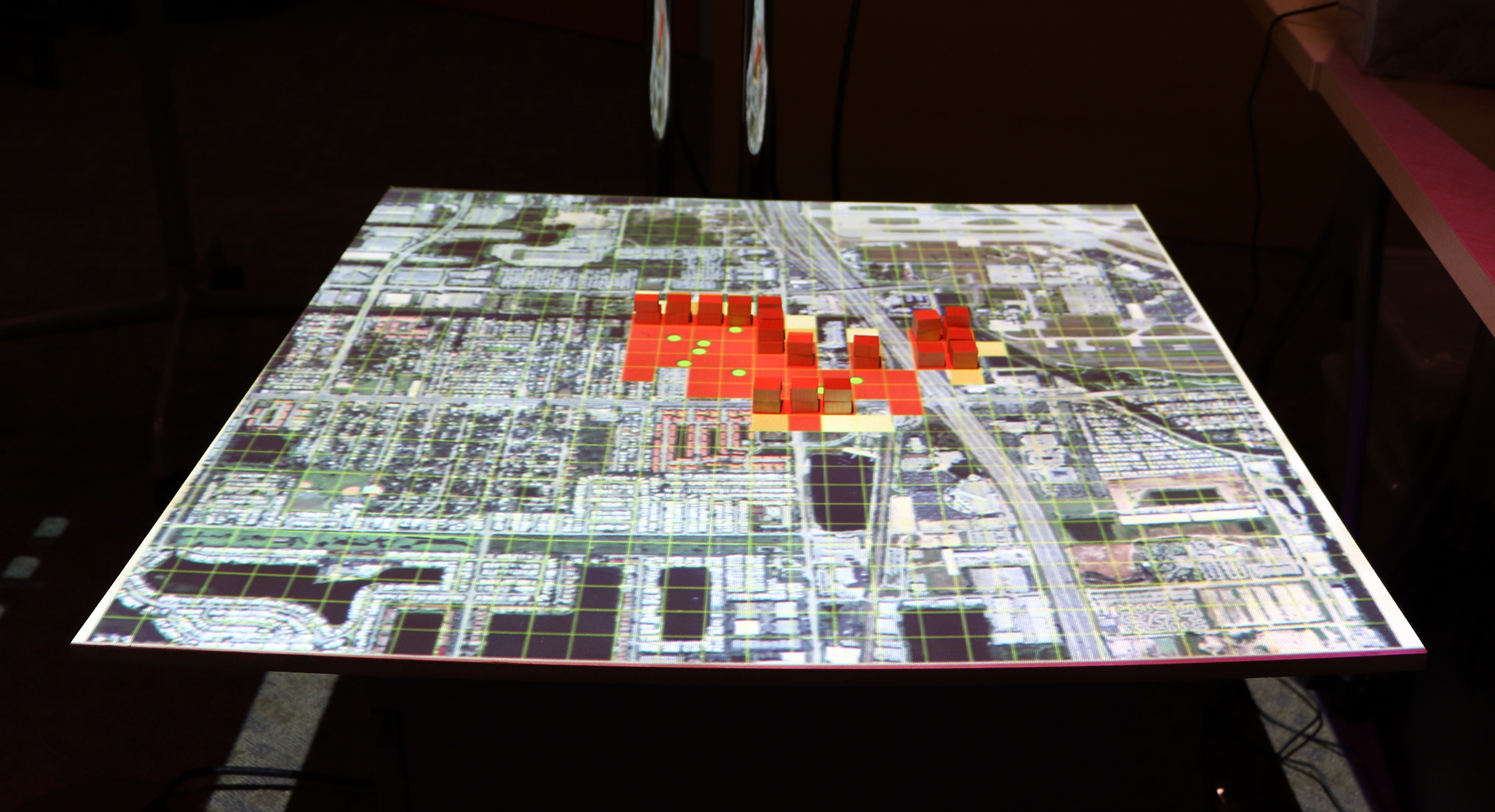
Manage the spread of termites across a city by treating city blocks using a model of biological invasion in R
User studies
3D spatial performance
in analog, digital, & tangible modeling
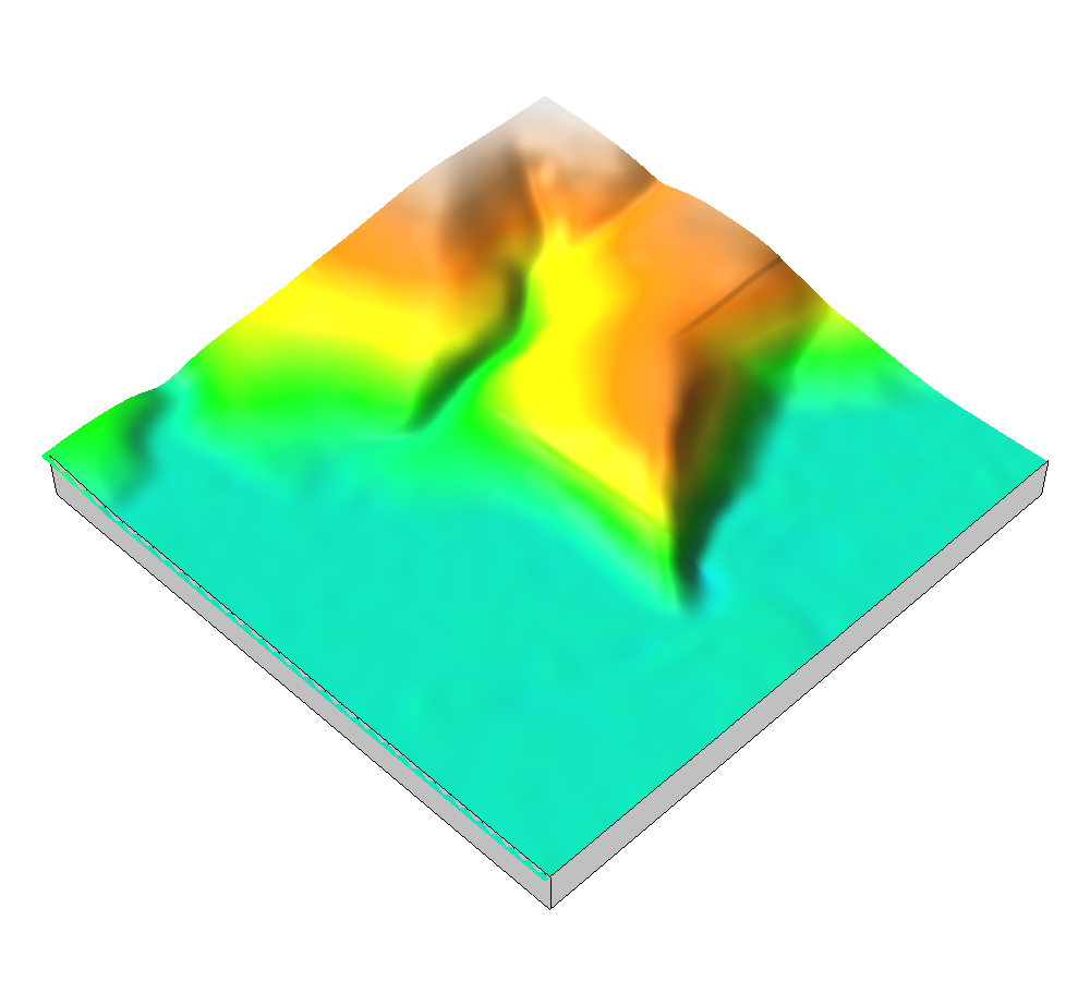
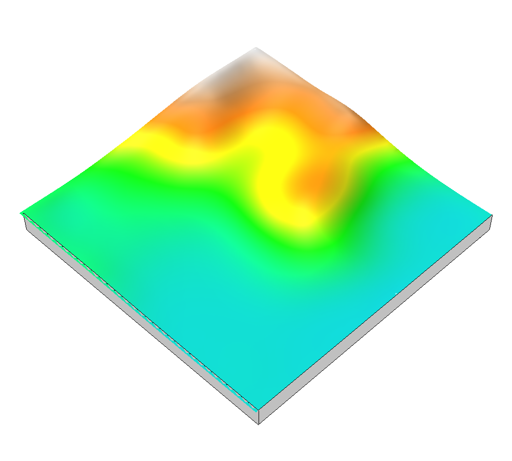
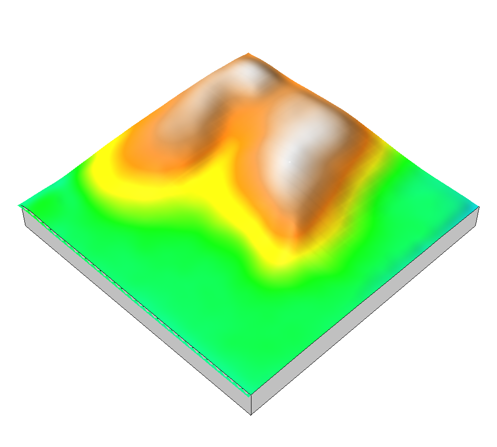
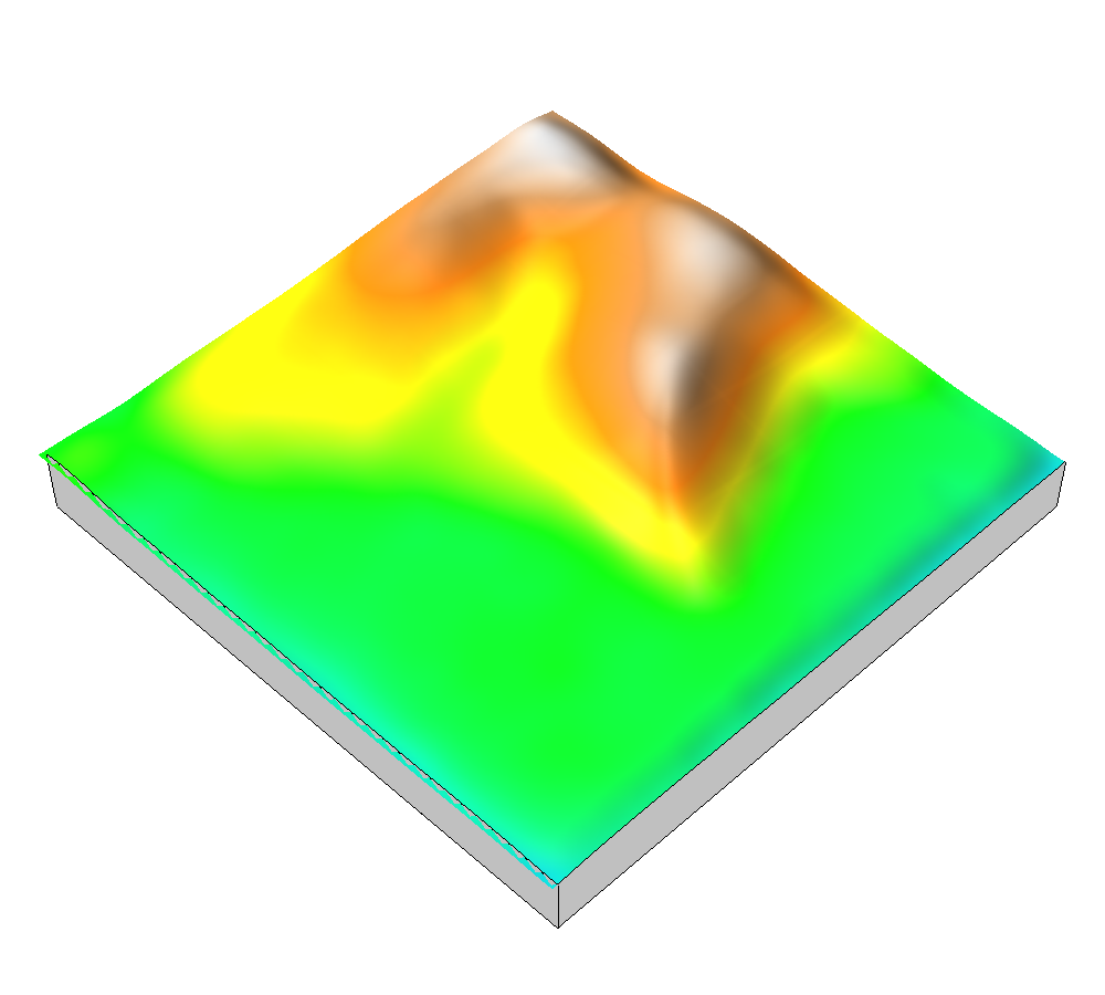
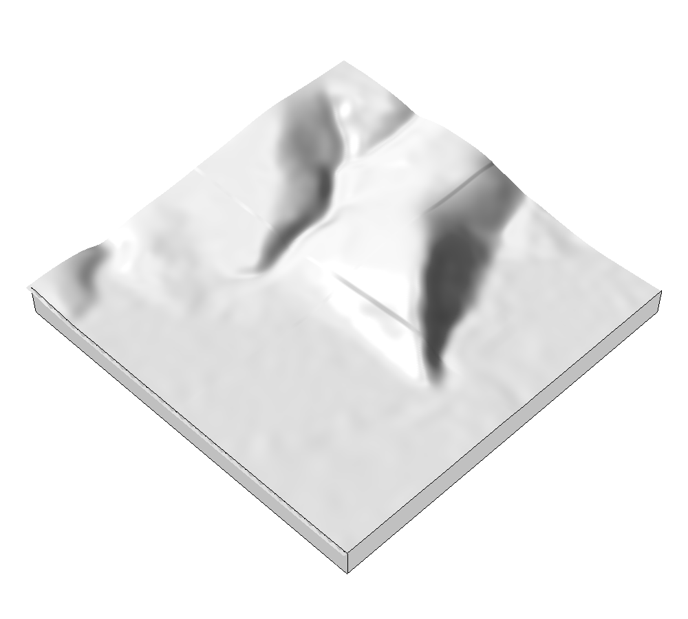
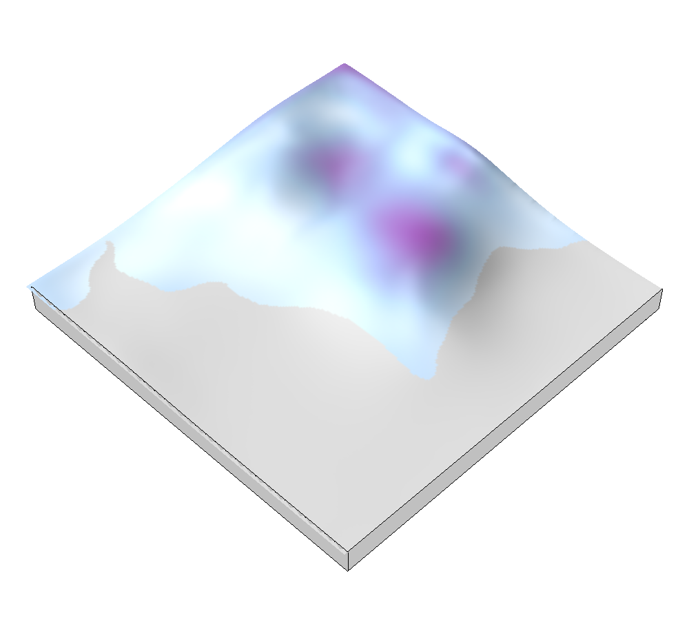
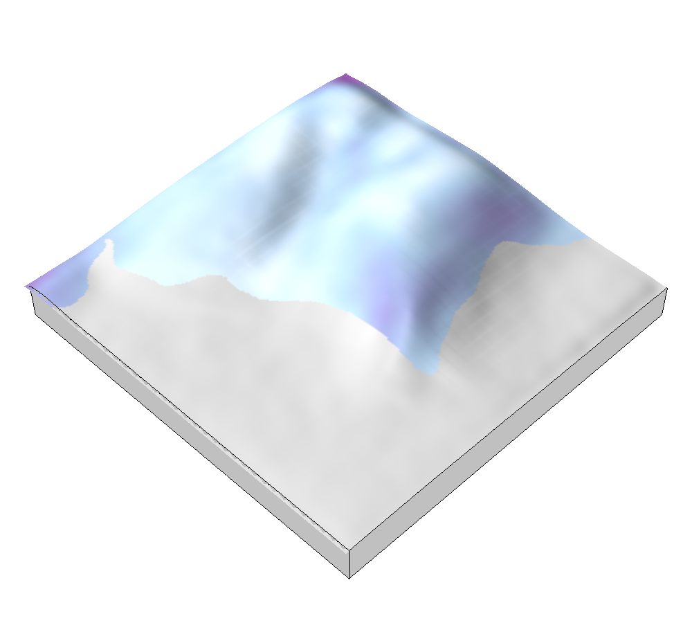
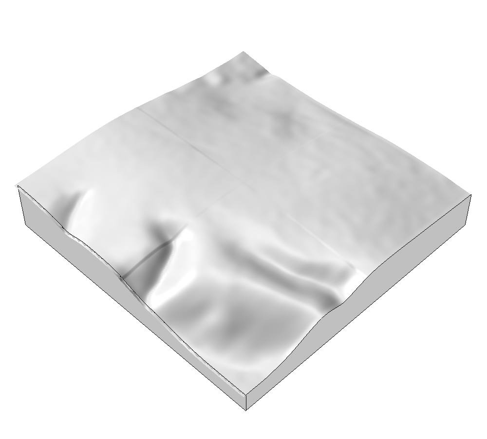
Digital 3D modeling
with Rhinoceros
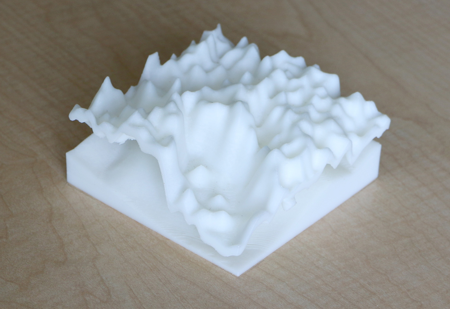
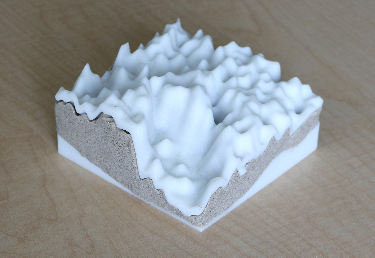
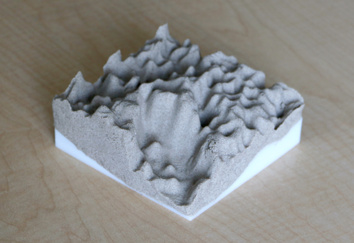
Analog 3D modeling
with polymeric sand
Projection augmented 3D modeling
with Tangible Landscape
3D modeling with the difference analytic
with Tangible Landscape
All participants
| Reference | Digital | Analog | Augmented | |
|---|---|---|---|---|
Elevation  |
 |
 |
 |
 |
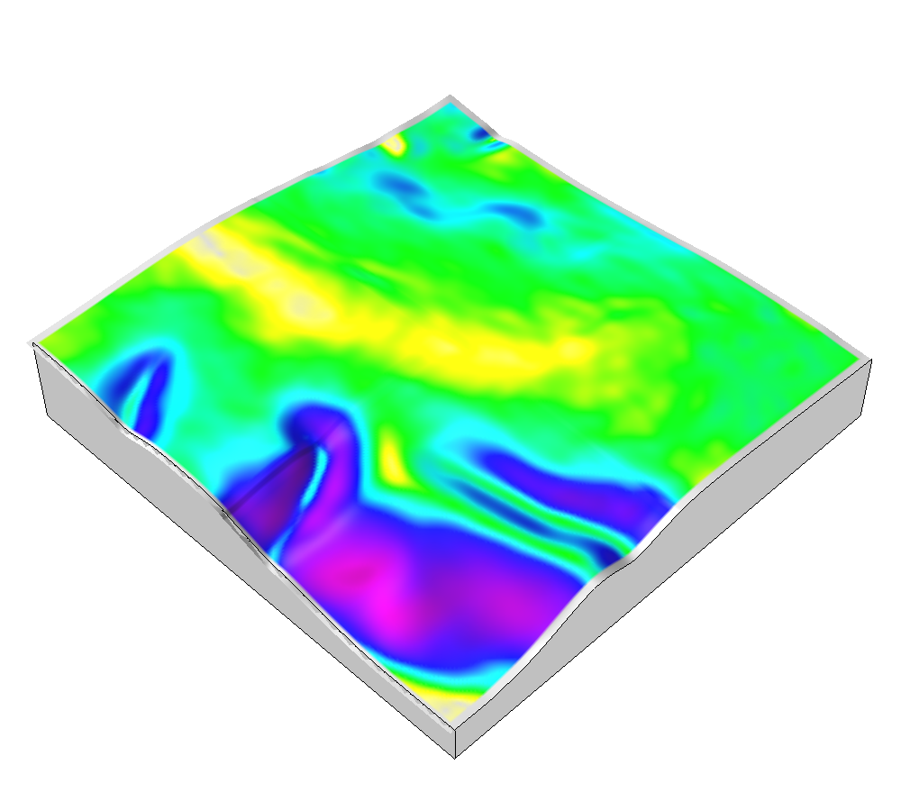
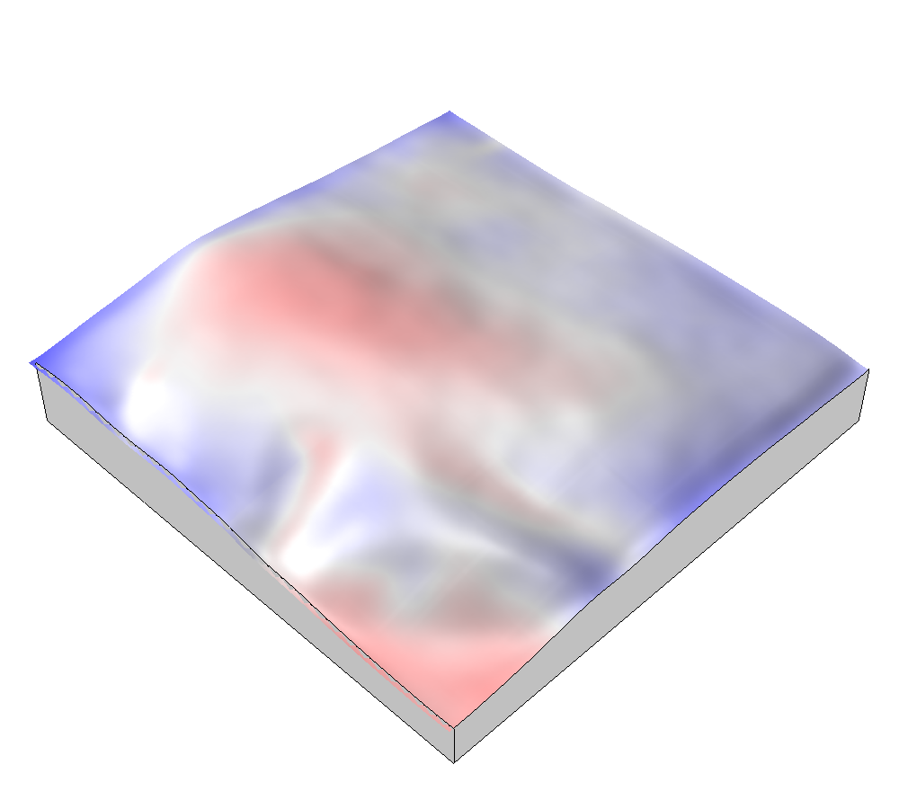
Stdev. of differences |
 |
 |
 |
 |
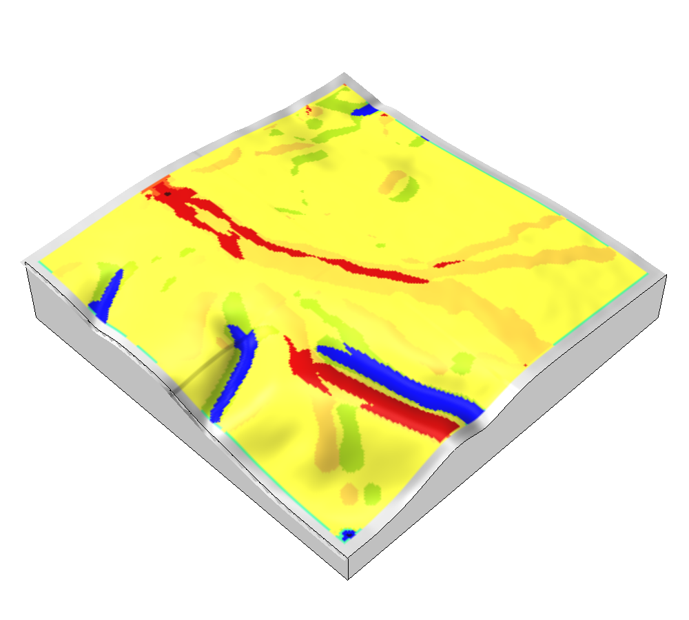
Landforms |
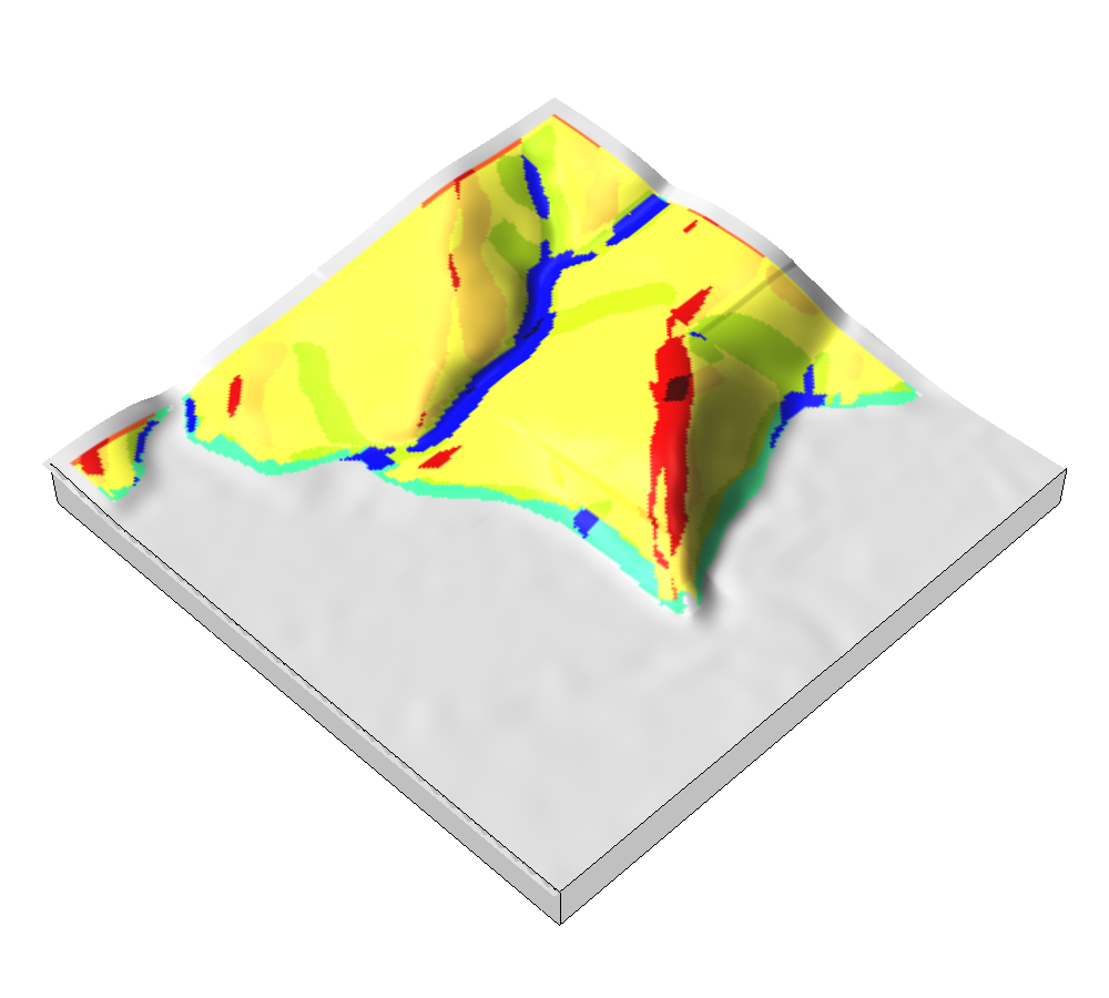 |
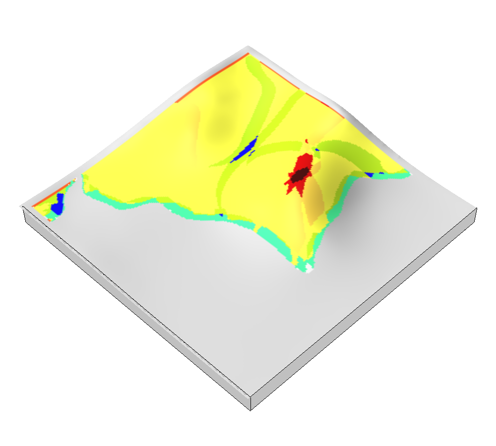 |
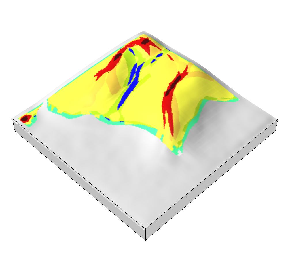 |
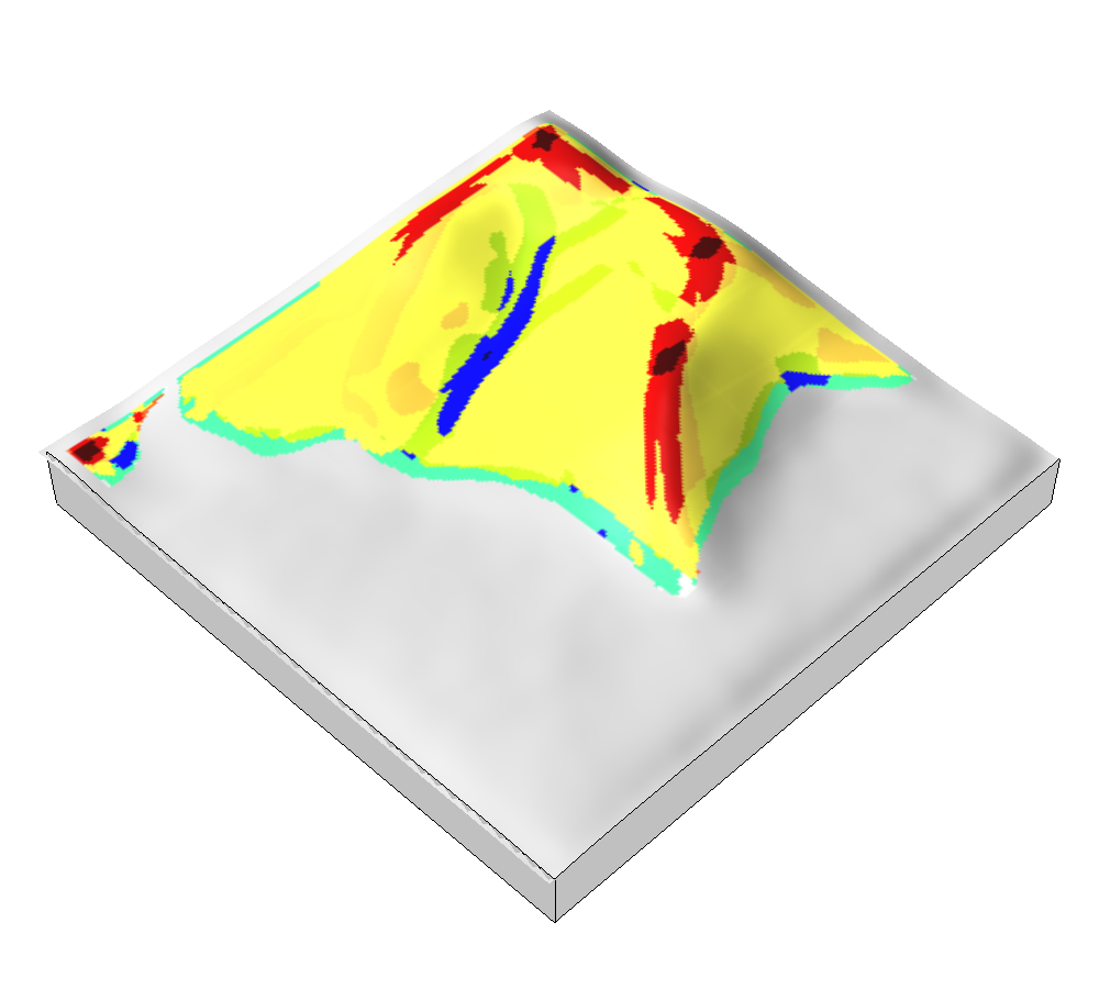 |
Difference
| Elevation | Difference | Slope | Landforms | |
|---|---|---|---|---|
| Reference | 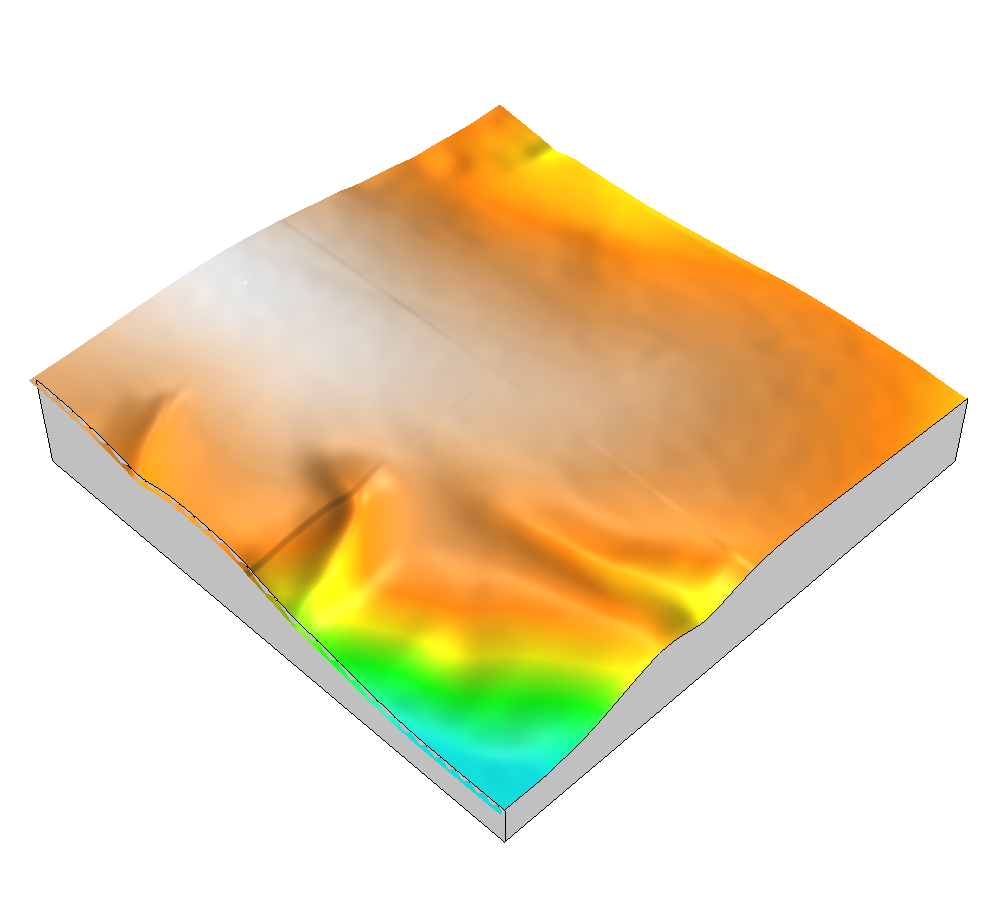 |
 |
 |
 |
| Mean | 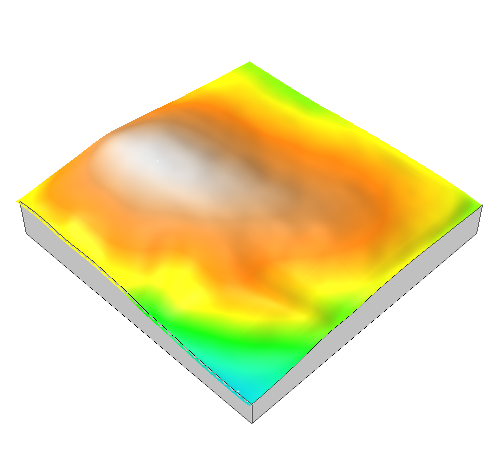 |
 |
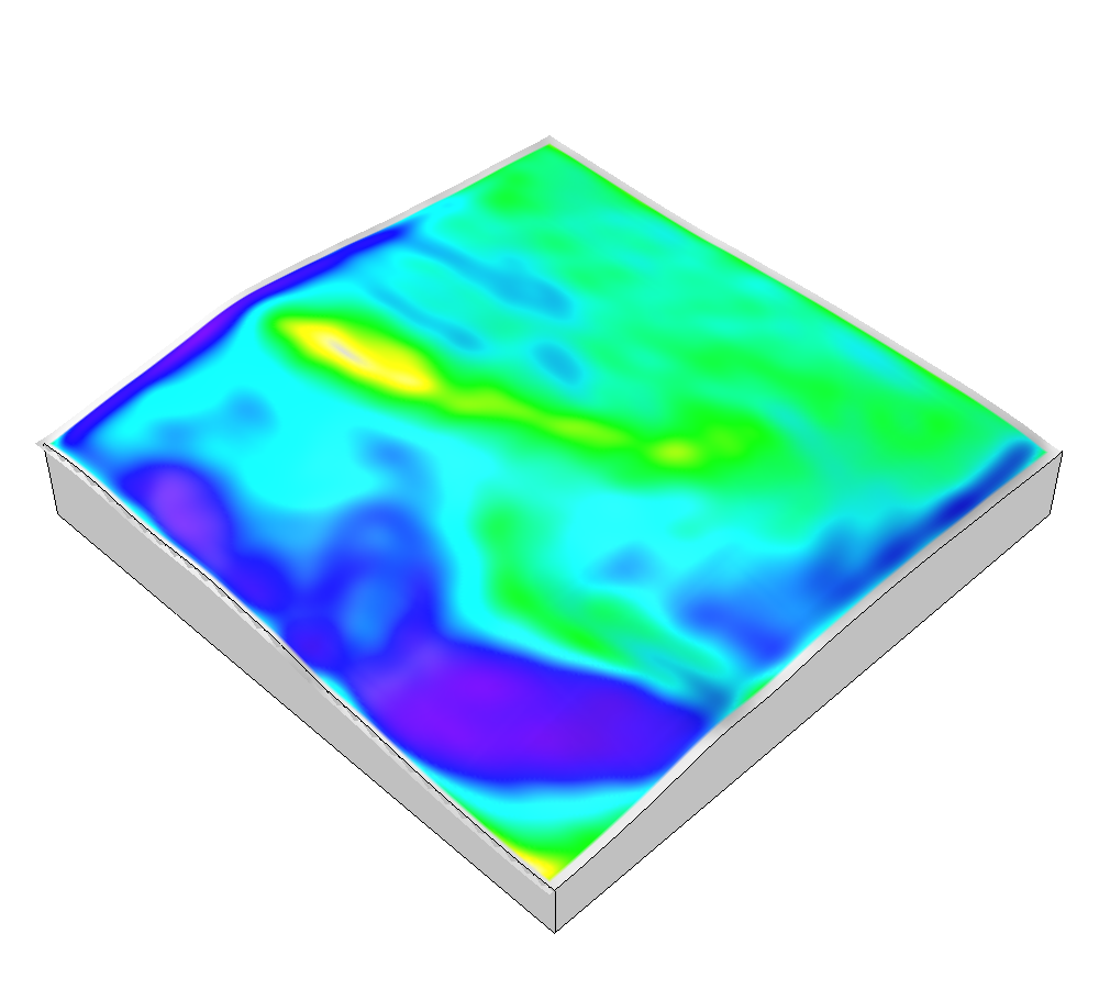 |
 |
 |
 |
 |
|
User studies
Tangible modeling
- is highly intuitive
- improves users' 3D spatial performance
- enables a rapid, iterative process of form-finding and critical analysis
Brendan A. Harmon. 2016. Embodied Spatial Thinking in Tangible Computing. In TEI ’16: Proceedings of the Tenth International Conference on Tangible, Embedded, and Embodied Interaction. Eindhoven, Netherlands: ACM Press, 693–696. DOI:http://dx.doi.org/10.1145/2839462.2854103
Brendan A. Harmon, Anna Petrasova, Vaclav Petras, Helena Mitasova, and Ross K. Meentemeyer. 2016. Tangible Landscape: cognitively grasping the flow of water. In The International Archives of the Photogrammetry, Remote Sensing and Spatial Information Sciences. Prague: International Society of Photogrammetry and Remote Sensing. DOI:http://dx.doi.org/10.5194/isprsarchives-XLI-B2-647-2016
Brendan A. Harmon et al. 2017. Cognitively Grasping Topography with Tangible Landscape. In review.
Design implications
- Rapid conceptual design with scientific analytics
- Easily engage stakeholders and the public in the design process
- New ways to teach grading, hydrology, & geomorphology
Future work
Planting with Tangible Landscape
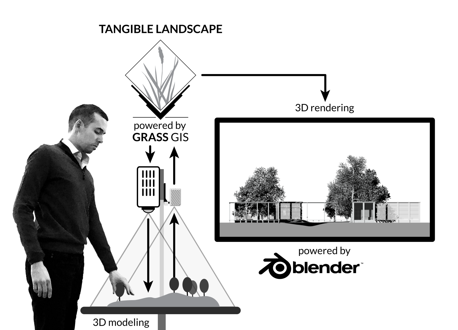
Planting tangible 3D trees with realtime rendering
Tangible Landscape with robotic fabrication
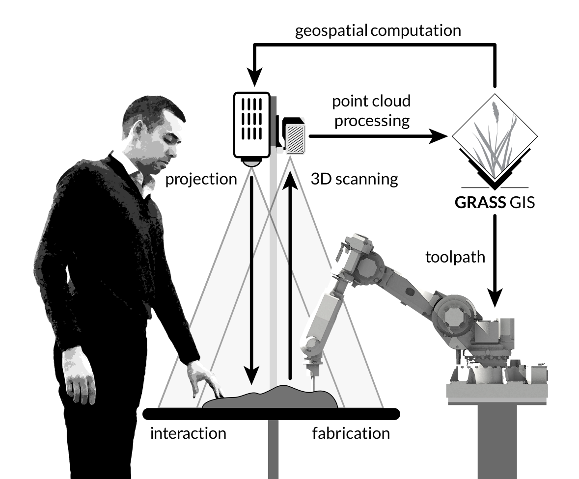
In-situ robotic fabrication for Tangible Landscape
Tangible Landscape with robotic fabrication, streaming data, and autonomous construction
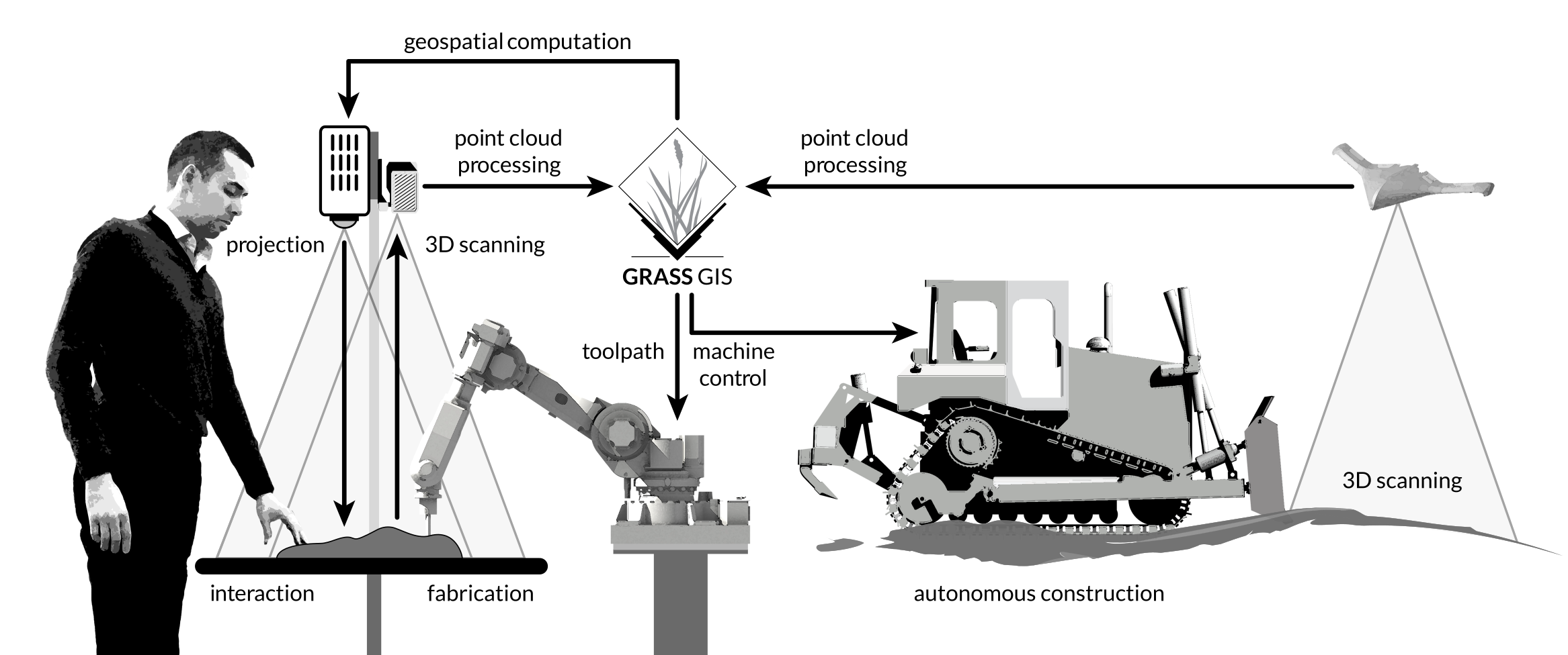
Bi-directionally coupling physical and digital landscapes
Courses
GIS for Designers
GIS for Designers
- Cartography
- Data acquisition
- Terrain modeling
- Hydrological modeling
- Viewshed analysis
- Solar analysis
- Trail routing
- Map algebra
- Map overlay analysis
Digital Design
Digital Design
- Architectural modeling
- Terrain modeling
- Freeform modeling
- Procedural modeling
- 3D plants
- Rendering
Landscape Representation
Landscape Representation
- Freehand drawing
- Gestural sketching
- Figure drawing
- Plans, sections, and perspectives
- Rapid ideation
- Sketching in nature
- Sketching in the city
Digital Fabrication
Digital Fabrication
- Rapid ideation and prototyping
- 3D modeling
- 3D printing
- Laser cutting
- Thermoforming
- CNC machining
- Robotic fabrication
- Autonomous construction
Landscape Ecology
Landscape Ecology
- Ecological theory
- Ecological census techniques
- Field work
- Computational ecology with GIS
- Ecological design
- Ecological restoration charrette
Lidar and UAV Analytics
Lidar and Unmanned Aerial Vehicle (UAV) Analytics
- Lidar binning
- Lidar interpolation
- UAV photogrammetry
- Structure-from-motion
- Image classification
Studios
Algorithmic Landscape Architecture
Algorithmic Landscape Architecture
- Computionally analyze landscape conditions
- Model social, geomorphological, and ecological processes
- Generatively design ecologically functioning landscapes
- Develop ecologically inspired aesthetics
- Simulate alternative futures
Design | Build
Design | Build
- Design a beautiful garden
- Design its furniture
- Design a sculpture
- Build it! Plant it!
Workshops
Fabrication
Fabrication workshops
- Woodworking
- Metalworking
- Casting
Web Mapping
Web Mapping workshops
- Build quick and easy webmaps
- Visualize and style spatial data
Programming for Designers
Programming workshops
- Scripting with Python
- Visual programming with Grasshopper
- Prototpying with Arduino
Virtual Reality
Virtual Reality workshop
360 photospheres
360 videospheres
3D modeling for VR
Appendix
Publications
Anna Petrasova, Brendan Harmon, Vaclav Petras, and Helena Mitasova. 2015. Tangible Modeling with Open Source GIS, Springer International Publishing. DOI:http://dx.doi.org/10.1007/978-3-319-25775-4
Publications
Anna Petrasova, Brendan A. Harmon, Vaclav Petras, and Helena Mitasova. 2014. GIS-based environmental modeling with tangible interaction and dynamic visualization. In D. P. Ames & N. Quinn, eds. Proceedings of the 7th International Congress on Environmental Modelling and Software. San Diego, California, USA: International Environmental Modelling and Software Society.
Brendan A. Harmon. 2016. Embodied Spatial Thinking in Tangible Computing. In TEI ’16: Proceedings of the Tenth International Conference on Tangible, Embedded, and Embodied Interaction. Eindhoven, Netherlands: ACM Press, 693–696. DOI:http://dx.doi.org/10.1145/2839462.2854103
Brendan A. Harmon, Anna Petrasova, Vaclav Petras, Helena Mitasova, and Ross K. Meentemeyer. 2016. Tangible Landscape: cognitively grasping the flow of water. In The International Archives of the Photogrammetry, Remote Sensing and Spatial Information Sciences. Prague: International Society of Photogrammetry and Remote Sensing. DOI:http://dx.doi.org/10.5194/isprsarchives-XLI-B2-647-2016
Payam Tabrizian, Anna Petrasova, Brendan Harmon, Vaclav Petras, Helena Mitasova, and Ross Meentemeyer. 2016. Immersive Tangible Geospatial Modeling. In Proceedings of the 24th ACM SIGSPATIAL International Conference on Advances in Geographic Information Systems. GIS ’16. San Francisco, CA: ACM, 88:1--88:4. DOI:http://dx.doi.org/10.1145/2996913.2996950
Setup
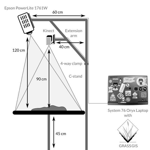
Hardware
| Type | Product | Cost |
|---|---|---|
| Computer | System 76 Oryx Pro | $1500 |
| Projector | Optoma ML750 WXGA 700 DLP LED | $500 |
| 3D sensor | Xbox One Kinect | $100 |
| Kinect Adapter for Windows | $50 | |
| Stand | Avenger 40-Inch C-Stand with Grip Kit | $200 |
| Avenger F800 3-Inch Baby Wall Plate | $10 | |
| Kupo 4 Way Clamp | $50 | |
| Kupo Baby 5/8-Inch (16mm) Receiver for 3 & 4 Way Clamp | $12 | |
| Avenger F810 3-Inch Baby Wall Plate with Swivel Pin | $36 | |
| Avenger D520L 40-Inch Extension Arm | $45 | |
| Peripherals | HDMI cable | $10 |
| Extension cord | $10 | |
| Modeling media | Waba Fun Kinetic Sand 11 Lbs | $50 |
| ~$2600 |
Software
Interfaces
TUI GUI API
Accuracy
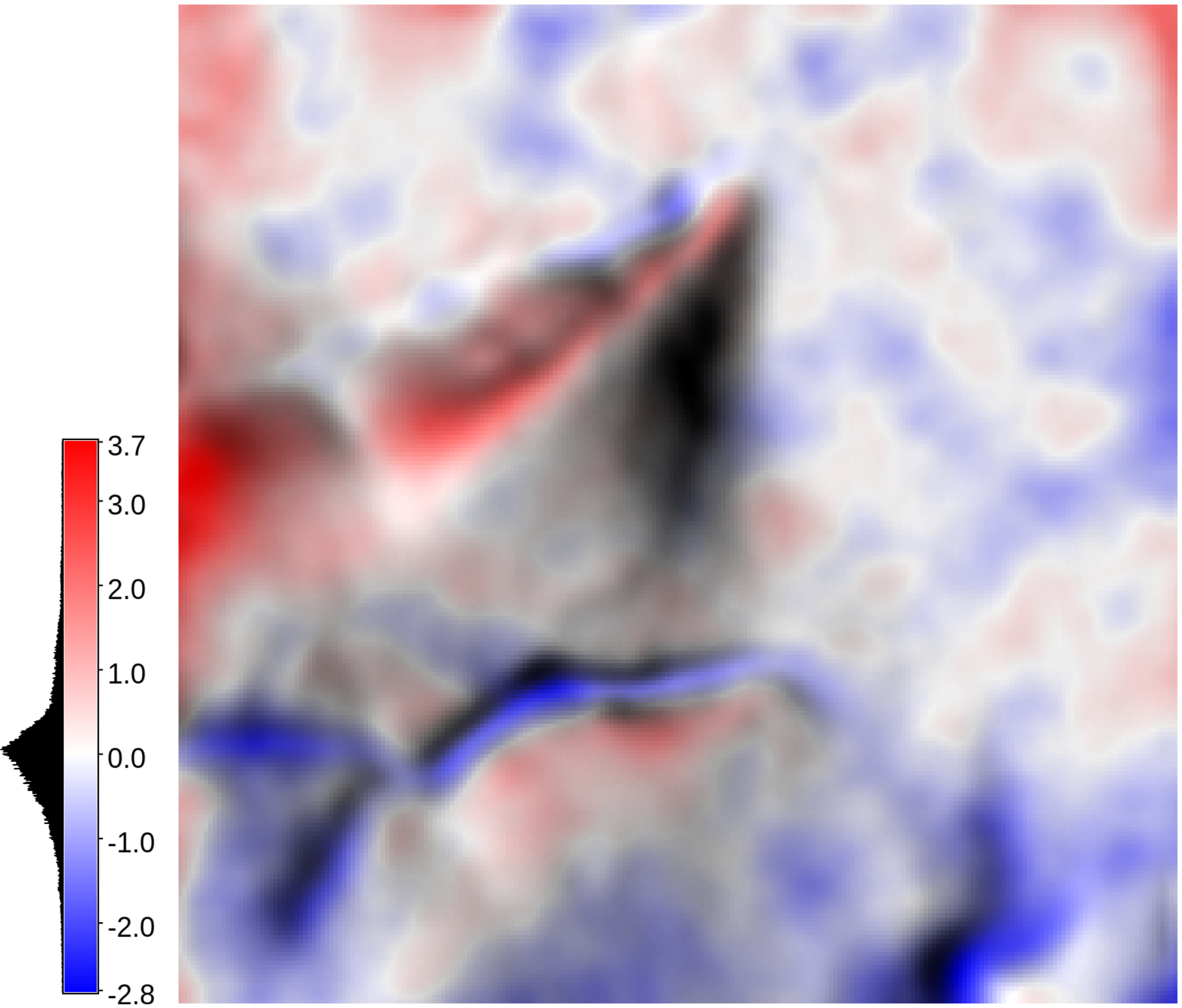
Model size: 135 mm x 135 mm
| Min | Max | Mean | Stdev | 1st Q | 3rd Q |
|---|---|---|---|---|---|
| -2.8 | 3.7 | -0.02 | 0.7 | -0.4 | 0.3 |
Speed
| Parameters | Small | Medium |
|---|---|---|
| Physical size | 23.5 cm x 23.5 cm | 34 cm x 34 cm |
| Cells | 13,456 | 26,235 |
| Binning | 0.51 s | 0.71 s |
| Interpolation | 0.74 s | 0.97 s |
| Water flow | 0.29 ± 0.01 s | 1.05 ± 0.05 s |
| Contours | 10.054 ± 0.004 s | 0.061 ± 0.004 s |
| Difference | 0.036 ± 0.002 s | 0.042 ± 0.003 s |
| Landforms | 0.034 ± 0.003 s | 0.084 ± 0.009 s |
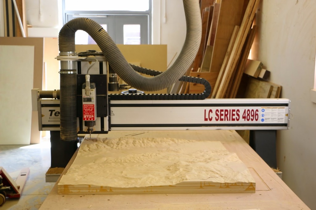
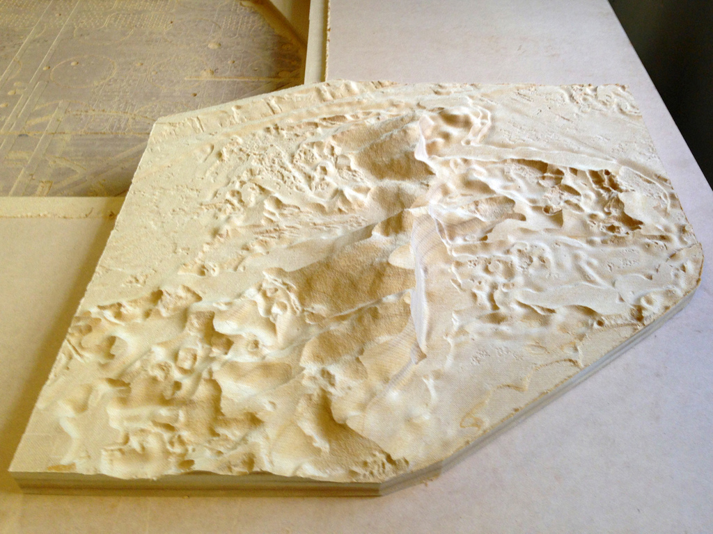
3D printing
CNC routing