Landscape Evolution Model
Abstract
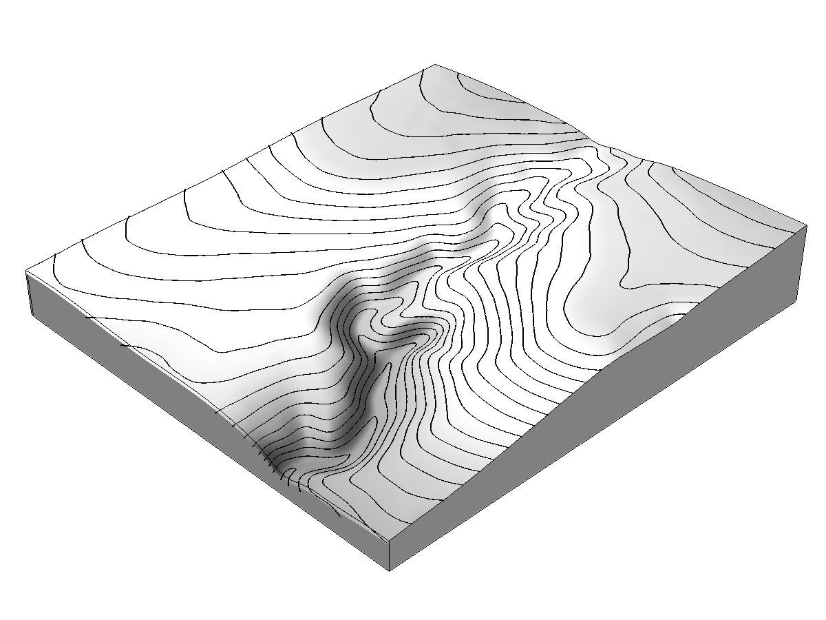
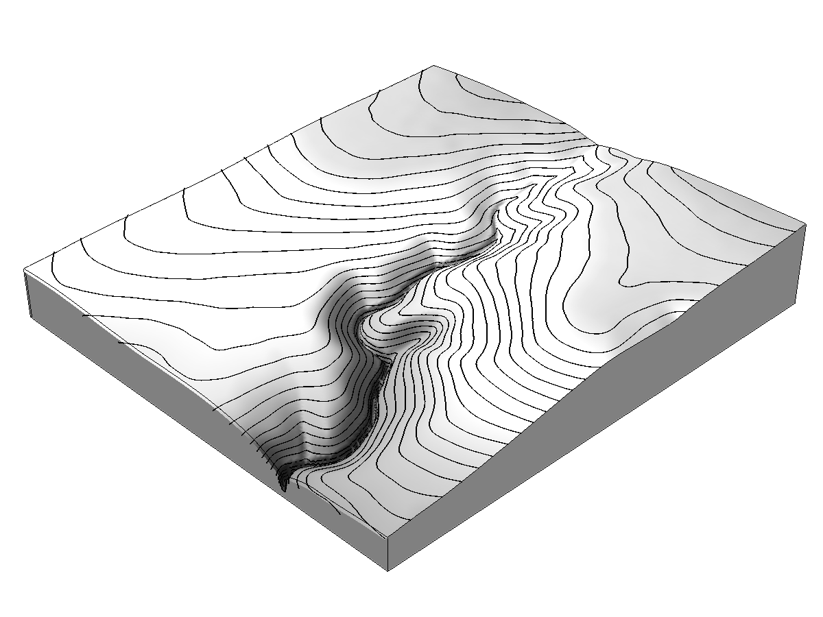
A dynamic, process-based landscape evolution model using simulated erosion and deposition to generate a timeseries of digital elevation models in GRASS GIS.
This is a simple, fine-scale, short term landscape evolution model using a path sampling method to solve water and sediment flow continuity equations and model mass flows over complex topographies based on topographic, land cover, soil, and rainfall parameters. This either steady state or dynamic model can simulate landscape evolution for a range of hydrologic soil erosion regimes. The GRASS modules r.sim.water and r.sim.sediment are used to simulate erosion and deposition. The change in elevation is a function of time, net erosion-deposition, and sediment mass density.
Equation
change in elevation (m) = change in time (s) * net erosion-deposition (kg/m^2s) / sediment mass density (kg/m^3)
Code
This set of python scripts is available on Github at https://github.com/baharmon/landscape_evolution released under the GNU General Public License version 2. These scripts are meant to be run inside of GRASS GIS using the GRASS Python Scripting Library. GRASS GIS is an open source project released under the GNU General Public License version 2. GRASS GIS is available at https://grass.osgeo.org/.
Recent work
- Function for erosion-deposition based landscape evolution
- Registration in temporal framework
- Function for dynamic modeling based on constant parameters
- Function for dynamic modeling based on list of rainfall observations
- Handling of edge effects from moving window computations
Future work
- Test the model on historical data
- Test the model with field data
- Empirically calibrate the parameters
- Refactor code
- Develop a GRASS GIS addon
- Implement as a Tangible Landscape analysis