Acquiring Global Data for GRASS GIS
Data Sources
See my list of geospatial data sources.
Importing the NASA Digital Elevation Model
In this section, we will download part of a global digital elevation model from NASA Earthdata. GRASS GIS has an addon module r.in.nasadem that automates the import of the NASADEM digital elevation model. NASADEM is a digital elevation model at 1 arcsecond or approximately 30 meter resolution derived from the Shuttle Radar Topography Mission (SRTM) and other sources including the the ASTER Global Digital Elevation Model and and the ALOS Global Digital Surface Model. Register with the NASA Earthdata portal and save your username and password.
Since NASADEM uses
World Geodetic System 1984 (WGS84)
as its coordinate reference system,
it must be imported into GRASS in a WGS84 location.
While you could create a new WGS84 location
using EPSG code 4326,
we will use Natural Earth Dataset for GRASS GIS.
Download the Natural Earth Dataset for GRASS GIS.
This dataset is a GRASS GIS location in WGS84
with global background maps from the
Natural Earth collection.
Extract the zip archive and move the natural-earth-dataset
to your GRASS GIS database directory named grassdata.
Start GRASS GIS.
Set the GRASS GIS database directory to grassdata,
set the location to the natural-earth-dataset,
and select the mapset called tutorial.
First install the r.in.nasadem addon module
with g.extension.
If it does not exist, create it now.
Before running r.in.nasadem
you must first set a computational region
with g.region
defining the area for downloading and importing raster tiles.
In this tutorial we will set the region
to the boundary of Switzerland.
Add the raster map natural_earth
and the vector map countries to the map display.
Extract Switzerland from the countries vector map using the module
v.extract.
Set the region to the new vector map switzerland and
set the resolution to 1 arcsecond.
Or optionally zoom into a smaller region within the country
and from the various zoom options button in the map display
select set computational region extent from display.
Run the addon module
r.in.nasadem
with your username and password for Earthdata.
For Switzerland r.in.nasadem will automatically
download, import, and patch 8 raster tiles to generate
a 1 arcsecond digital elevation model for the country.
After importing the NASADEM raster,
set a mask using the vector map for Switzerland
with r.mask
and use map algebra to crop the elevation raster
with r.mapcalc.
Then set the color table to elevation
using r.colors
and optionally set histogram equalization with the -e flag.
g.extension extension=r.in.nasadem
d.rast map=natural_earth
d.vect map=countries fill_color=none
v.extract input=countries where="ADMIN = 'Switzerland'" output=switzerland
g.region vector=switzerland res=0:00:01
r.in.nasadem output=swiss_elevation username=your_username password=your_password
r.mask vector=switzerland
r.mapcalc "swiss_elevation = swiss_elevation" --overwrite
r.colors -e map=swiss_elevation color=elevation
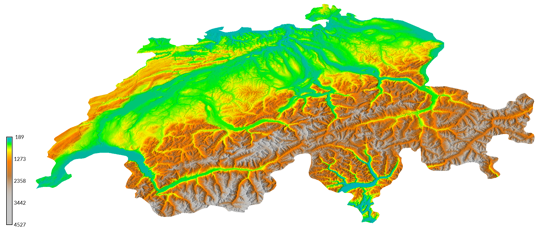
| Swiss Topography |
|---|
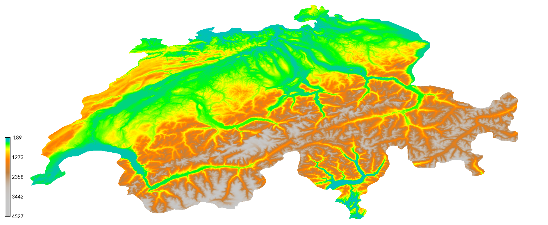 |
To better visualize the topography, compute a shaded relief map with the module r.relief. Then overlay the relief map with the elevation map using the module r.shade to create a colorized shaded relief map. Add a legend for the elevation map using the module d.legend.
r.relief input=swiss_elevation output=swiss_relief
r.shade shade=swiss_relief color=swiss_elevation output=swiss_shaded_relief brighten=30
d.legend raster=swiss_elevation
Compare the map with hypsometric tinting with shaded relief
from Natural Earth with the shaded relief map derived from NASADEM.
Use the module
r.info
to compare the resolution of both maps.
The resolution of the natural earth map is 0:01:12,
while the resolution of NASADEM is 0:00:01
in degrees-minutes-seconds.
| Swiss Shaded Relief |
|---|
|
Other sources of elevation data for Switzerland include:
- the 25 m resolution EU-DEM available for download from Copernicus
- data from the Swiss Federal Office of Topography at swisstopo.