American Association of Geographers 2016
Creative spatial thinking with Tangible Landscape
Brendan Harmon, Anna Petrasova, Vaclav Petras, Helena Mitasova, & Ross Meentemeyer

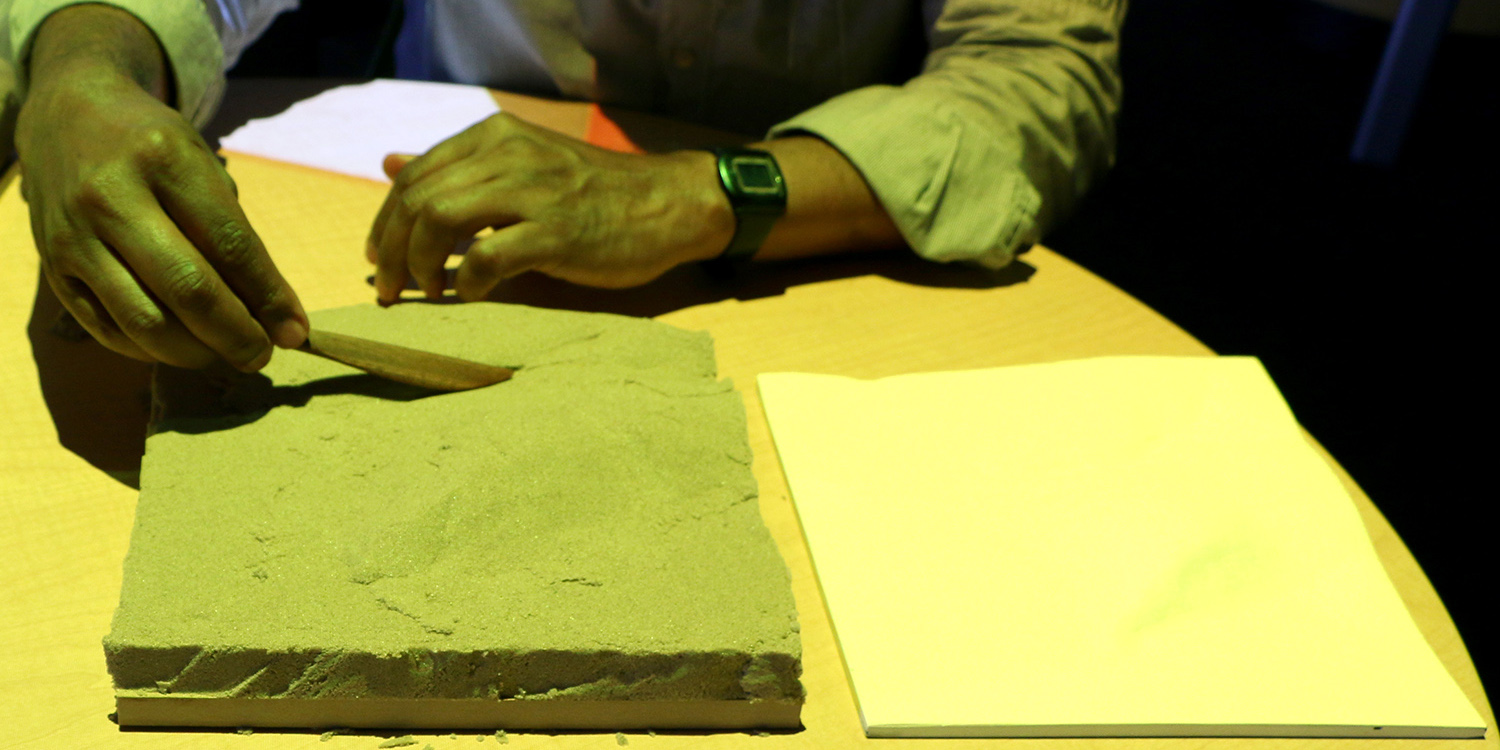
Tangible Landscape
A tangible user interface powered by open source GIS
History
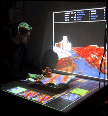
An evolution of Illuminating Clay and the Tangible Geospatial Modeling System
Image source: MIT Media Lab
Tanigble interaction with GIS
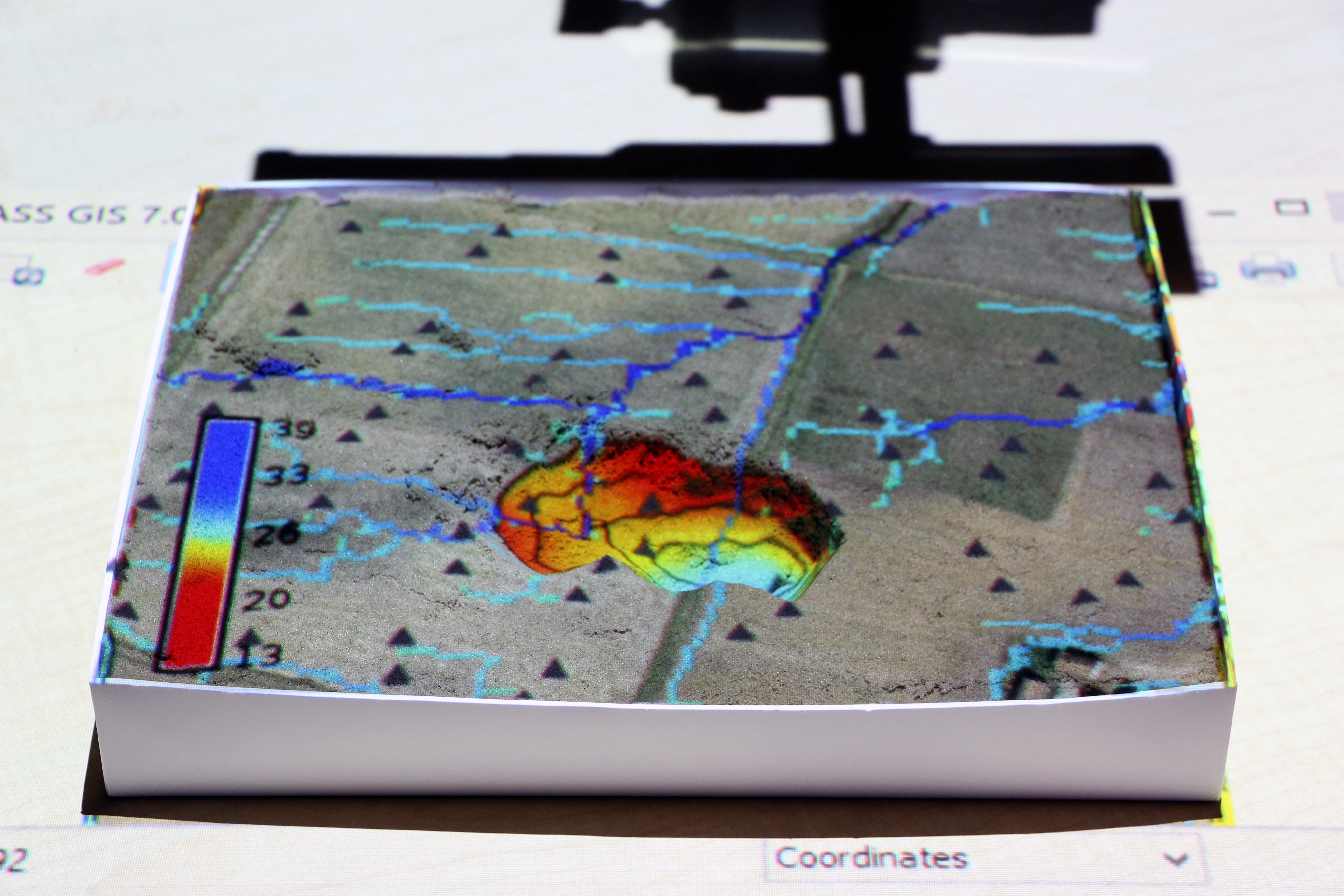
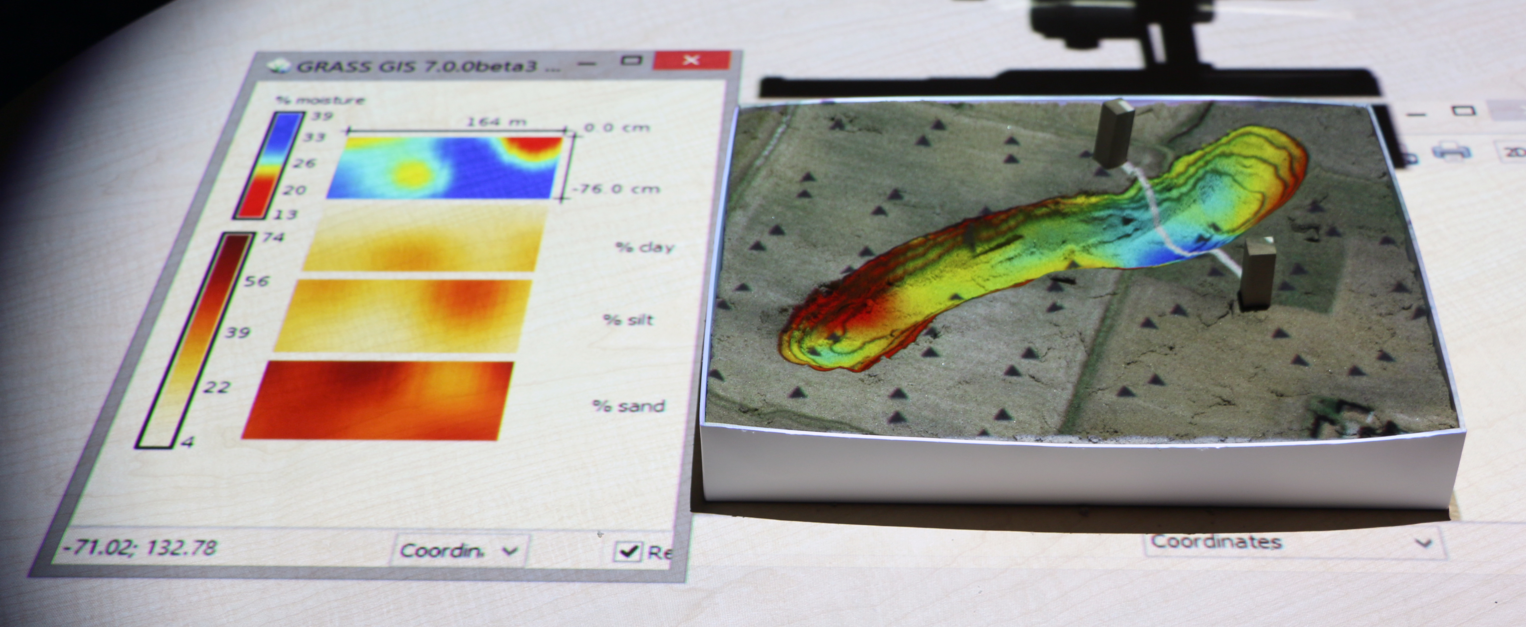
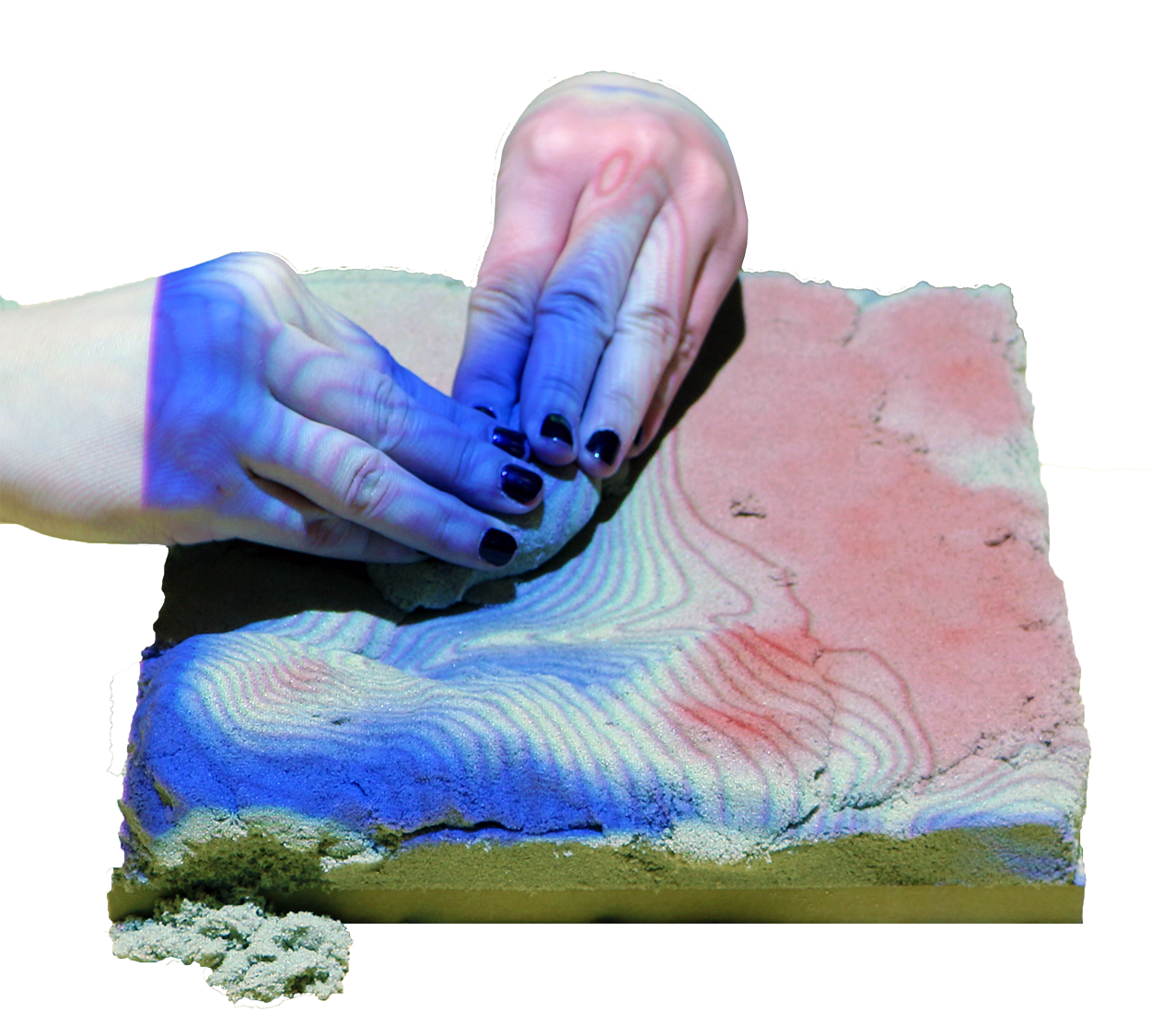
With Tangible Landscape you can hold a GIS in your hands - feeling the shape of the earth, sculpting its topography, and directing the flow of water.
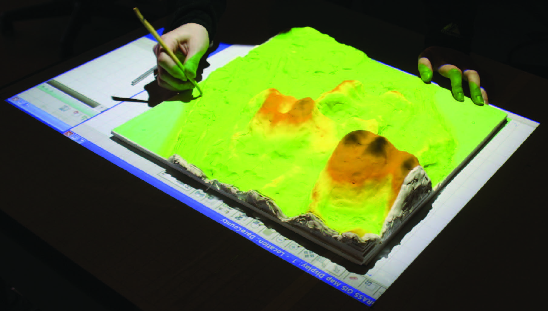
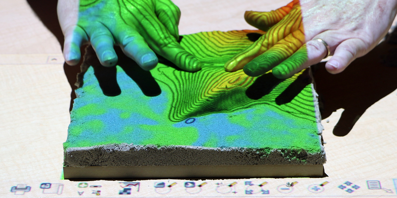
How-it-works
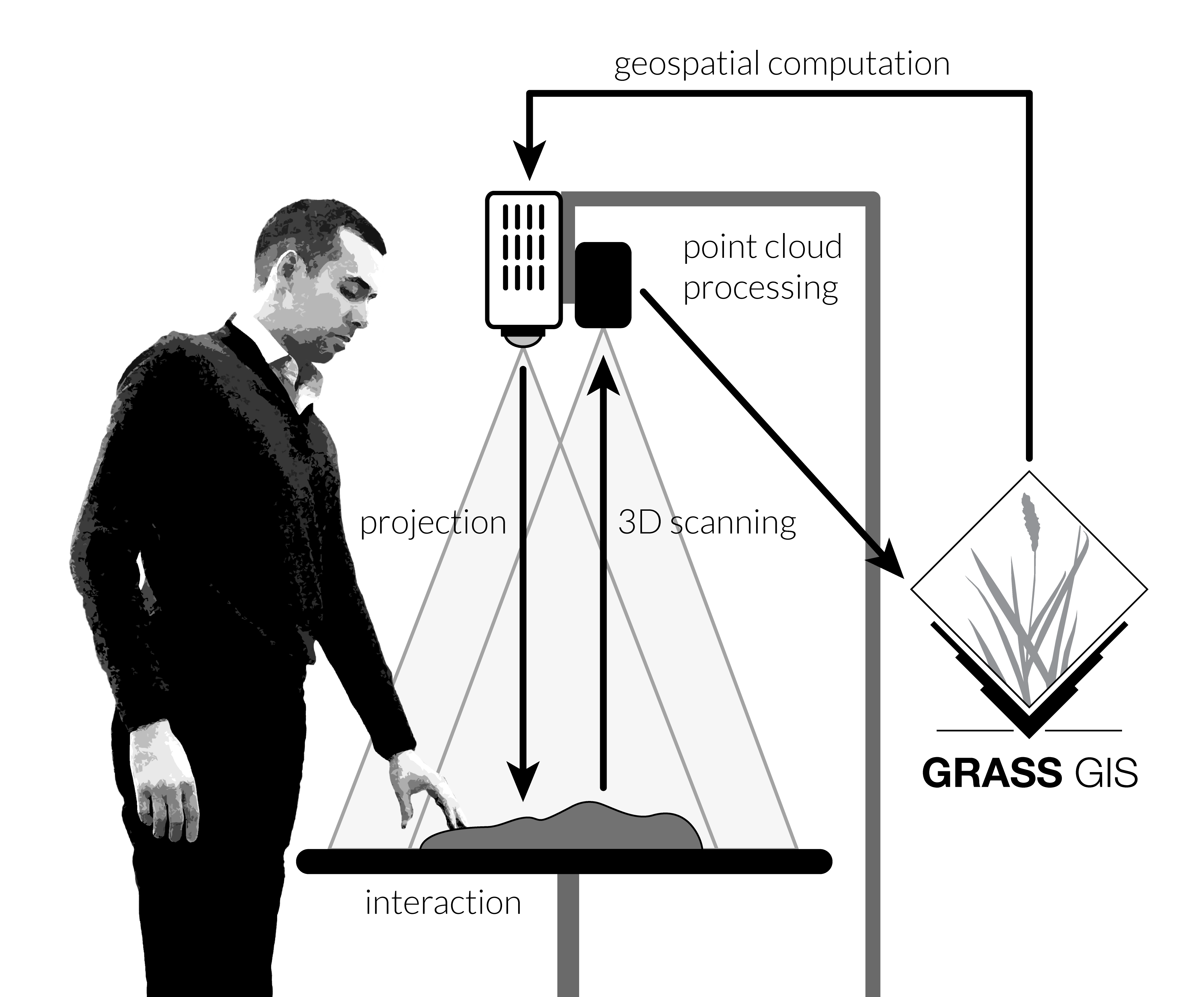
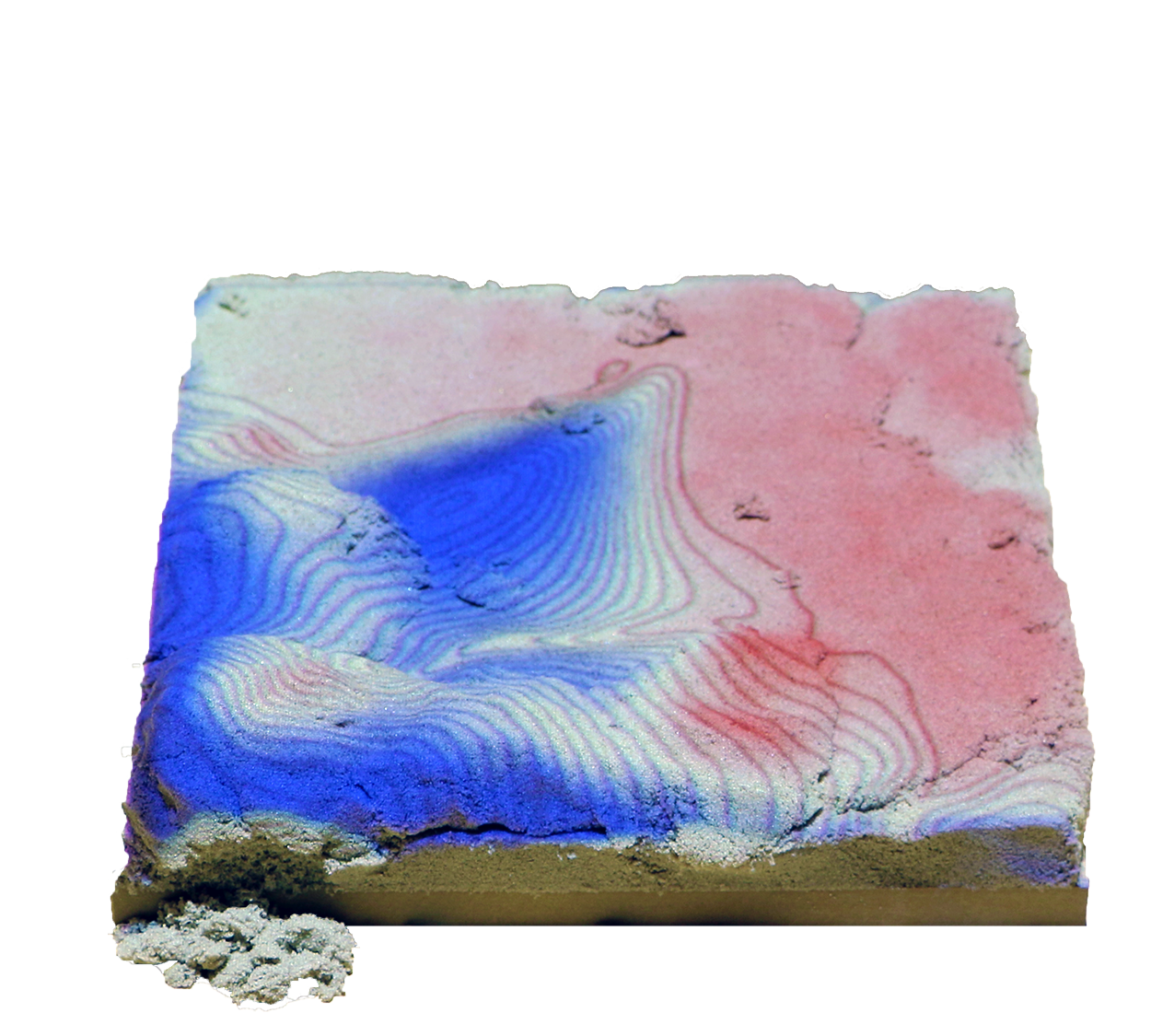
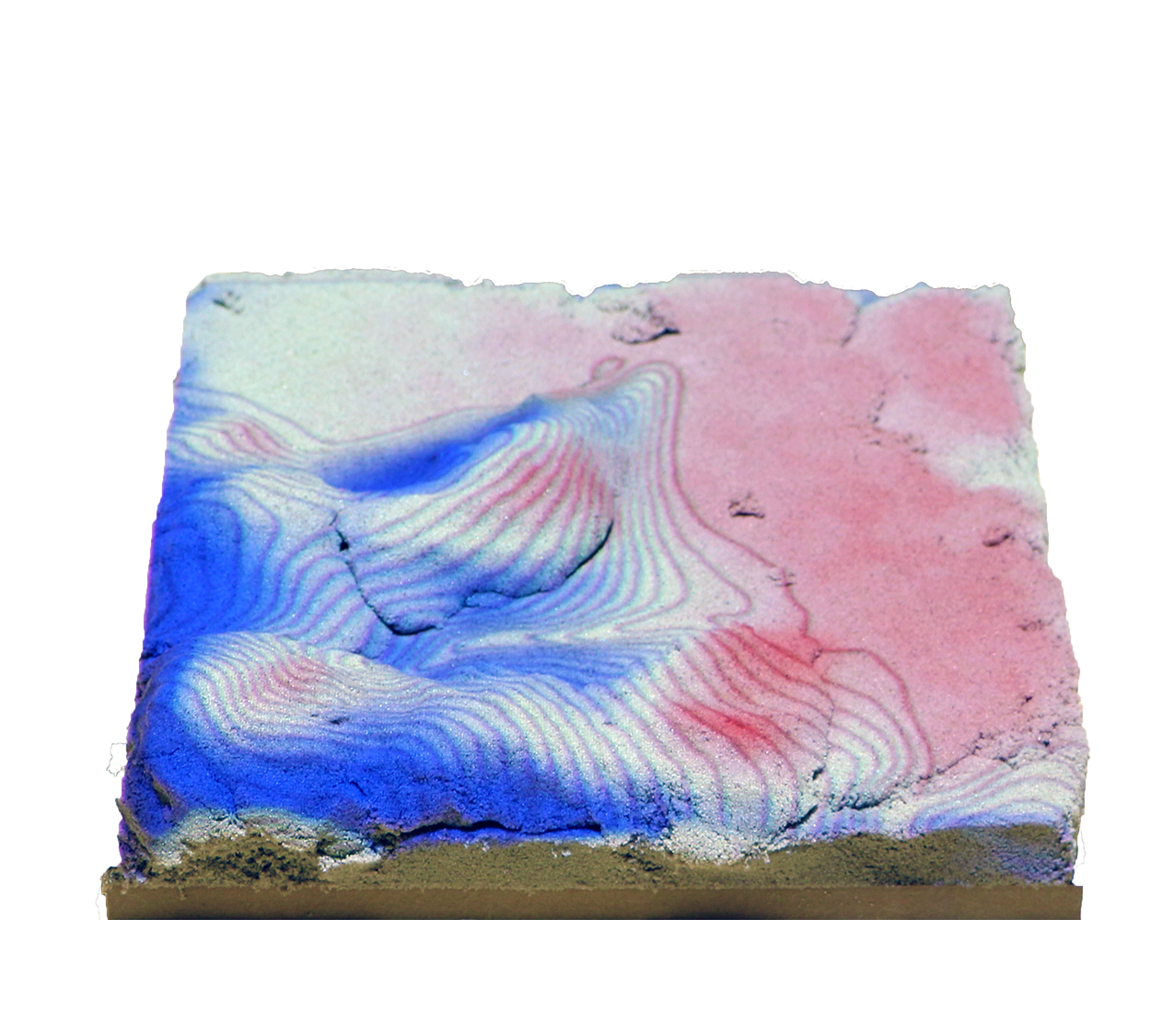
Tangible Landscape couples a digital and a physical model through a continuous cycle of 3D scanning, geospatial modeling, and projection
Intuitive scientific modeling with Tangible Landscape
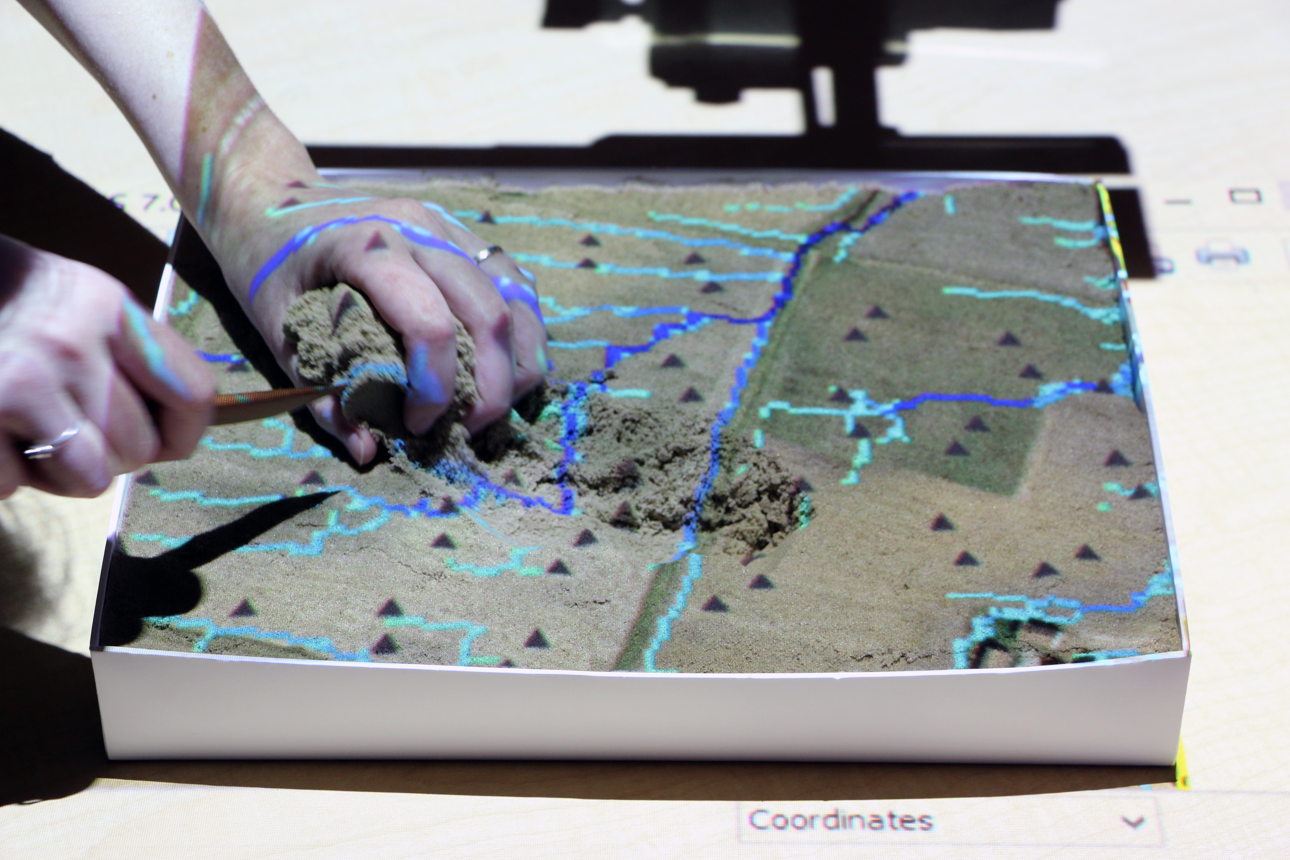
Tangible Landscape is designed to make scientific data, models, and simulations exploratory, engaging, and fun
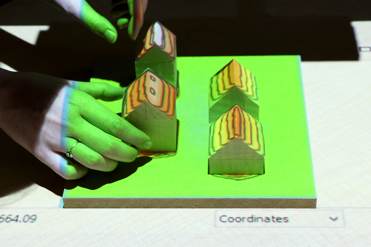
Geodesign
Designing performance landscapes
through an iterative cycle of ideation, geospatial modeling, and critique
Geodesign applications
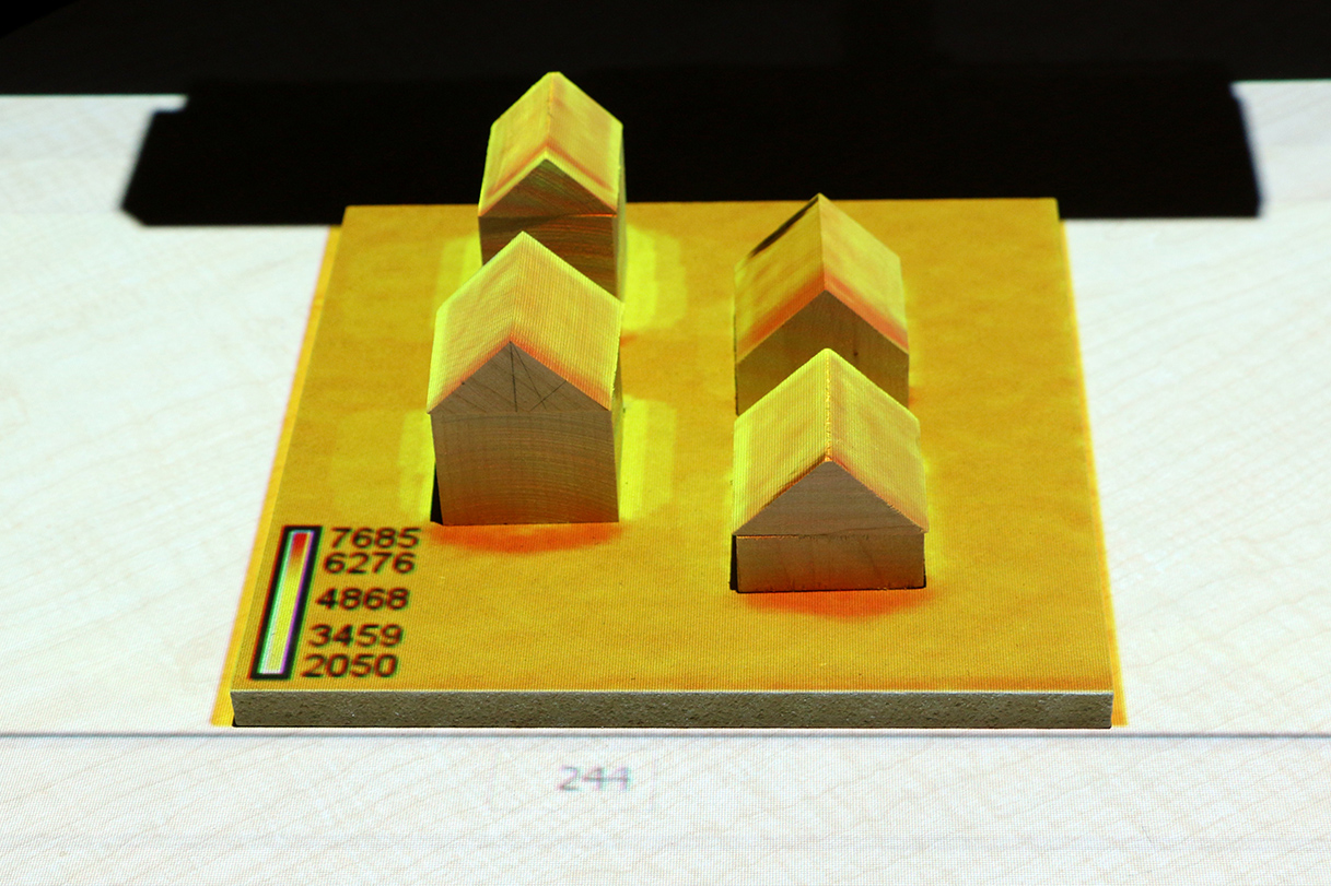
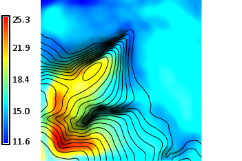
Visibility analysis
Geodesign applications
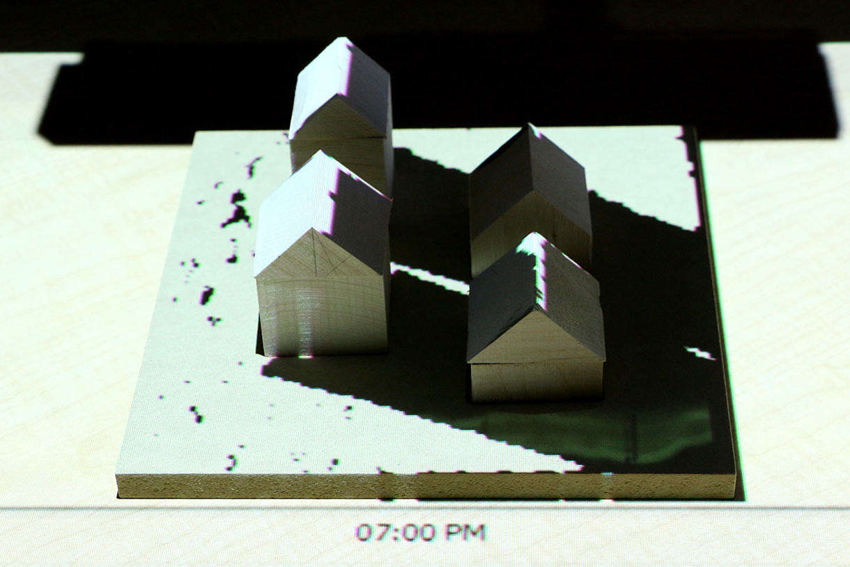
Solar analysis
Solar irradiation and cast shadow
Geodesign applications
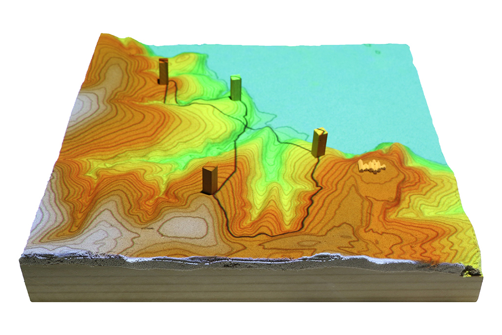
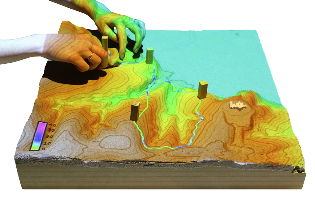
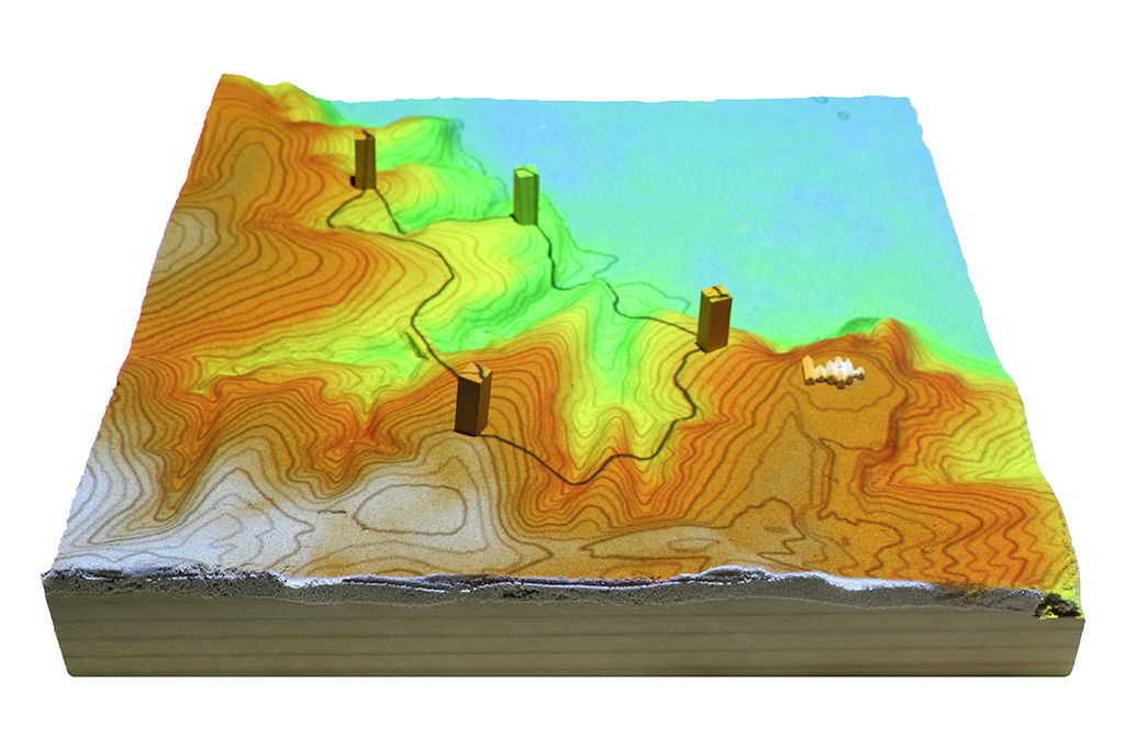
Trail planning
Optimized trail routing between waypoints based on energetics, topography, and cost maps with feedback including trail slopes and viewsheds
Scientific gaming
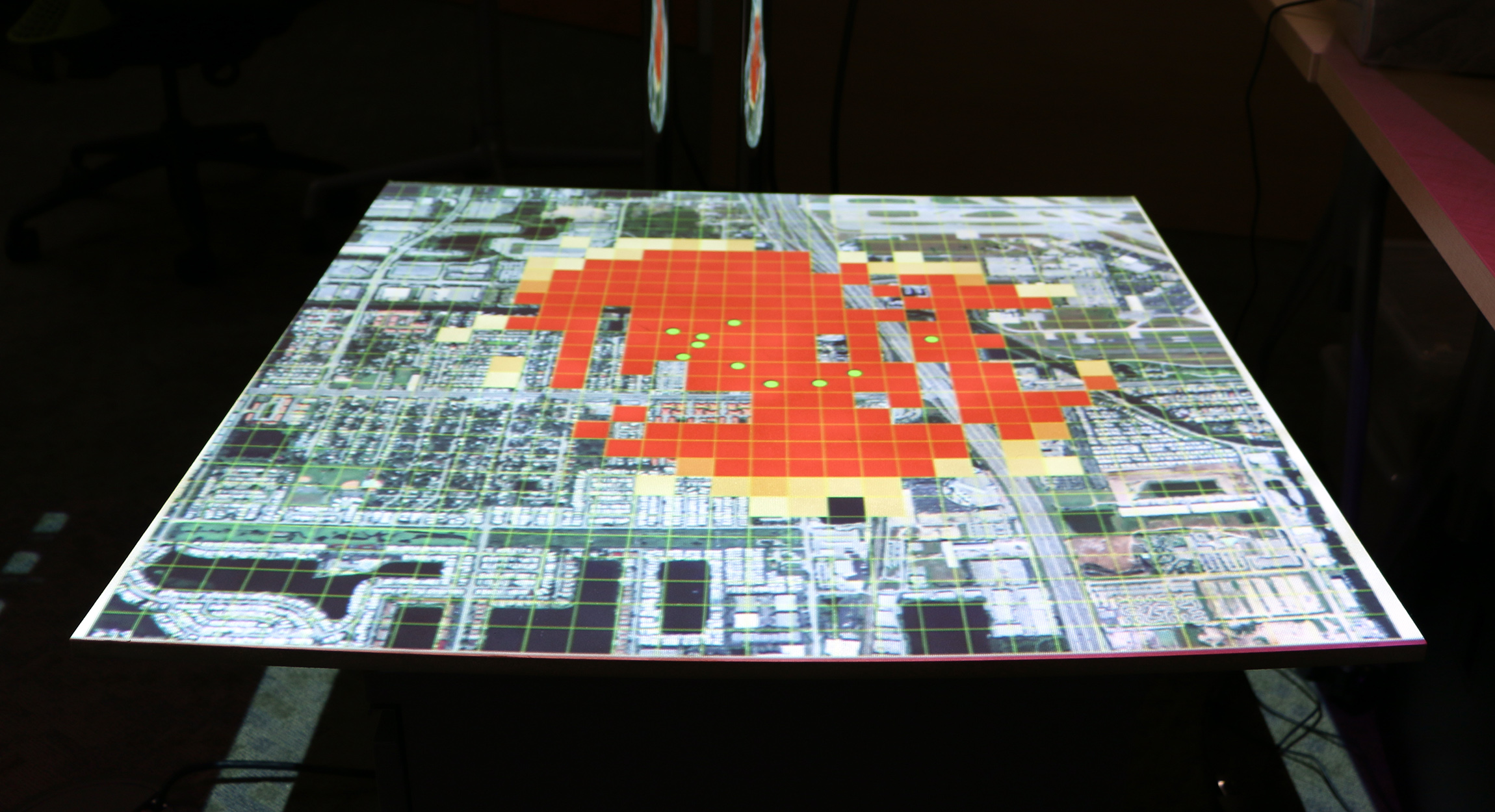
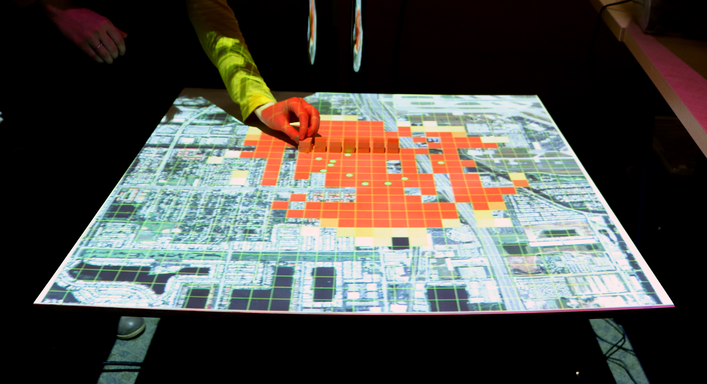
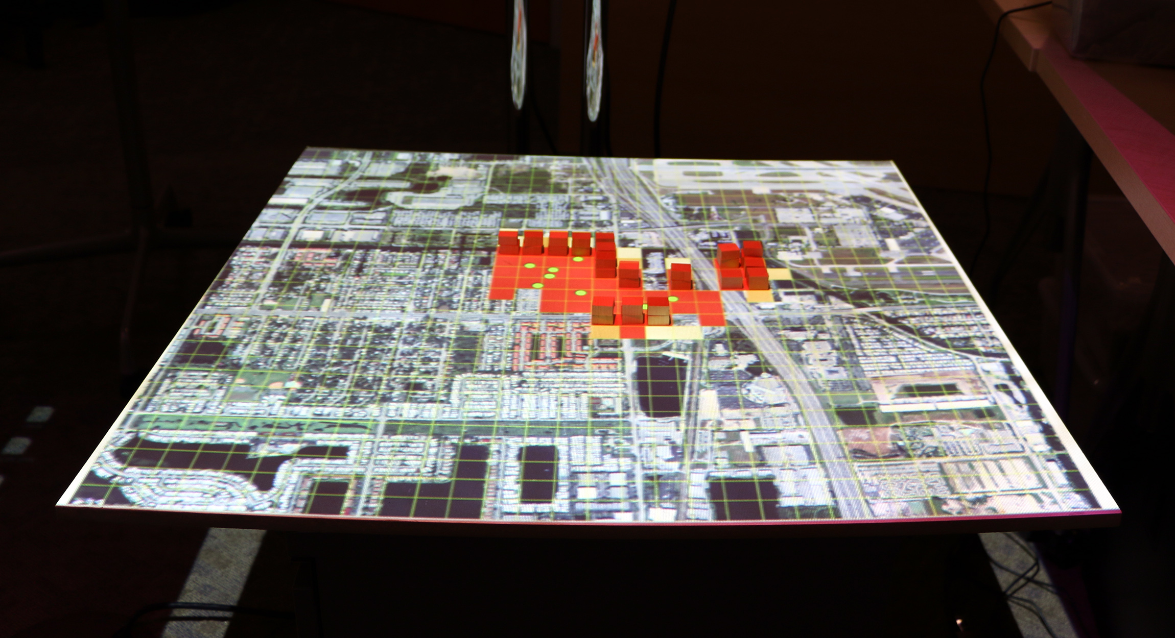
Termite infestation game
Manage the spread of termites across a city by treating city blocks
Scientific gaming
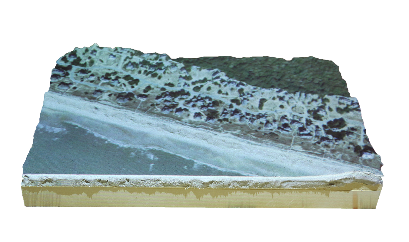
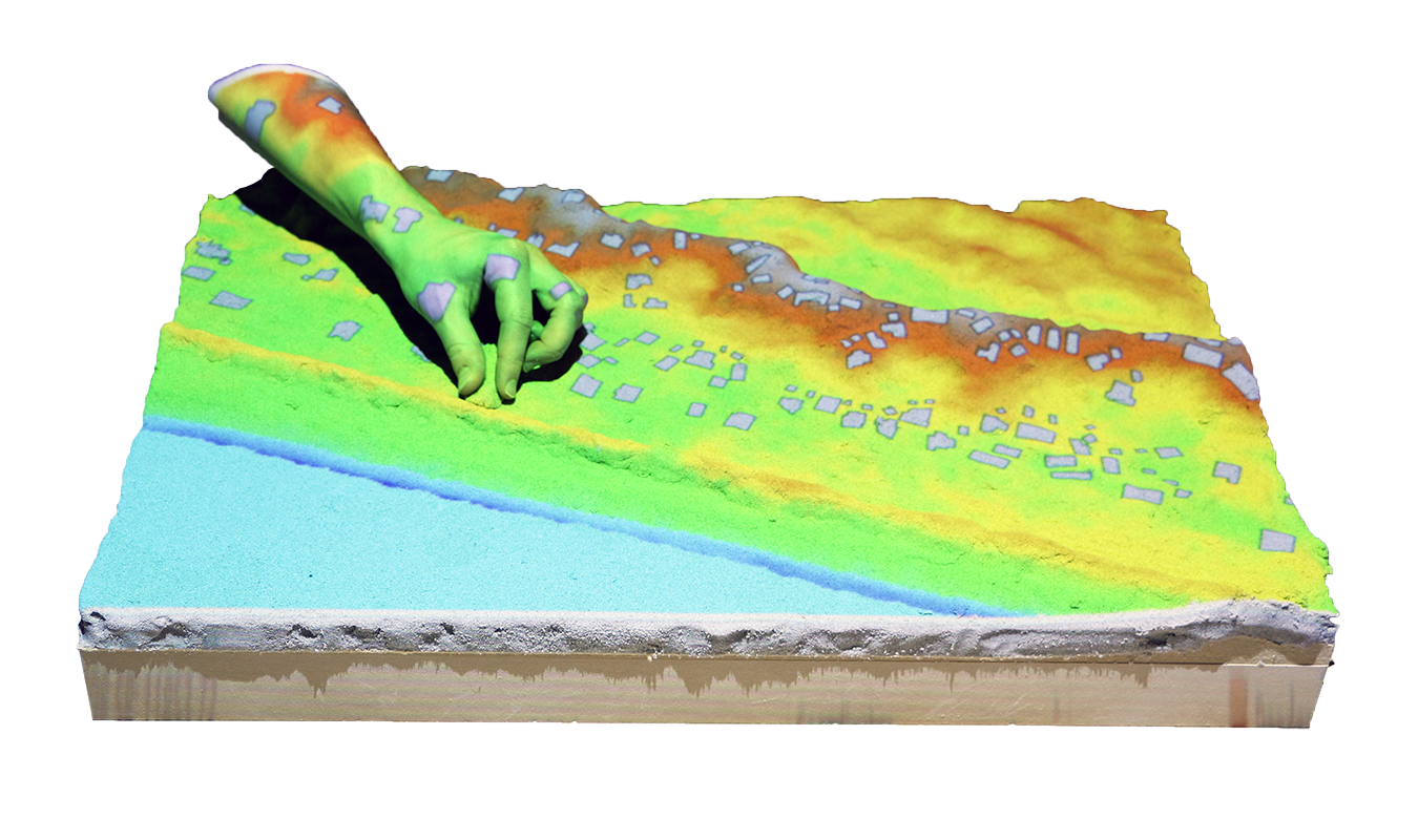
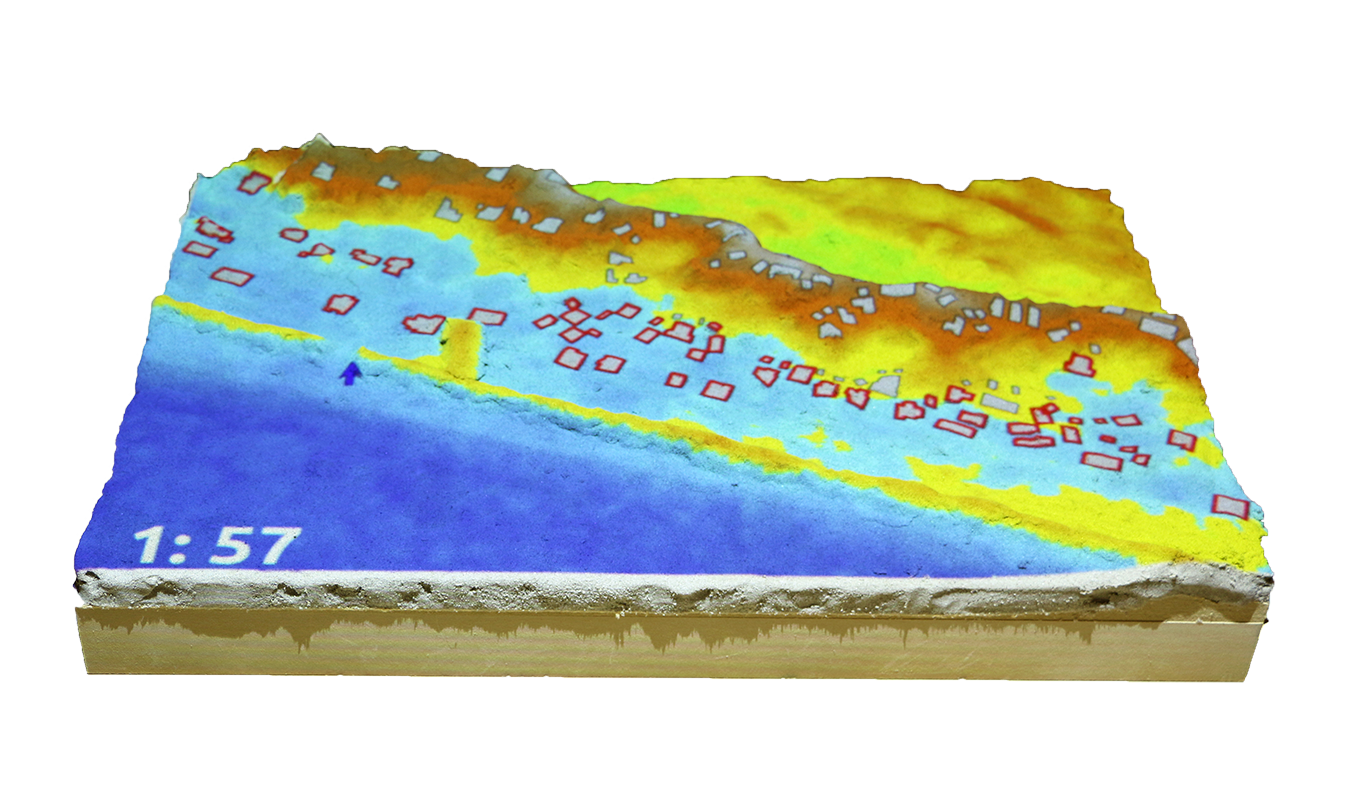
Coastal flooding game
Save houses from coastal flooding by building coastal defenses
Experiment
A comparative study of 3D spatial performance with 1. digital modeling, 2. hand modeling, and 3. tangible interaction
Experiment
Spatial statistics
The standard deviation of the differences of all participants using 1. digital modeling, 2. hand modeling, and 3. tangible interaction
Experiment
Cut-fill analytic
Tangible Landscape's cut-fill analytic enabled participants to generatively shape form and critically assess the results in an iterative cycle
Experiment
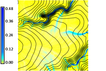

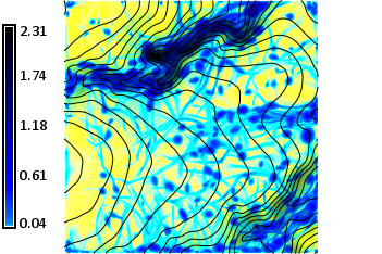
Simulated flow statistics
1. Reference depth, 2. max depth with digital modeling, 3. max depth with tangible interaction
Tangible Landscape's water flow simulation enabled an iterative cycle of form-finding and critical assessment that helped participants to learn how form controls process
Open science

Fork us on GitHub
Repository with experiment instructions, scripts, data, and results
Open education
Open source software, open algorithms, open data, and open educational resources
Petras, V., Petrasova, A., Harmon, B., Meentemeyer, R.K., Mitasova, H. Integrating Free and Open Source Solutions into Geospatial Science Education. ISPRS International Journal of Geo-Information. 2015, 4, 942-956. doi:10.3390/ijgi4020942
Set up your own system
Read our book and give it a try